Category:Map Lab-ar
Jump to navigation
Jump to search
Media in category "Map Lab-ar"
The following 200 files are in this category, out of 830 total.
(previous page) (next page)-
2012 US presidential election Electoral College map-ar.svg 1,020 × 593; 40 KB
-
Second Crusade-ar.svg 955 × 1,315; 153 KB
-
'Political Middle East' CIA World Factbook-ar.jpg 544 × 660; 193 KB
-
12 Tribes of Israel Map-ar.svg 2,168 × 3,300; 1.18 MB
-
131Etendue de l'Empire Français-ar.png 1,425 × 720; 67 KB
-
14 century BC Eastern-ar.svg 1,001 × 557; 883 KB
-
17th century Spanish routes to Petén flat-ar.gif 1,216 × 1,482; 747 KB
-
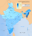
1947 Indian Presidential Election-ar.svg 860 × 1,021; 237 KB
-
1947-UN-Partition-Plan-1949-Armistice-Comparison-ar.png 367 × 1,029; 56 KB
-
1948 Arab Israeli War - May 15-June 10-ar.svg 2,345 × 2,293; 1.72 MB
-
1952 Indian Presidential Election-ar.svg 860 × 1,021; 263 KB
-
1956 Suez war - conquest of Sinai-ar.png 740 × 918; 1 MB
-
1957 Indian Presidential Election-ar.svg 860 × 1,021; 238 KB
-
1962 Indian Presidential Election Map-ar.svg 900 × 720; 445 KB
-
1967 Indian Presidential Election Map-ar.svg 860 × 1,021; 217 KB
-
1969 Indian Presidential Election-ar.svg 860 × 1,021; 296 KB
-
1974 Indian Presidential Election-ar.svg 860 × 1,021; 304 KB
-
1977 Indian Presidential Election Map-ar.svg 950 × 958; 292 KB
-
1982 Indian Presidential Election-ar.svg 898 × 720; 282 KB
-
1992 Indian Presidential Election-ar.svg 860 × 1,021; 278 KB
-
2 Battle of El Alamein 001-ar.png 1,384 × 1,384; 510 KB
-
2005 Iraqi Kurdistan independence referendum map-ar.png 1,241 × 1,265; 211 KB
-
2005salt-ar.png 1,425 × 625; 3.4 MB
-
2006carob-ar.png 1,425 × 625; 60 KB
-
2007 Arctic Sea Ice-ar.jpg 540 × 451; 84 KB
-
2007 Indian Presidential Election-ar.svg 860 × 1,021; 316 KB
-
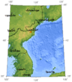
2009 North Korean nuclear test-ar.png 357 × 407; 55 KB
-
2010 Polish Air Force Tu-154 crash map-ar.svg 1,000 × 567; 1,002 KB
-
2014 Iraqi election map ar.svg 1,241 × 1,264; 331 KB
-
2014 pro-Russian unrest in Ukraine-ar.png 1,547 × 1,041; 341 KB
-
2017 world map, median age by country-ar.svg 864 × 443; 1.62 MB
-
2018 Pakistani Presidential Elections-ar.svg 1,000 × 800; 216 KB
-
2021 AFCON Group stage-ar.png 4,800 × 4,795; 1,023 KB
-
2022 Indian Presidential Election-ar.svg 860 × 1,021; 334 KB
-
2023 Turkish presidential election map second round-ar.svg 1,500 × 920; 4.4 MB
-
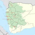
2024 missile strikes against Yemen-ar.svg 665 × 671; 318 KB
-
Abbasid Caliphate 850AD-ar.png 1,832 × 1,139; 784 KB
-
Abrahamic distribution-ar.png 1,338 × 640; 58 KB
-
Abu mahali rihla-ar.png 800 × 414; 124 KB
-
Accreting coast Image6-ar.svg 1,481 × 697; 15 KB
-
Administrative Division of Macau-ar.png 1,110 × 1,500; 262 KB
-
Adurbadagan as a Sasanian province-ar.svg 2,871 × 2,186; 1.65 MB
-
Aegean-ar.png 2,367 × 3,503; 4.88 MB
-
Aerial-herbicide-spray-missions-in-Southern-Vietnam--1965-1971-ar.png 1,262 × 1,628; 1.43 MB
-
Africa slave Regions-ar.svg 1,525 × 1,440; 795 KB
-
Africa1940-ar.png 4,200 × 2,916; 1.1 MB
-
African Great Lakes-ar.svg 765 × 990; 905 KB
-
Afro-Asiatic language-ar.png 1,856 × 1,250; 152 KB
-
Afroasiatic languages-ar.svg 899 × 585; 421 KB
-
Agadez Arrondissements-ar.png 776 × 600; 81 KB
-
Ahara division-ar.PNG 352 × 382; 108 KB
-
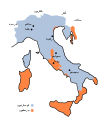
Aistulf's Italy-ar.svg 604 × 682; 72 KB
-
Aksai Chin Sino-Indian border map-ar.svg 650 × 990; 871 KB
-
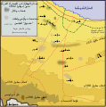
Al alamayn map-ar.png 714 × 369; 109 KB
-
Al Anbar-ar.svg 656 × 552; 121 KB
-
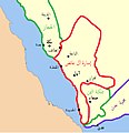
Al Ayed Emirate of Asir-ar.jpg 640 × 658; 107 KB
-
Al-qaim-area ar.svg 429 × 328; 450 KB
-
Alamein1st1942 07-ar.svg 653 × 656; 94 KB
-
Albania majority religion 2011 census-ar.png 521 × 727; 144 KB
-
Alboin's Italy-ar.svg 520 × 623; 76 KB
-
Alboran Sea map ar.svg 1,004 × 1,028; 420 KB
-
Aleppo Eyalet, Ottoman Empire (1609)-ar.png 1,600 × 1,250; 1.55 MB
-
Algeria extradition treaties-ar.svg 2,754 × 1,398; 1.19 MB
-
Alps-Mediterranean Euroregion map-ar.svg 1,465 × 1,126; 483 KB
-
America 1000 BCE-ar.png 1,407 × 2,138; 171 KB
-
AmundsenSea-ar.jpg 2,808 × 1,985; 672 KB
-
Anachronous map of the All French Empire (1534 -1970)-ar.png 2,000 × 1,015; 381 KB
-
Anatolian Beyliks in 1300-ar.png 952 × 593; 380 KB
-
Anatolian Metropolises 1880-ar.svg 1,375 × 779; 2.39 MB
-
Anaximander world map-ar.svg 1,063 × 1,063; 129 KB
-
Ancient colonies-ar.png 2,500 × 1,249; 982 KB
-
Ancient Egypt map-ar.png 1,577 × 3,219; 281 KB
-
Ancient Greek cities-ar.png 1,508 × 1,592; 3.95 MB
-
Ancient Levant routes-ar.png 800 × 541; 778 KB
-
Ancient Regions Mainland Greece-ar.png 950 × 1,100; 537 KB
-
AncientGreekDialects (Woodard) ar.svg 660 × 555; 1.64 MB
-
Angevin empire-ar.svg 1,270 × 1,455; 627 KB
-
Anglo American War 1812 Locations map-ar.svg 1,052 × 744; 1.02 MB
-
Anguilla islands-ar.svg 1,694 × 851; 325 KB
-
Annexation of Southern and Eastern Ukraine-ar.svg 1,546 × 1,038; 928 KB
-
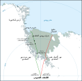
Antarctic expedition map (Amundsen - Scott)-ar.svg 1,898 × 1,865; 353 KB
-
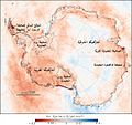
Antarctic Temperature Trend 1981-2007-ar.jpg 540 × 508; 104 KB
-
Antarctic-seas-ar.jpg 1,118 × 882; 123 KB
-
Antarctica map indicating Antarctic Peninsula-ar.jpg 5,966 × 5,420; 584 KB
-
AntikeGriechen1-ar.jpg 2,994 × 1,706; 1.65 MB
-
Arab Christians-ar.png 1,401 × 981; 68 KB
-
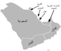
Arab Cooperation Council-ar.png 1,688 × 904; 332 KB
-
Arab Gas Pipeline-ar.png 482 × 599; 116 KB
-
Arab Gulf States arabic.png 1,202 × 1,156; 87 KB
-
Arab population israel 2000-ar.png 692 × 1,575; 142 KB
-
Arab-Byzantine frontier zone-ar.svg 1,705 × 1,498; 3.5 MB
-
Arabia 1914-ar.png 976 × 821; 164 KB
-
Arabian Peninsula Map-ar.svg 1,854 × 1,546; 63 KB
-
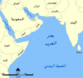
Arabian Sea map-ar.png 797 × 753; 130 KB
-
ArabianPlate-ar.png 608 × 590; 127 KB
-
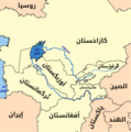
Aral map-ar.png 279 × 281; 53 KB
-
Arbil Map-ar.jpg 480 × 534; 407 KB
-
Arcipelaghi italiani-ar.svg 1,034 × 1,299; 1.8 MB
-
Asia Minor ca 780 AD-ar.svg 1,317 × 687; 2.19 MB
-
Asia Minor ca 842 AD-ar.png 1,325 × 688; 1.26 MB
-
Asia Minor ca 842 AD-ar.svg 1,325 × 688; 1.7 MB
-
Assam in 1950s-ar.png 720 × 960; 71 KB
-
Assyria World War 1 relief Arabic.png 1,920 × 1,358; 860 KB
-
Austria Hungary ethnic-ar.svg 1,360 × 1,052; 1,000 KB
-
Austria-Hungary map new-ar.svg 783 × 605; 294 KB
-
Austroasiatic-ar.svg 540 × 615; 534 KB
-
B&W Iraq map with oil infrastructure-ar.png 2,004 × 1,935; 161 KB
-
Bab el Mandeb NASA with description-ar.jpg 1,024 × 702; 172 KB
-
Bafata sectors-ar.png 948 × 770; 46 KB
-
Baffin Bay, Canada-ar.svg 1,156 × 981; 77 KB
-
Baghdad - airport and green zone-ar.jpg 496 × 371; 117 KB
-
Baghdad 150 to 300 AH-ar.png 1,805 × 1,445; 665 KB
-
BaghdadRailwayMap-ar.png 1,858 × 1,238; 3.79 MB
-
Bahrain map-ar.svg 306 × 330; 214 KB
-
Baku pipelines-ar.svg 1,316 × 762; 139 KB
-
Balkan 1912-ar.svg 969 × 925; 1.73 MB
-
Baltic History 7500-BC-ar.svg 961 × 1,306; 876 KB
-
Banjul districts-ar.png 950 × 772; 16 KB
-
Bantu expansion-ar.png 400 × 424; 138 KB
-
Banu Khalid-ar.png 2,225 × 1,495; 882 KB
-
BarrierMay2005-ar.png 358 × 592; 28 KB
-
Battle cannae destruction-ar.png 737 × 567; 42 KB
-
Battle of Baghuz (2019)-ar.svg 1,779 × 1,226; 824 KB
-
Battle of lake trasimene-ar.gif 1,280 × 983; 308 KB
-
Battle of Nicopolis (1396) plan-ar.png 2,828 × 1,921; 651 KB
-
Battle of Okinawa-ar.png 800 × 566; 56 KB
-
Bengali dialects political map-ar.svg 1,250 × 1,250; 505 KB
-
Bermuda-St. George's-ar.png 592 × 652; 140 KB
-
Best results of countries in the FIFA U-17 World Cup-ar.png 1,460 × 638; 72 KB
-
Biafra independent state map-ar.svg 1,100 × 850; 663 KB
-
Biombo sectors-ar.png 948 × 770; 22 KB
-
Biot-map-ar.png 328 × 353; 20 KB
-
Black Sea map-ar.png 2,006 × 1,541; 675 KB
-
Bolama sectors-ar.png 948 × 770; 44 KB
-
Borno in 1810-ar.svg 280 × 270; 468 KB
-
BritishEmpire1919-ar.png 1,425 × 728; 51 KB
-
BritishMandatePalestine1920-ar.svg 675 × 542; 162 KB
-
Bubonic plague map-ar.png 1,024 × 1,108; 506 KB
-
Bulgaria after Treatry of Neuilly-sur-Seine-ar.png 654 × 600; 122 KB
-
Bulgaria Ivan Alexander (1331-1371)-ar.svg 391 × 319; 305 KB
-
Bulgaria Samuil raster-ar.png 825 × 672; 353 KB
-
Bulgaria Simeon I (893-927)-ar.svg 752 × 719; 639 KB
-
Buyids 970-ar.png 1,321 × 841; 1.07 MB
-
ByzantineEmpire717+extrainfo+themes-ar.svg 800 × 366; 138 KB
-
ByzantineEmpire867AD4lightpurple-ar.png 800 × 370; 62 KB
-
Byzantium1170lightpurple + seljuks-ar.svg 803 × 371; 102 KB
-
Byzantium1180-ar.svg 550 × 375; 60 KB
-
Byzantium1204-ar.png 512 × 357; 47 KB
-
Byzantium1230-ar.svg 512 × 357; 208 KB
-
Byzantiumforecrusades-ar.jpg 550 × 375; 74 KB
-
Cabilas del Protectorado Español de Marruecos-ar.png 1,272 × 631; 189 KB
-
Cacheu sectors-ar.png 948 × 770; 43 KB
-
Cairo 1992 Isoseismal Map-ar.png 1,458 × 1,727; 531 KB
-
Califato de Córdoba - 1000-ar.png 688 × 597; 104 KB
-
Campaigns of Ivan Assen II-ar.png 5,165 × 5,503; 5.41 MB
-
Campanna Admirable-ar.png 2,356 × 1,352; 595 KB
-
CanaanMap-ar.jpg 581 × 950; 530 KB
-
Canal des Pharaons-ar.svg 684 × 738; 33 KB
-
Carbon cycle -ar.jpg 2,600 × 2,192; 2.36 MB
-
Carib Territory-ar.svg 1,500 × 1,189; 182 KB
-
Caroline Islands-map-ar.gif 326 × 350; 13 KB
-
Carolingian empire 828-ar.svg 1,164 × 1,123; 149 KB
-
Carolingian empire 855-ar.svg 1,091 × 1,053; 273 KB
-
Carolingian empire 870-ar.svg 1,091 × 1,053; 225 KB
-
Carolingian territorial divisions, 843-ar.png 497 × 594; 84 KB
-
Carolingian territorial divisions, 855-ar.png 497 × 594; 75 KB
-
Carolingian territorial divisions, 870-ar.png 497 × 594; 70 KB
-
Carte Coffea robusta arabic-ar.png 4,500 × 2,223; 1.06 MB
-
Carte de la premiere croisade-ar.jpg 1,800 × 1,386; 929 KB
-
Carte provence 1125-ar.png 964 × 964; 130 KB
-
Carte Thessalonique 1204-ar.png 322 × 351; 40 KB
-
Caspian lang-ar.png 1,200 × 1,105; 211 KB
-
Caspianseamap-ar.png 600 × 602; 188 KB
-
Catholic Majority Countries-ar.png 900 × 430; 33 KB
-
Caucasiamapussr-ar.gif 739 × 623; 199 KB
-
Central Asia political-ar.png 396 × 313; 198 KB
-
Central River districts-ar.png 950 × 772; 48 KB
-
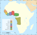
CentralEastAfrica1750-ar.png 574 × 380; 47 KB
-
Chaophrayarivermap-ar.png 1,000 × 1,000; 340 KB
-
Chaouia Tribus-ar.png 848 × 932; 73 KB
-
China administrative-ar.svg 857 × 699; 228 KB
-
China autonomous regions-ar.svg 857 × 699; 211 KB
-
China direct-administered municipalities-ar.svg 857 × 699; 205 KB
-
China opium growing areas 1908 AR.svg 835 × 940; 34 KB
-
China province-level divisions-ar.svg 857 × 699; 561 KB
-
China provinces highlighted-ar.svg 857 × 699; 417 KB
-
Choropath Map 2012a-ar.svg 677 × 503; 138 KB
-
Christianity in China (Chinese General Social Survey 2009)-ar.png 3,096 × 2,157; 188 KB
-
Christianity in Syria-ar.png 601 × 645; 178 KB
-
Chupanid - Jalayerid dynasty 1337–1432 ad-ar.png 620 × 428; 37 KB
-
CIA map of Afghanistan in 2007-ar.png 326 × 350; 337 KB
-
CIA map- Syrian and Hezbollah presence in Beirut-ar.png 2,002 × 2,563; 253 KB
-
CIA Secret Prisons-ar.svg 2,000 × 1,001; 359 KB
-
Cities of Sumer-ar.svg 436 × 480; 67 KB
-
Clash of Civilizations map-ar.png 1,265 × 625; 63 KB
-
Clash of Civilizations mapn2-ar.png 1,260 × 612; 65 KB
-
Cold war europe economic alliances map ar.png 1,165 × 1,200; 860 KB


