Category:Arabic-language maps
Jump to navigation
Jump to search
Please place all maps in Arabic in this category.
Subcategories
This category has the following 12 subcategories, out of 12 total.
Media in category "Arabic-language maps"
The following 200 files are in this category, out of 394 total.
(previous page) (next page)-
0529121005168j0jg5b4jylwj5snftmefj.jpg 418 × 389; 22 KB
-
052912100531u4znhzkqf4qzc.jpg 561 × 730; 71 KB
-
1154 Tabula Rogeriana noroeste Peninsula Iberica Al Idrisi copia mas antigua.jpg 4,800 × 3,231; 6.31 MB
-
1154 world map by Moroccan cartographer al-Idrisi for king Roger of Sicily.jpg 1,296 × 1,296; 741 KB
-
1513 Piri Reis.jpg 2,000 × 2,753; 2.29 MB
-
1803 World Map published in Istanbul.tif 10,805 × 7,774; 240.37 MB
-
2006carob-ar.png 1,425 × 625; 60 KB
-
800px-Arab-Israeli Map2.png 800 × 455; 39 KB
-
Kurd scattering.jpg 1,280 × 1,149; 246 KB
-
A Complete Portrayal of the Earth WDL131.png 1,024 × 1,051; 2.64 MB
-
Abass-will-007.png 1,002 × 745; 102 KB
-
Abdalwadid.JPG 1,134 × 531; 170 KB
-
Abrahamic distribution-ar.png 1,338 × 640; 58 KB
-
Abu mahali rihla-ar.png 800 × 414; 124 KB
-
Adygea ar.png 731 × 635; 31 KB
-
Aegean Sea map bathymetry ar.svg 4,688 × 5,700; 5.18 MB
-
Agouza district map.jpg 1,056 × 719; 338 KB
-
Al-Aaimmah bridge area-ar.png 665 × 243; 42 KB
-
Al-Haramain Mosque.jpg 1,322 × 675; 322 KB
-
Al-hasa.png 942 × 732; 1.95 MB
-
Al-idrisi world map.jpg 6,828 × 5,068; 11.05 MB
-
Al-Idrisi's world map.JPG 1,424 × 1,552; 917 KB
-
Al-Idrisi-s world map.jpg 492 × 570; 72 KB
-
Albers projection ar.png 1,288 × 749; 1.06 MB
-
Algeria extradition treaties-ar.svg 2,754 × 1,398; 1.19 MB
-
Antarctic-seas-ar.jpg 1,118 × 882; 123 KB
-
Ar Larache Province Morocco.png 966 × 490; 68 KB
-
Arab world map 1154.png 342 × 336; 76 KB
-
Arabian Sea map-A.png 800 × 757; 126 KB
-
Arabian woman Portal.png 866 × 694; 94 KB
-
Arabic-Snider-Pellegrini Wegener fossil map.png 577 × 443; 115 KB
-
Archaeological Sites of Horse Remains-ar.png 2,866 × 2,274; 15.65 MB
-
Ayyubid Dynasty ar.png 2,012 × 1,224; 346 KB
-
Azawad map-arabic.jpg 660 × 706; 124 KB
-
AzChiraqGuneshliYataqlari.jpg 439 × 132; 7 KB
-
Bab el Mandeb NAS-AR description.png 1,024 × 702; 1.26 MB
-
Bahri Dynasty 1250 - 1382 (AD) ar.png 511 × 346; 84 KB
-
Balkan 1912-ar.svg 969 × 925; 1.73 MB
-
Bani Khalid Invades Diriyah (Arabic).jpg 1,080 × 601; 85 KB
-
Bantu expansion-ar.png 400 × 424; 138 KB
-
Bataille navarine ar.png 924 × 683; 218 KB
-
Battle of lake trasimene-ar.gif 1,280 × 983; 308 KB
-
Battle of Santa Cruz map-ar.jpg 800 × 799; 105 KB
-
Bay-of-Piran maritime-boundary-dispute-ar.png 2,000 × 1,863; 334 KB
-
Bin Mohaya.jpg 650 × 640; 161 KB
-
Black Sea map-ar.png 2,006 × 1,541; 675 KB
-
Bodleian Library MS. Marsh 294 f 6a.jpg 785 × 1,000; 704 KB
-
Book of Curiosities - Sicily map.jpg 3,200 × 2,182; 4.94 MB
-
Bordj Map.png 2,536 × 1,600; 115 KB
-
Branches of Christianity (Arabic 2).png 811 × 518; 61 KB
-
1581 Bunting clover leaf map-ar.png 2,961 × 2,331; 13.19 MB
-
C952 map of ash-Sham by Ibrahim ibn Muhammad Istakhri (rotated 180°).jpg 2,224 × 3,008; 3.23 MB
-
C952 map of ash-Sham by Ibrahim ibn Muhammad Istakhri.jpg 2,224 × 3,008; 3.23 MB
-
Caffa and Theodoro-ar.png 700 × 470; 65 KB
-
Cairo300.jpg 800 × 850; 247 KB
-
Cairoeg.jpg 1,024 × 890; 248 KB
-
Campania Provinces ar.png 1,056 × 816; 25 KB
-
CanaanMap-ar.jpg 581 × 950; 530 KB
-
CAR تقسيم إداري.png 423 × 281; 34 KB
-
Cart 05.jpg 693 × 506; 79 KB
-
Carte archéologique de l'Iraq - btv1b53212203v.jpg 7,421 × 9,127; 8.21 MB
-
Carte de la ville d'Islamabad Ouest.png 496 × 367; 125 KB
-
Carte peuple touareg ar.jpg 600 × 383; 85 KB
-
Celts in Europe with color key.jpg 450 × 456; 134 KB
-
Cheetah range-ar.png 488 × 394; 22 KB
-
Chukchi Sea map ar.png 1,202 × 675; 229 KB
-
ClimateMapWorld Arabic.png 727 × 470; 336 KB
-
Colonizationoftheamericas-ar.png 463 × 599; 68 KB
-
Communes Wilaya Jijel Arabe.png 1,280 × 660; 268 KB
-
Country foreign exchange reserves minus external debt-ar.png 1,818 × 828; 196 KB
-
Dagestan topographic map-ar.png 500 × 640; 382 KB
-
Dagestanian avar`s.png 421 × 315; 59 KB
-
Daira de merouana.jpg 740 × 537; 96 KB
-
DesoukLocationInKFS2.PNG 371 × 276; 25 KB
-
Die Portugiesenzeit (Strandes) 109.jpg 1,165 × 1,800; 376 KB
-
Diriyah Invades Bani Khalid (Arabic).jpg 1,080 × 599; 87 KB
-
Disciplines mind map-ar.png 1,173 × 622; 249 KB
-
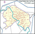
Diwaniya districts.jpg 1,593 × 1,528; 1.07 MB
-
Djibouti-regions-ar.png 676 × 735; 95 KB
-
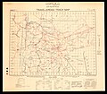
Dāʼirat al-Arāḍī wa-al-Misāḥah, Trans-Jordan track map 01 (FL27925363 2366969).jpg 19,082 × 16,769; 346.6 MB
-
Dāʼirat al-Arāḍī wa-al-Misāḥah, Trans-Jordan track map 02 (FL27925368 2366969).jpg 18,697 × 15,625; 361.67 MB
-
Equal-Earth-Map-0-AR.jpg 19,250 × 10,150; 20.59 MB
-
World-Map-Ismail-Hakki-Erzurumi-1756.png 357 × 573; 461 KB
-
Esh Sheikh Muwannis.Registration block 6630. Wad en Najma & Wad en Nada (FL197694331 1134534).jpg 13,514 × 16,384; 213.38 MB
-
Ethnic Groups In Caucasus Region 2009-ar.jpg 2,000 × 2,325; 1.66 MB
-
Fatimid Islamic Caliphate-ar.png 994 × 544; 141 KB
-
Ghajar highlighted-ar.jpg 742 × 860; 372 KB
-
Gineifa station (FL35476356 2661582).jpg 17,175 × 13,249; 288.39 MB
-
Gov-HasakeLargFont.jpg 1,060 × 751; 309 KB
-
Grand casablanca Morocco.jpg 445 × 397; 95 KB
-
Guelf c12-ar.jpg 600 × 614; 162 KB
-
Guidimaka DepartmentsAR.png 776 × 600; 77 KB
-
Gulf of Aden map-ar.png 3,333 × 2,781; 1.06 MB
-
Haditha location map-Recovered-ar.png 876 × 660; 172 KB
-
Halhul map.JPG 407 × 383; 28 KB
-
Hecataeus world map-ar.png 616 × 600; 90 KB
-
Herodotus world map-ar.png 796 × 485; 139 KB
-
Historical map of Shiraz.png 2,450 × 2,107; 7.63 MB
-
Historical map of Turkey AD 1393-ar.png 843 × 473; 123 KB
-
IberianPeninsula Banu Qasi-ar.png 237 × 169; 74 KB
-
Ibn al Wardi's atlas.jpg 1,000 × 665; 429 KB
-
Ibn Howqal World map-001.jpg 460 × 473; 178 KB
-
Ibn Wardi Kaaba map.jpeg 478 × 720; 81 KB
-
Ibn Wardi mappa mundi.jpeg 720 × 569; 88 KB
-
Islamic map of the world Wellcome L0035009.jpg 3,576 × 4,072; 2.54 MB
-
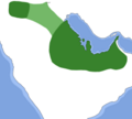
Island of the Jewel.png 2,232 × 946; 3.25 MB
-
Istanbul districts-ar.png 950 × 772; 111 KB
-
Jacques-Nicolas Bellin, Vera delineatio civitatis Bassorae (FL37476699 2473381).jpg 10,350 × 9,031; 133.82 MB
-
Jerusalem Gates.png 1,306 × 919; 263 KB
-
Jerusalem Gates.svg 1,306 × 919; 161 KB
-
JAO blanco AR.png 773 × 475; 17 KB
-
Jewry-ar.PNG 950 × 417; 42 KB
-
Khalid ajaaj.jpg 1,202 × 824; 172 KB
-
Khalili Collection Hajj and Arts of Pilgrimage arc.pt 0626.jpg 2,500 × 3,718; 528 KB
-
Layoune-Semara-Rio doro.PNG 250 × 250; 11 KB
-
Major tribes of Iraqi marshes.jpg 784 × 787; 95 KB
-
Mamlakat abu mahali 2-ar.jpg 478 × 499; 36 KB
-
Mamlukes-Ayyubid Dynasty-ar.png 511 × 346; 91 KB
-
Map assassination of Hisham Barakat.jpg 1,316 × 630; 277 KB
-
Map Greco-Persian Wars-ar.png 663 × 532; 413 KB
-
Map of Al Hijaz Train Lines.png 1,074 × 1,127; 1.69 MB
-
Map of Bani Khalid Emirate.png 1,600 × 1,046; 137 KB
-
Map of Damietta, Jacut.png 440 × 286; 77 KB
-
Map of Jabrid Emirate.png 10,000 × 9,000; 3.98 MB
-
Map of Jarwanid Emirate.png 9,779 × 8,280; 3.45 MB
-
Map of Kingdom of Ormus.png 10,000 × 9,000; 2.87 MB
-
Map of Pashtunistan.jpg 1,600 × 1,540; 976 KB
-
Map of pre-Nakba Palestine framed صورة لخارطة لفلسطين ما قبل النكبة.jpg 1,280 × 1,920; 956 KB
-
Map of Usfurid Emirate.png 9,779 × 8,280; 3.15 MB
-
Map of Uyunid Emirate (3).png 10,000 × 9,000; 2.56 MB
-
Map of Uyunid Emirate.png 3,737 × 4,000; 579 KB
-
Map-Europe-Outermost-regions-ar.PNG 1,427 × 628; 567 KB
-
Mapa do Mediterráneo de al-Balkhī (c. 921).jpg 2,971 × 3,847; 7.24 MB
-
Mapa do Mediterráneo de al-Balkhī (c. 921; trans. de K. Miller, 1926).jpg 3,333 × 4,316; 6.51 MB
-
Mapa do Mediterráneo do Libro de Curiosidades (1190-1210).jpg 12,599 × 8,560; 14.32 MB
-
Mapa do Mediterráneo, al-Balkhī (921).jpg 1,080 × 1,404; 1.84 MB
-
Mappa di Eratostene-ar.png 1,040 × 611; 887 KB
-
Marawi.map.arabic.jpg 300 × 250; 52 KB
-
Middle east map 920.png 1,268 × 1,080; 338 KB
-
Muhammad al-Idrisi - Oxford transcript of V-4.jpg 2,102 × 1,450; 1.72 MB
-
Muhammad al-Idrisi - Oxford transcript of VI-4.jpg 2,106 × 1,448; 1.65 MB
-
Muhammad al-Idrisi - Oxford transcript of VI-5.jpg 2,105 × 1,452; 1.53 MB
-
Muhammad al-Idrisi - Paris transcript of V-4.jpg 2,114 × 1,461; 2.02 MB
-
Muhammad al-Idrisi - Paris transcript of VI-4.jpg 2,112 × 1,459; 1.98 MB
-
Muhammad al-Idrisi - Paris transcript of VI-5.jpg 2,112 × 1,462; 1.9 MB
-
Muhammad al-Idrisi - Saint Petersburg transcript of V-4.jpg 2,120 × 1,470; 1.9 MB
-
Muhammad al-Idrisi - Saint Petersburg transcript of VI-4.jpg 2,107 × 1,458; 1.81 MB
-
Muhammad al-Idrisi - Saint Petersburg transcript of VI-5.jpg 2,108 × 1,462; 1.96 MB
-
Muhammad al-Idrisi - Sofia transcript of V-4.jpg 2,107 × 1,448; 1.57 MB
-
Muhammad al-Idrisi - Sofia transcript of VI-4.jpg 2,109 × 1,456; 1.57 MB
-
Muhammad al-Idrisi - Sofia transcript of VI-5.jpg 2,114 × 1,463; 1.94 MB
-
Multan fort.png 600 × 391; 284 KB
-
Muslim Constitution Religion ar.png 1,348 × 622; 29 KB
-
Nador Province.PNG 208 × 166; 5 KB
-
Naqab map.jpg 300 × 701; 27 KB
-
Navarin navires ottomans ar.png 934 × 683; 153 KB
-
NE 565ad-ar.png 533 × 351; 431 KB
-
North Africa & Andalus map 800.png 1,530 × 1,080; 294 KB
-
Onepiece-welt (2)-ar.png 653 × 663; 245 KB
-
Osmanli Ortadogu.jpg 7,374 × 5,629; 9.42 MB
-
Ottoman Empire in Asia Administrative Divisions.jpg 5,594 × 3,561; 1.74 MB
-
Outre-mer-ar.png 1,480 × 740; 82 KB
-
Palestine and Turkey (FL25570486 2514341).jpg 22,981 × 15,683; 477.91 MB
-
Palestine-recognition-map-ar.png 905 × 419; 84 KB
-
Pangaea continents-ar.png 758 × 853; 65 KB
-
Percentage population undernourished world map-ar.PNG 1,355 × 768; 46 KB
-
Petite Kabylie.png 640 × 410; 29 KB
-
Phalia Map New By Tariq Imran 3rd.jpg 1,000 × 700; 484 KB
-
Piri Reis - Map of the City of Alexandria - Walters W658302A - Full Page-1.jpg 1,800 × 1,232; 701 KB
-
Piri Reis - Oval World Map - Google Art Project.jpg 11,360 × 7,589; 16.88 MB
-
Piri Reis - World Map in a Double Hemisphere - Google Art Project.jpg 12,568 × 8,349; 18.46 MB
-
Plates tect2 ar.png 800 × 546; 1.67 MB
-
Qais006.gif 380 × 407; 80 KB
-
Rayons of the Republic of Azerbaijan.png 2,000 × 1,586; 190 KB
-
RBSCLHeliopolis1951Map(publicdomain).png 512 × 512; 381 KB
-
Re.png 1,035 × 539; 1,008 KB
-
Red Sea topographic map-ar.png 1,771 × 2,751; 4.59 MB
-
Region Fes-Boulemane.PNG 194 × 202; 6 KB
-
Rhodesialand Arabic.png 699 × 747; 200 KB
-
Rojava february2014 2-ar.png 3,903 × 1,802; 413 KB
-
Romah.jpg 800 × 942; 119 KB
-
Romain Empire in 210 AD arabic coloured map.png 2,052 × 1,414; 175 KB
-
Rostomi.png 588 × 748; 46 KB
-
Sadr City April 2008-ar.jpg 1,378 × 1,164; 1.62 MB
-
Safavid Empire 1501 1722 AD-ar.png 620 × 428; 41 KB
-
Sahara avant le désert-ar.jpg 1,077 × 964; 452 KB
-
Saudi map of Persian gulf 1952.jpg 623 × 442; 127 KB
-
Shamiya regions.png 433 × 413; 25 KB
-
Shams abad map.jpg 2,000 × 1,466; 1.34 MB
-
Sharqiyya arabic.jpg 1,146 × 1,291; 771 KB
-
Shattering isochamend ar.png 1,304 × 720; 650 KB
-
Shemal arabic.jpg 833 × 429; 301 KB
-
Sicilia-Idrisi1154-XIIIsec.jpg 600 × 400; 50 KB


