Category:Locator maps of neighborhoods in Eindhoven
Jump to navigation
Jump to search
Media in category "Locator maps of neighborhoods in Eindhoven"
The following 200 files are in this category, out of 202 total.
(previous page) (next page)-
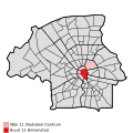
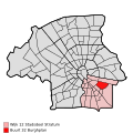
Map - NL - Eindhoven - Wijk 11 Stadsdeel Centrum.svg 625 × 575; 14 KB
-
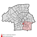
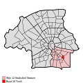
Map - NL - Eindhoven - Wijk 12 Stadsdeel Stratum.svg 625 × 575; 14 KB
-
Map - NL - Eindhoven - Wijk 13 Stadsdeel Tongelre.svg 625 × 575; 14 KB
-
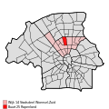
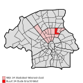
Map - NL - Eindhoven - Wijk 14 Stadsdeel Woensel-Zuid.svg 625 × 575; 14 KB
-
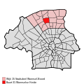
Map - NL - Eindhoven - Wijk 15 Stadsdeel Woensel-Noord.svg 625 × 575; 14 KB
-
Map - NL - Eindhoven - Wijk 16 Stadsdeel Strijp - Buurt 21 Hurk.svg 375 × 375; 54 KB
-
Map - NL - Eindhoven - Wijk 16 Stadsdeel Strijp - Buurt 31 Ba A2.svg 375 × 375; 54 KB
-
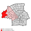
Map - NL - Eindhoven - Wijk 16 Stadsdeel Strijp.svg 625 × 575; 14 KB
-
Map - NL - Eindhoven - Wijk 17 Stadsdeel Gestel.svg 625 × 575; 14 KB
-
Map NL Eindhoven - 't Hofke.png 892 × 601; 325 KB
-
Map NL Eindhoven - Aanschot.png 892 × 601; 322 KB
-
Map NL Eindhoven - Acht.png 892 × 601; 29 KB
-
Map NL Eindhoven - Achtse Barrier.png 892 × 601; 315 KB
-
Map NL Eindhoven - Achtse Molen.png 892 × 601; 317 KB
-
Map NL Eindhoven - Airport.PNG 892 × 601; 46 KB
-
Map NL Eindhoven - Barrier.png 892 × 601; 318 KB
-
Map NL Eindhoven - Begijnenbroek.png 892 × 601; 315 KB
-
Map NL Eindhoven - Bennekel en Gagelbosch.png 892 × 601; 321 KB
-
Map NL Eindhoven - Binnenstad.png 892 × 601; 29 KB
-
Map NL Eindhoven - Blaarthem.png 892 × 601; 321 KB
-
Map NL Eindhoven - Blixembosch.png 892 × 601; 29 KB
-
Map NL Eindhoven - Bloemenplein.png 892 × 601; 319 KB
-
Map NL Eindhoven - Bokt.png 892 × 601; 320 KB
-
Map NL Eindhoven - Boschdijk.png 892 × 601; 326 KB
-
Map NL Eindhoven - Centrum.PNG 892 × 601; 46 KB
-
Map NL Eindhoven - De Laak.png 892 × 601; 320 KB
-
Map NL Eindhoven - De Tempel.png 892 × 601; 29 KB
-
Map NL Eindhoven - Dommelbeemd.png 892 × 601; 318 KB
-
Map NL Eindhoven - Doornakkers-Oost.png 892 × 601; 326 KB
-
Map NL Eindhoven - Doornakkers-West.png 892 × 601; 326 KB
-
Map NL Eindhoven - Eckart.png 892 × 601; 321 KB
-
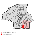
Map NL Eindhoven - Eikenburg.png 892 × 601; 326 KB
-
Map NL Eindhoven - Eliasterrein en Vonderkwartier.png 892 × 601; 320 KB
-
Map NL Eindhoven - Elzent.png 892 × 601; 319 KB
-
Map NL Eindhoven - Engelsbergen.png 892 × 601; 320 KB
-
Map NL Eindhoven - Erp.png 892 × 601; 317 KB
-
Map NL Eindhoven - Fellenoord.png 892 × 601; 29 KB
-
Map NL Eindhoven - Genderdal.png 892 × 601; 318 KB
-
Map NL Eindhoven - Gerardusplein.png 892 × 601; 327 KB
-
Map NL Eindhoven - Gestel.PNG 892 × 601; 46 KB
-
Map NL Eindhoven - Gijzenrooi.png 892 × 601; 322 KB
-
Map NL Eindhoven - Groenewoud.png 892 × 601; 317 KB
-
Map NL Eindhoven - Hagenkamp.png 892 × 601; 320 KB
-
Map NL Eindhoven - Halve Maan.png 892 × 601; 316 KB
-
Map NL Eindhoven - Heistraat.png 892 × 601; 319 KB
-
Map NL Eindhoven - Herdgang.png 892 × 601; 326 KB
-
Map NL Eindhoven - Hurk en Croy.png 892 × 601; 316 KB
-
Map NL Eindhoven - Irisbuurt.png 892 × 601; 319 KB
-
Map NL Eindhoven - Jagershoef.png 892 × 601; 326 KB
-
Map NL Eindhoven - Karpen.png 892 × 601; 326 KB
-
Map NL Eindhoven - Kerstroosplein.png 892 × 601; 327 KB
-
Map NL Eindhoven - Kortonjo.png 892 × 601; 324 KB
-
Map NL Eindhoven - Koudenhoven.png 892 × 601; 326 KB
-
Map NL Eindhoven - Kronehoef.png 892 × 601; 318 KB
-
Map NL Eindhoven - Looiakkers.png 892 × 601; 319 KB
-
Map NL Eindhoven - Meerhoven.PNG 892 × 601; 46 KB
-
Map NL Eindhoven - Meerhoven.png 892 × 601; 312 KB
-
Map NL Eindhoven - Mensfort.png 892 × 601; 318 KB
-
Map NL Eindhoven - Muschberg en Geestenberg.png 892 × 601; 327 KB
-
Map NL Eindhoven - Ontginning.png 892 × 601; 324 KB
-
Map NL Eindhoven - Oud Kasteel.png 892 × 601; 325 KB
-
Map NL Eindhoven - Oud-Gestel.png 892 × 601; 318 KB
-
Map NL Eindhoven - Oud-Stratum.png 892 × 601; 319 KB
-
Map NL Eindhoven - Oud-Strijp.png 892 × 601; 30 KB
-
Map NL Eindhoven - Oud-Tongelre.png 892 × 601; 320 KB
-
Map NL Eindhoven - Oud-Woensel.png 892 × 601; 317 KB
-
Map NL Eindhoven - Oude Spoorbaan.png 892 × 601; 321 KB
-
Map NL Eindhoven - Philipsdorp.png 892 × 601; 321 KB
-
Map NL Eindhoven - Poelhekkelaan.png 892 × 601; 327 KB
-
Map NL Eindhoven - Putten.png 892 × 601; 322 KB
-
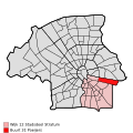
Map NL Eindhoven - Rapenland.png 892 × 601; 318 KB
-
Map NL Eindhoven - Rochusbuurt.png 892 × 601; 320 KB
-
Map NL Eindhoven - Roosten.png 892 × 601; 326 KB
-
Map NL Eindhoven - Rozenknopje.png 892 × 601; 320 KB
-
Map NL Eindhoven - Schrijversbuurt.png 892 × 601; 321 KB
-
Map NL Eindhoven - Sportpark Aalsterweg.png 892 × 601; 326 KB
-
Map NL Eindhoven - Stratum.PNG 892 × 601; 46 KB
-
Map NL Eindhoven - Strijp-S.png 892 × 601; 326 KB
-
Map NL Eindhoven - Strijp.PNG 892 × 601; 46 KB
-
Map NL Eindhoven - Tongelre.PNG 892 × 601; 46 KB
-
Map NL Eindhoven - TU-terrein.png 892 × 601; 29 KB
-
Map NL Eindhoven - Tuindorp.png 892 × 601; 319 KB
-
Map NL Eindhoven - Urkhoven.png 892 × 601; 326 KB
-
Map NL Eindhoven - Vaartbroek.png 892 × 601; 321 KB
-
Map NL Eindhoven - Vlokhoven.PNG 892 × 601; 29 KB
-
Map NL Eindhoven - Vredeoord.png 892 × 601; 318 KB
-
Map NL Eindhoven - Wielewaal.png 892 × 601; 325 KB
-
Map NL Eindhoven - Winkelcentrum.png 892 × 601; 327 KB
-
Map NL Eindhoven - Witte Dame.png 892 × 601; 29 KB
-
Map NL Eindhoven - Woensel Noord.PNG 892 × 601; 45 KB
-
Map NL Eindhoven - Woensel Zuid.PNG 892 × 601; 46 KB
-
Map NL Eindhoven - Woenselse Watermolen.png 892 × 601; 317 KB
-
Map NL Eindhoven - Zwaanstraat.png 892 × 601; 326 KB
