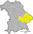
Category:Locator maps by government district in Bavaria
Jump to navigation
Jump to search
Federal states of Germany:
Subcategories
This category has the following 3 subcategories, out of 3 total.
Media in category "Locator maps by government district in Bavaria"
The following 6 files are in this category, out of 6 total.
-
Regierungsbezirk Mittelfranken 1970.png 773 × 797; 24 KB
-
Regierungsbezirk Niederbayern 1970.png 773 × 797; 24 KB
-
Regierungsbezirk Oberbayern 1970.png 773 × 797; 24 KB
-
Regierungsbezirk Oberfranken 1970.png 773 × 797; 24 KB
-
Regierungsbezirk Oberpfalz 1970.png 773 × 797; 24 KB
-
Regierungsbezirk Unterfranken 1970.png 773 × 797; 24 KB


