Category:Location maps of regions of France
Jump to navigation
Jump to search
| This category should only contain blank "Location maps" created for geo-location purposes which follow a same uniform standard, and have been created with a Geographic information system (GIS) software program using a compatible equirectangular or conical projection and for which the geographic coordinate system is known. For more information or questions see the wikiproject: German Wikipedia:Kartenwerkstatt/Positionskarten and this discussion page. |
Administrative regions and territorial collectivity of Metropolitan France (‡ since start of 2016):
Auvergne-Rhône-Alpes‡ · Bourgogne-Franche-Comté‡ · Bretagne · Centre-Val de Loire · Corsica · Grand Est‡ · Hauts-de-France‡ · Île-de-France · Normandie‡ · Nouvelle-Aquitaine‡ · Occitanie‡ · Pays de la Loire · Provence-Alpes-Côte d'Azur
Former administrative regions of Metropolitan France (until end of 2015):
Alsace · Aquitaine · Auvergne · Bourgogne · Champagne-Ardenne · Franche-Comté · Languedoc-Roussillon · Limousin · Lorraine · Midi-Pyrénées · Nord-Pas-de-Calais · Basse-Normandie · Haute-Normandie · Picardie · Poitou-Charentes · Rhône-Alpes
Overseas departments and regions: Guadeloupe · Martinique · French Guiana · Réunion · Mayotte
Overseas collectivities: Saint-Barthélemy · Saint-Martin (France) · Saint-Pierre and Miquelon · French Polynesia · Wallis and Futuna · the French Southern and Antarctic Lands+ ≈ French Southern and Antarctic Lands+
Sui generis territories: New Caledonia · Clipperton Island+
Subcategories
This category has the following 35 subcategories, out of 35 total.
Pages in category "Location maps of regions of France"
This category contains only the following page.
Media in category "Location maps of regions of France"
The following 3 files are in this category, out of 3 total.
-
France relief location map.jpg 2,000 × 1,922; 907 KB
-
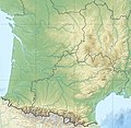
France South West relief location map.jpg 860 × 839; 294 KB
-
France South relief location map.jpg 935 × 429; 121 KB


