Category:Administrative maps of regions of France
Jump to navigation
Jump to search
Administrative regions and territorial collectivity of Metropolitan France (‡ since start of 2016):
Auvergne-Rhône-Alpes‡ · Bourgogne-Franche-Comté‡ · Brittany · Centre-Val de Loire · Corsica · Grand Est‡ · Hauts-de-France‡ · Île-de-France · Normandy‡ · Nouvelle-Aquitaine‡ · Occitania‡ · Pays de la Loire · Provence-Alpes-Côte d'Azur
Former administrative regions of Metropolitan France (until end of 2015):
Alsace · Auvergne · Burgundy · Champagne-Ardenne · Franche-Comté · Languedoc-Roussillon · Limousin · Lorraine · Nord-Pas-de-Calais · Lower Normandy · Upper Normandy · Picardy · Rhône-Alpes
Overseas departments and regions: Guadeloupe · Martinique · French Guiana · Réunion · Mayotte
Overseas collectivities: Saint Barthélemy · Saint-Martin
Sui generis territories: New Caledonia · Clipperton Island+
- Please use Category:SVG locator maps of regions in France (bright red location map scheme) (current standard) to illustrate your articles.
Subcategories
This category has the following 5 subcategories, out of 5 total.
!
*
Media in category "Administrative maps of regions of France"
The following 15 files are in this category, out of 15 total.
-
Carte france-zones.jpg 384 × 407; 17 KB
-
Carte-des-codes-des-regions-selon-l-INSEE.jpg 603 × 709; 54 KB
-
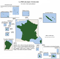
DOM3.png 3,337 × 3,300; 360 KB
-
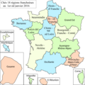
France 18 regions.png 648 × 599; 101 KB
-
France zones de defense 2000.png 4,000 × 3,844; 699 KB
-
France-constituent-lands.png 3,337 × 3,300; 383 KB
-
France-Constituent-Lands.png 3,337 × 3,300; 382 KB
-
France-Terres-Emergées.png 3,337 × 3,300; 299 KB
-
France-zone-defense-2016.png 526 × 556; 30 KB
-
France-zone-defense.png 526 × 556; 29 KB
-
ONEMAPêcheDélégationsInterrégionales2008.jpg 434 × 481; 48 KB
-
Regions of France (2016),with departements.png 4,379 × 4,096; 1.37 MB
-
Règions Franche 2016.png 2,048 × 2,048; 514 KB
-
Régions de France 2016 SZL.png 1,000 × 960; 151 KB
-
프랑스 본토 해외 영토 해외 데파르망트.png 3,337 × 3,300; 371 KB


