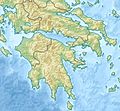
Category:Location maps of Greece
Jump to navigation
Jump to search
| This category should only contain blank "Location maps" created for geo-location purposes which follow a same uniform standard, and have been created with a Geographic information system (GIS) software program using a compatible equirectangular or conical projection and for which the geographic coordinate system is known. For more information or questions see the wikiproject: German Wikipedia:Kartenwerkstatt/Positionskarten and this discussion page. |
Media in category "Location maps of Greece"
The following 83 files are in this category, out of 83 total.
-
Greece (ancient) Attica (cropped).svg 856 × 773; 1.75 MB
-
Balkans 4087 cut bersko.png 2,690 × 1,537; 5.07 MB
-
Balkans 4087 cut centralna makedonia.png 8,769 × 4,907; 46.71 MB
-
Balkans 4087 cut dedeagachko.png 3,964 × 4,426; 18.16 MB
-
Balkans 4087 cut dramsko.png 3,859 × 2,049; 11.49 MB
-
Balkans 4087 cut grevensko.png 3,191 × 1,461; 7.06 MB
-
Balkans 4087 cut gyumurdzhinsko.png 3,095 × 1,667; 6.55 MB
-
Balkans 4087 cut halkidika.png 4,676 × 2,506; 7.04 MB
-
Balkans 4087 cut iztochna makedonia trakia.png 9,681 × 4,426; 45.01 MB
-
Balkans 4087 cut kardishko.png 2,989 × 1,796; 7.83 MB
-
Balkans 4087 cut katerinsko.png 2,040 × 2,056; 5.03 MB
-
Balkans 4087 cut kavalsko.png 3,296 × 2,191; 6.35 MB
-
Balkans 4087 cut kostursko.png 2,525 × 2,051; 7.56 MB
-
Balkans 4087 cut kozhansko.png 3,752 × 2,535; 13.68 MB
-
Balkans 4087 cut ksantiisko.png 2,622 × 1,921; 6.13 MB
-
Balkans 4087 cut kukushko.png 3,304 × 1,971; 8.79 MB
-
Balkans 4087 cut lamiisko.png 5,047 × 2,595; 16.21 MB
-
Balkans 4087 cut larisko.png 3,510 × 3,505; 14.77 MB
-
Balkans 4087 cut lerinsko.png 2,924 × 1,461; 5.49 MB
-
Balkans 4087 cut sersko.png 4,067 × 2,257; 12.51 MB
-
Balkans 4087 cut solunsko.png 4,220 × 2,231; 11.14 MB
-
Balkans 4087 cut trikalsko.png 3,626 × 1,833; 9.83 MB
-
Balkans 4087 cut vodensko.png 3,201 × 1,887; 8.15 MB
-
Balkans 4087 cut volosko.png 5,922 × 2,092; 6.63 MB
-
Balkans 4087 cut yaninsko.png 3,277 × 3,595; 18.5 MB
-
Balkans 4087 cut zapadna makedonia.png 4,672 × 3,637; 24.4 MB
-
Central Greece location map.png 1,200 × 700; 203 KB
-
Central Macedonia and East Macedonia & Thrace Regions Greece location map.svg 2,056 × 1,025; 92 KB
-
Central Macedonia location map.png 1,200 × 883; 197 KB
-
Central Macedonia Thessaly Central Greece Regions Greece location map.svg 1,464 × 1,645; 403 KB
-
Crete location map.svg 3,370 × 1,600; 101 KB
-
Epirus location map.png 800 × 932; 140 KB
-
Greece (ancient) Central (cropped).svg 1,937 × 1,253; 1.75 MB
-
Greece (ancient) Chalcidice (cropped).svg 1,591 × 1,204; 1.75 MB
-
Greece (ancient) Crete (cropped).svg 2,743 × 1,313; 1.75 MB
-
Greece (ancient) Epirus (cropped).svg 1,740 × 1,559; 1.76 MB
-
Greece (ancient) Euboea (cropped).svg 1,599 × 1,229; 1.75 MB
-
Greece (ancient) IonianIslands (cropped).svg 1,161 × 1,815; 1.75 MB
-
Greece (ancient) Larissa (cropped).svg 927 × 1,201; 1.75 MB
-
Greece (ancient) Macedonia (cropped).svg 2,697 × 1,837; 1.75 MB
-
Greece (ancient) NorthAegean (cropped).svg 1,839 × 2,761; 1.75 MB
-
Greece (ancient) Peloponnesus (cropped).svg 2,108 × 2,411; 1.75 MB
-
Greece (ancient) SouthAegean (cropped).svg 3,546 × 2,844; 1.75 MB
-
Greece (ancient) Thessaly (cropped).svg 2,695 × 1,393; 1.75 MB
-
Greece and Cyprus location map.svg 1,570 × 846; 897 KB
-
Greece Attica region location map.svg 1,053 × 2,738; 4.18 MB
-
Greece location map Melos.svg 1,003 × 825; 833 KB
-
Greece location map Psara.svg 1,003 × 825; 833 KB
-
Greece location map.png 1,003 × 825; 231 KB
-
Greece location map.svg 1,003 × 825; 833 KB
-
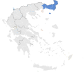
Greece Macedonia and Thrace location map.svg 575 × 272; 733 KB
-
Greece North Half location map.svg 741 × 395; 733 KB
-
Greece Phthiotis Regional Unit.svg 992 × 655; 201 KB
-
Greece relief location map.jpg 1,003 × 825; 691 KB
-
Ionian Islands location map.svg 994 × 1,780; 129 KB
-
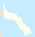
Limnos mapa.svg 888 × 676; 72 KB
-
Location map of AegeanIslands (Greece).svg 8,460 × 7,315; 1.87 MB
-
Location map of Central Greece (Greece).svg 8,460 × 7,315; 1.36 MB
-
Location map of CentralGreece (Greece).svg 8,460 × 7,315; 1.82 MB
-
Location map of Epirus (Greece).svg 8,460 × 7,315; 1.82 MB
-
Location map of Ionian Islands (Greece).svg 8,460 × 7,315; 1.84 MB
-
Location map of IonianIslands (Greece).svg 8,460 × 7,315; 1.84 MB
-
Location map of MountAthos (Greece).svg 7,304 × 7,315; 1.74 MB
-
Location map of Peloponnese (Greece).svg 8,460 × 7,315; 1.82 MB
-
Location map of Thessaly (Greece).svg 8,460 × 7,315; 1.36 MB
-
Location map of Thrace (Greece).svg 8,460 × 7,315; 1.82 MB
-
Location map of WesternGreece (Greece).svg 8,460 × 7,315; 1.82 MB
-
Mount Athos location map.svg 2,366 × 2,481; 59 KB
-
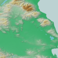
Northeastern Greece relief location map.jpg 450 × 225; 99 KB
-
Northern Aegean relief location map.jpg 455 × 345; 149 KB
-
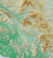
Northwestern Greece relief location map.jpg 405 × 325; 142 KB
-
Peloponnese location map.png 1,000 × 1,032; 189 KB
-
Reliefkarte Griechenland.png 2,943 × 2,557; 7.36 MB
-
South Aegean location map.png 2,000 × 1,253; 259 KB
-
Southern Aegean relief location map.jpg 511 × 374; 165 KB
-
Southern Greece location map.svg 1,003 × 924; 899 KB
-
Southern Greece relief location map.jpg 381 × 351; 135 KB
-
West & Central Macedonia Regions Greece location map.svg 1,457 × 1,182; 201 KB
-
Western Greece location map.png 800 × 1,081; 192 KB
-
Western Macedonia location map.png 3,101 × 3,302; 98 KB
-
Zaforas.jpg 1,003 × 825; 337 KB
-
Zaforas1.jpg 1,003 × 825; 369 KB
-
Zakynthos location map.svg 512 × 384; 31 KB


