Category:Location maps of Europe
Jump to navigation
Jump to search
| This category should only contain blank "Location maps" created for geo-location purposes which follow a same uniform standard, and have been created with a Geographic information system (GIS) software program using a compatible equirectangular or conical projection and for which the geographic coordinate system is known. For more information or questions see the wikiproject: German Wikipedia:Kartenwerkstatt/Positionskarten and this discussion page. |
Subcategories
This category has the following 56 subcategories, out of 56 total.
+
A
- Location maps of Albania (9 F)
- Location maps of Armenia (24 F)
B
C
- Location maps of Cyprus (18 F)
D
E
- Location maps of Estonia (9 F)
F
G
- Location maps of Greece (83 F)
H
I
- Location maps of Iceland (10 F)
K
- Location maps of Kosovo (8 F)
L
- Location maps of Latvia (23 F)
M
- Location maps of Malta (4 F)
- Location maps of Moldova (9 F)
- Location maps of Monaco (1 F)
N
- Location maps of Norway (74 F)
P
R
- Location maps of Romania (22 F)
S
- Location maps of Serbia (13 F)
- Location maps of Slovakia (15 F)
T
U
V
Y
- Location maps of Yugoslavia (12 F)
Media in category "Location maps of Europe"
The following 84 files are in this category, out of 84 total.
-
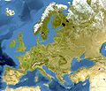
Europa - orografia.jpg 1,580 × 1,351; 1.71 MB
-
Europe blank laea location map.svg 1,401 × 1,198; 1.42 MB
-
Europe bluemarble laea location map.jpg 1,400 × 1,197; 926 KB
-
Europe EU laea location map.svg 1,401 × 1,198; 1.43 MB
-
Europe laea location map.svg 1,401 × 1,198; 2.21 MB
-
Europe natural laea location map.jpg 1,580 × 1,351; 1.15 MB
-
Europe relief laea location map.jpg 1,580 × 1,351; 1.1 MB
-
Europe location map.svg 450 × 369; 144 KB
-
Baltic Sea location map.svg 869 × 1,039; 881 KB
-
Relief Map of Baltic Sea.png 869 × 1,039; 1.14 MB
-
Baltic states location map.svg 660 × 992; 358 KB
-
BeNe.png 800 × 1,087; 124 KB
-
Benelux location map.svg 960 × 1,304; 175 KB
-
English Channel location map.svg 955 × 665; 178 KB
-
Relief Map of English Channel.png 955 × 665; 614 KB
-
Europe satellite image location map.jpg 5,668 × 3,800; 1.83 MB
-
Alpen 300dpi.jpg 3,279 × 2,265; 4.3 MB
-
Alps location map borders cities.png 5,555 × 3,836; 11.87 MB
-
Alps location map borders.png 2,000 × 1,381; 4.72 MB
-
Alps location map.png 2,000 × 1,381; 4.73 MB
-
Central Europe location map.svg 1,796 × 1,245; 601 KB
-
D-A-CH location map.svg 1,257 × 1,514; 586 KB
-
Scandinavia location map.svg 765 × 961; 1.23 MB
-
South-West Scandinavia location map.svg 437 × 462; 807 KB
-
North Sea location map.svg 988 × 1,159; 582 KB
-
Arcipelago siciliano nel Mar Mediterraneo.svg 1,754 × 862; 1.2 MB
-
Belgien plan ohne Südosten.png 877 × 641; 74 KB
-
Bohemian Massif relief location map.jpg 1,400 × 1,085; 1.02 MB
-
Carpathians relief location map.jpg 1,150 × 851; 807 KB
-
Carpathians relief location map.svg 1,172 × 867; 4.85 MB
-
Caspian Sea relief location map.jpg 900 × 1,794; 771 KB
-
Central-and-East-Europe.jpg 1,297 × 1,544; 218 KB
-
D-F location map.svg 612 × 620; 1.95 MB
-
Dinarides relief location map.jpg 900 × 765; 483 KB
-
EBEL INL location map.png 600 × 367; 84 KB
-
EBYSL location map 2015.png 750 × 367; 86 KB
-
Estonia and Latvia location map.svg 512 × 574; 225 KB
-
Europe blank laea location map (variant).svg 1,401 × 1,198; 1.38 MB
-
Europe blank laea location map before 1990.svg 1,401 × 1,198; 1.38 MB
-
Europe blank laea location map no boundaries.svg 1,401 × 1,198; 1.72 MB
-
Europe blank laea location map-1.svg 1,401 × 1,198; 1.54 MB
-
Europe central west blank laea location map.png 1,000 × 890; 290 KB
-
Europe central west blank laea location map.xcf 1,000 × 890; 329 KB
-
Europe EU laea location map (configurable).svg 1,200 × 1,027; 1.39 MB
-
Europe laea location map-es.svg 1,401 × 1,198; 2.06 MB
-
Europe large location map.svg 700 × 545; 1.33 MB
-
Europe large topographic location map.png 2,334 × 1,816; 1.19 MB
-
Europe location map.png 1,928 × 1,986; 1.42 MB
-
Europe satellite image location map Britain To Turkey.jpg 3,807 × 2,954; 1.8 MB
-
Europe Unified Patent Court laea location map (configurable).svg 1,200 × 1,027; 1.39 MB
-
Europe Unified Patent Court local divisions laea location map (configurable).svg 1,200 × 1,027; 1.39 MB
-
Finnish dialect location map - Central and North Ostrobothnian dialects.svg 1,012 × 1,558; 2.13 MB
-
Finnish dialect location map - Lapland dialects.svg 1,012 × 1,558; 2.13 MB
-
Finnish dialect location map - Savonian dialects.svg 1,012 × 1,558; 2.13 MB
-
Finnish dialect location map - South Ostrobothnian dialects.svg 1,012 × 1,558; 2.12 MB
-
Finnish dialect location map - southeastern dialects.svg 1,012 × 1,558; 2.13 MB
-
Finnish dialect location map - southwestern dialects.svg 1,012 × 1,558; 2.13 MB
-
Finnish dialect location map - Tavastian dialects.svg 1,012 × 1,558; 2.13 MB
-
Finnish dialect location map.svg 800 × 950; 1.8 MB
-
Iberian Peninsula location map.svg 1,184 × 1,016; 413 KB
-
Irish Sea location map.svg 305 × 397; 824 KB
-
Iron Gates relief location map.jpg 224 × 128; 25 KB
-
Italia continentale.png 2,000 × 1,381; 5.31 MB
-
Jura location map.png 3,234 × 3,055; 10.41 MB
-
Mediterranean Sea location map (blank) 2.svg 1,754 × 862; 1.02 MB
-
Mediterranean Sea location map (blank).svg 1,754 × 862; 1.01 MB
-
Mediterranean Sea location map islands-de.svg 1,576 × 794; 1.57 MB
-
NATO Europe location map.svg 1,401 × 1,198; 1.42 MB
-
North Sea Network location map.jpg 988 × 1,159; 405 KB
-
North Sea relief location map.jpg 988 × 1,159; 909 KB
-
Northern and Central Europe 2 location map.svg 520 × 500; 1.84 MB
-
Northern and Central Europe location map.svg 400 × 500; 1.84 MB
-
NUMBERED-ICELAND-REGION-(with labels).png 12,000 × 8,520; 2.8 MB
-
Pannonian Plain relief location map.jpg 850 × 798; 532 KB
-
Principaux secteurs de la manche.svg 611 × 426; 841 KB
-
Regenbogen location map.svg 744 × 1,052; 1.92 MB
-
Relief location map of Eastern Europe.jpg 801 × 988; 131 KB
-
Relief Map of Beltsee.png 226 × 225; 78 KB
-
Scandinavia LCC admin map.svg 539 × 757; 5.02 MB
-
Scandinavia LCC topographic map.svg 539 × 757; 7.88 MB
-
SGP 2014 Nordic combined.svg 1,401 × 1,198; 2.19 MB
-
SGP 2015 Nordic combined.svg 1,401 × 1,198; 2.19 MB
-
Silesia location map.svg 856 × 918; 98 KB
-
Transylvania relief location map.jpg 621 × 537; 256 KB


