Category:Linguistic maps of the German language
Jump to navigation
Jump to search
Subcategories
This category has the following 22 subcategories, out of 22 total.
Media in category "Linguistic maps of the German language"
The following 92 files are in this category, out of 92 total.
-
19 of 'Schlesien. Eine Landeskunde für das deutsche Volk, etc' (11234976795).jpg 1,554 × 2,382; 932 KB
-
1942 German Dialects (30249105593).jpg 3,167 × 2,199; 1.38 MB
-
Aire de diffusion de la langue allemande en 1910.png 1,280 × 808; 574 KB
-
Benrater, Speyerer und Germersheimer Linie.png 1,673 × 2,013; 827 KB
-
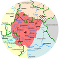
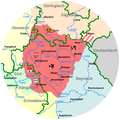
Benrather and Speyerer Linie.png 328 × 421; 24 KB
-
Benrather, Speyerer und Germersheimer Linie.png 328 × 421; 37 KB
-
Boarisch-mit-Flaggn.png 1,024 × 1,022; 120 KB
-
BosenSheng.JPG 194 × 250; 15 KB
-
Brockhaus 1894 Deutsche Mundarten (Thür.-Obers.).jpg 865 × 495; 323 KB
-
Brockhaus 1894 Deutsche Mundarten Sorbisch.jpg 900 × 675; 464 KB
-
Carte moselle germanophone 2.JPG 2,311 × 1,636; 186 KB
-
Comunidades lingüísticas de Bélgica.png 405 × 333; 8 KB
-
Czechoslovakia 1930 linguistic map - fr.svg 1,281 × 778; 749 KB
-
Deutsche Ostsiedlung.png 1,181 × 1,575; 354 KB
-
Deutsche Sprache vor 1WK.png 34,450 × 34,667; 64.38 MB
-
Deutsche Sprachinseln in Norditalien3.JPG 484 × 340; 45 KB
-
Distribution of the German language in Austria-Hungary, 1910.png 2,560 × 1,978; 394 KB
-
Duits.jpg 816 × 621; 94 KB
-
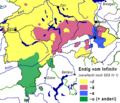
Euch-enk.png 253 × 148; 8 KB
-
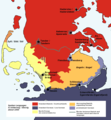
Folkesprogene i Hertugdømmet Slesvig (Higher Resolution Version).png 3,456 × 5,184; 25.97 MB
-
Folkesprogene i Hertugdømmet Slesvig (Map Only Version).png 2,826 × 3,888; 20.3 MB
-
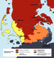
Folkesprogene i Hertugdømmet Slesvig.png 865 × 1,341; 1.91 MB
-
Frangn(2).PNG 1,047 × 1,045; 90 KB
-
Frangn.PNG 1,047 × 1,045; 91 KB
-
German dialect continuum in 1900 (according to Wiesinger & König).png 3,048 × 3,044; 1.14 MB
-
German language frequency in Poland based on Polish census of 1931.PNG 1,337 × 1,473; 143 KB
-
German language in gminas.png 387 × 612; 133 KB
-
German language in the Russian Empire (1897).svg 4,648 × 2,744; 1.39 MB
-
German Speakers in Prussia 1905+10.png 10,024 × 6,960; 4.4 MB
-
German1910.png 1,031 × 650; 60 KB
-
Gminy zamieszkane przez Niemców warmińsko-mazurskie.png 1,503 × 927; 319 KB
-
Gminy zamieszkane przez Niemców.png 1,503 × 2,209; 611 KB
-
Haut-allemand v2.png 671 × 865; 61 KB
-
Haut-Allemand.png 671 × 865; 85 KB
-
Heckendalheim sprachlinien2.jpg 735 × 379; 40 KB
-
Heutige oberdeutsche Mundarten neu.PNG 326 × 459; 56 KB
-
Historical German linguistical area.PNG 1,031 × 651; 63 KB
-
Insediamenti germanici sec. XI-XIV nelle Alpi centro-orientali.jpg 1,170 × 988; 152 KB
-
Isoglosse alt - al.jpg 1,118 × 653; 266 KB
-
Isoglosse bin-sei.jpg 1,001 × 489; 312 KB
-
Isoglosse treib-treiw.jpg 1,113 × 481; 193 KB
-
Isoglosse wor-woa.jpg 1,101 × 464; 189 KB
-
Isoglosse wär-war.jpg 1,118 × 481; 205 KB
-
Isoglosse zu - ze.jpg 1,126 × 479; 223 KB
-
Jezyk niemiecki w gminach.png 775 × 1,312; 267 KB
-
Karte erzgebirgisch.png 451 × 259; 5 KB
-
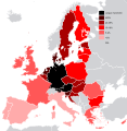
Knowledge German EU map.png 1,218 × 1,245; 55 KB
-
Knowledge of German EU map (2010).svg 590 × 603; 670 KB
-
Knowledge of German EU map-fr.svg 1,212 × 1,242; 541 KB
-
Knowledge of German EU map.png 1,218 × 1,245; 55 KB
-
Lange diercke sachsen deutschtum erde.jpg 2,553 × 1,213; 1.91 MB
-
Lausitzisch-Schlesisches Mundartgebiet.PNG 652 × 652; 28 KB
-
Linguistic map of South Tyrol.png 686 × 501; 30 KB
-
LinguisticSituationSchleswigSlesvig.png 824 × 889; 267 KB
-
Luxemburgs.png 370 × 573; 19 KB
-
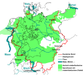
Maas memel etsch belt.svg 1,300 × 1,200; 608 KB
-
Mapa del alemán coloniero hablado en Venezuela.png 800 × 812; 81 KB
-
Mitteldeutsche Mundarten.png 745 × 1,053; 109 KB
-
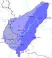
Moselfrankisch.png 527 × 593; 10 KB
-
Oberdeutsche Dialekte.png 745 × 1,053; 147 KB
-
Oberdeutsches Sprachgebiet-1937.PNG 1,031 × 651; 62 KB
-
Oestareichische-Voiksgrubbm.PNG 1,030 × 650; 58 KB
-
Ofen (Felsen) Verbreitung.png 648 × 298; 258 KB
-
Oostelike Opperduits.png 555 × 487; 47 KB
-
Osadnictwo niemieckie na wschodzie-es.svg 1,270 × 1,292; 6.24 MB
-
Osadnictwo niemieckie na wschodzie.PNG 540 × 579; 32 KB
-
Ostfraenkischer Sprachraum.png 1,180 × 825; 511 KB
-
Ostmitteldeutsches Mundartgebiet.png 652 × 652; 29 KB
-
PADutch-version 1.png 545 × 418; 30 KB
-
Palfen (Toponym) Verbreitung.png 691 × 385; 264 KB
-
Parz (Toponym) Verbreitung.png 676 × 501; 345 KB
-
Platt 1630.svg 750 × 601; 448 KB
-
Plattdüütsch in Hessen.svg 403 × 542; 64 KB
-
Pälzisch.gif 374 × 360; 6 KB
-
Rheinfrankisch.png 559 × 595; 17 KB
-
Rheinischer faecher.png 756 × 730; 49 KB
-
Ripuarisch.png 686 × 508; 14 KB
-
Schlesien Karte Dialekte Vorläufig.png 1,718 × 1,036; 40 KB
-
Schwalpicum.png 1,233 × 1,062; 90 KB
-
Sprachkarte von Deutschland - entworfen von Dr Karl Bernhardt - btv1b8469614m.jpg 9,562 × 8,292; 12.15 MB
-
SprachlicheVerhältnisseSchleswig.png 824 × 889; 262 KB
-
SprogforholdSlesvig.png 824 × 889; 262 KB
-
St. Goarer Linie (Südwestfalen).png 975 × 859; 1.23 MB
-
Standard varieties of German.png 666 × 636; 54 KB
-
Suedfraenkischer Sprachraum.png 1,180 × 825; 351 KB
-
Verbreitungsgebiet der deutschen Sprache 2010.png 1,030 × 650; 69 KB
-
Verbreitungsgebiet der deutschen Sprache neu.PNG 1,024 × 646; 451 KB
-
Vinxtbachlinie Siegerland.png 1,315 × 870; 1.84 MB
-
Vojvodina-1910-German.gif 2,940 × 2,322; 189 KB
-
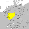
Westmitteldeutsches Mundartgebiet.PNG 652 × 652; 29 KB
-
Zakarpatska2001german.PNG 1,003 × 783; 68 KB
-
Zweisprachige Gemeinden OS.png 775 × 1,232; 263 KB


