Category:Linguistic maps of West Germanic languages
Jump to navigation
Jump to search
Subcategories
This category has the following 5 subcategories, out of 5 total.
A
D
G
L
Media in category "Linguistic maps of West Germanic languages"
The following 97 files are in this category, out of 97 total.
-
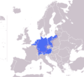
01Europe blank map with Germany Region (detail).png 514 × 428; 35 KB
-
01Europe blank map with Germany Region.png 1,360 × 1,245; 80 KB
-
1937 linguistic map of Central Europe-EN.svg 1,224 × 772; 1.63 MB
-
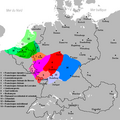
2013 August - West Germanic language Area around 580 CE.png 1,024 × 876; 532 KB
-
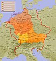
AlthochdeutscheSprachräume962 Box.jpg 800 × 874; 583 KB
-
Benrater und Speyrer Linie.png 1,673 × 2,013; 814 KB
-
Benrather und Speyerer Linie.png 1,158 × 1,130; 1,011 KB
-
Carte des langues franciques.png 651 × 651; 28 KB
-
Carte des langues francisques.png 651 × 651; 36 KB
-
Continental West Germanic languages.png 1,796 × 2,332; 539 KB
-
Continental West Germanic languages1000.png 1,114 × 1,585; 2.02 MB
-
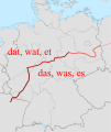
Dat-das-Isogloss.svg 1,075 × 1,273; 551 KB
-
Deutsch-Niederländischer Sprachraum (nach Werner König).png 2,123 × 1,676; 2.01 MB
-
Deutsche Dialekte (1945).png 1,653 × 1,323; 96 KB
-
Deutsche Dialekte (nur Karte).png 652 × 652; 29 KB
-
Deutsche Dialekte 1910.png 7,107 × 4,683; 13.39 MB
-
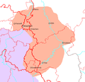
Deutsche Dialekte Ausschnitt Rheinland.PNG 549 × 472; 244 KB
-
Deutsche Dialekte.PNG 13,162 × 6,779; 5.82 MB
-
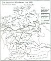
Deutsche Mundarten seit 1945.png 1,917 × 758; 72 KB
-
Deutsche Mundarten.gif 1,627 × 1,181; 663 KB
-
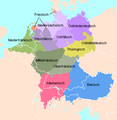
Deutsche Mundarten.png 1,031 × 651; 81 KB
-
Deutsche Mundarten.PNG 1,031 × 651; 82 KB
-
DeutschesSprachgebiet962.png 1,114 × 1,585; 1.72 MB
-
The development of the German linguistic area.gif 1,031 × 650; 160 KB
-
Dialekte in der DDR.png 1,161 × 1,500; 450 KB
-
Dialekte in Nordrhein-Westfalen - blank.PNG 720 × 863; 76 KB
-
Dialekte in Nordrhein-Westfalen.PNG 665 × 857; 322 KB
-
Dialekte und Einzugsgebiete im Eichsfeld .jpg 1,765 × 903; 241 KB
-
Dialetti tedeschi.png 1,653 × 1,323; 654 KB
-
Die Frankiese taalgebied.png 652 × 652; 32 KB
-
Eenheids-pluralislijn.png 756 × 836; 29 KB
-
ENHG diphthongisation.jpg 3,222 × 3,290; 1.14 MB
-
Frankischetalen.png 498 × 427; 63 KB
-
Frankish Foederatus.png 570 × 471; 73 KB
-
Fränkisches Sprachgebiet.png 652 × 652; 29 KB
-
German dialectal map-ar.png 629 × 651; 32 KB
-
German dialectal map-es.png 629 × 651; 36 KB
-
German dialectal map.PNG 629 × 651; 16 KB
-
Germanic pitch.png 567 × 546; 18 KB
-
Germersheimer Linie.png 1,158 × 1,130; 1.24 MB
-
Hansesprache no text.jpg 6,750 × 4,000; 9.01 MB
-
Hansesprache-mit Legende.jpg 6,750 × 4,000; 8.38 MB
-
Hansesprache.jpg 6,750 × 4,000; 9.61 MB
-
Historical West Germanic language area.png 1,266 × 1,250; 831 KB
-
Hochdeutscher Sprachraum.png 629 × 651; 88 KB
-
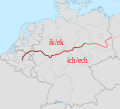
Ik-ich-Isogloss - Uerdinger Lien.svg 1,397 × 1,272; 722 KB
-
KR Mundartgrenzen.jpg 1,290 × 1,114; 501 KB
-
Lange diercke sachsen deutschtum mitteleuropa.jpg 2,546 × 2,107; 6.06 MB
-
Languages Benelux (cropped).PNG 699 × 920; 23 KB
-
Languages Benelux (cropped1).PNG 699 × 910; 17 KB
-
Languages Benelux (cropped2).PNG 699 × 915; 90 KB
-
Languages Benelux.PNG 699 × 2,737; 170 KB
-
Languages Benelux.png 693 × 927; 38 KB
-
Languages in Central Europe 1910.jpg 1,049 × 1,031; 429 KB
-
Languages of Central Europe 1910 v češtině.png 2,600 × 1,977; 966 KB
-
Languages of Central Europe 1910 without borders.png 1,035 × 925; 280 KB
-
Languages of Central Europe 1910.png 2,600 × 1,977; 982 KB
-
Ligne de Benrath.PNG 328 × 352; 22 KB
-
Maas memel etsch belt (rus).svg 1,300 × 1,200; 611 KB
-
Maas Memel Etsch Belt (svg).svg 1,138 × 1,135; 558 KB
-
Maas Memel Etsch Belt (svg, rus).svg 1,138 × 1,135; 558 KB
-
Maas Memel Etsch Belt.png 1,138 × 1,135; 294 KB
-
Map of German dialects (according to Wiesinger & König).png 2,148 × 2,749; 715 KB
-
Mitteleuropa – Völker u. Sprachgebiete.jpg 5,613 × 4,147; 15.16 MB
-
Brockhaus 1894 Deutsche Mundarten.jpg 3,551 × 2,866; 1.17 MB
-
Karte der deutschen Mundarten (Brockhaus).jpg 6,638 × 5,057; 21.36 MB
-
Mundarten.jpg 800 × 949; 99 KB
-
Mundarten.png 370 × 380; 12 KB
-
Nederlandstaalgebied.png 531 × 391; 30 KB
-
Niederländische Dialekte.png 845 × 2,520; 153 KB
-
Német nyelvjárások.png 579 × 599; 109 KB
-
Plural suffixes.png 541 × 520; 20 KB
-
RheinFächer LVR.png 1,400 × 1,980; 526 KB
-
Rheinische Schärfung.jpg 573 × 506; 179 KB
-
Rheinischer faecher.png 756 × 730; 49 KB
-
Zz-02-Kurt Ebner-Sahne Rahm-Oberbegriff süß sauer.jpg 1,002 × 616; 180 KB
-
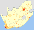
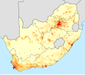
South Africa 2001 West Germanic speakers density map.svg 1,072 × 933; 1.36 MB
-
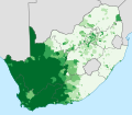
South Africa 2001 West Germanic speakers proportion map.svg 1,072 × 933; 595 KB
-
South Africa 2011 West Germanic speakers density map.svg 809 × 709; 1.73 MB
-
South Africa 2011 West Germanic speakers proportion map.svg 809 × 709; 1.03 MB
-
Sprachenkarte Deutschland1880.png 1,513 × 1,166; 356 KB
-
Sprachenkarte Kozenn 1906.jpg 1,528 × 1,550; 2.06 MB
-
Sprachenkarte Mitteleuropas (1937).png 1,412 × 687; 62 KB
-
Sprachkarte von Deutschland - entworfen von Dr Karl Bernhardt - btv1b8469614m.jpg 9,562 × 8,292; 12.15 MB
-
Uerdinger und Karlsruher Linie.png 1,158 × 1,130; 1.23 MB
-
Verbreitungsgebiet der deutschen Sprache 2010.png 1,030 × 650; 69 KB
-
VerbreitungsgebietDeutscheMundarten.png 571 × 648; 60 KB
-
West Germanic dialect continuum (according to Wiesinger, Heeringa & König).png 2,836 × 2,749; 890 KB
-
West Germanic dialect continuum in 1900 (according to Wiesinger, Heeringa & König).png 3,748 × 3,044; 1.31 MB
-
West Germanic group speakers density ZA.svg 995 × 768; 900 KB
-
West Germanic group speakers proportion ZA.svg 995 × 768; 899 KB
-
West germanic languages c 500.png 2,148 × 1,962; 542 KB
-
Western European languages800AD.png 585 × 410; 47 KB
-
Westgermanische Sprachvarietäten 1990.png 1,653 × 1,323; 123 KB
-
Wikipedias deutsch-niederländischer und friesischer Dialektgruppen.png 790 × 651; 135 KB
-
Zuidgelders jodaan.png 567 × 261; 9 KB

