Category:Karte des Deutschen Reichs (Carl Vogel)
Jump to navigation
Jump to search
map series with scale 1:500000 | |||||
| Upload media | |||||
| Instance of |
| ||||
|---|---|---|---|---|---|
| Location |
| ||||
| Creator | |||||
| Different from | |||||
| |||||
Media in category "Karte des Deutschen Reichs (Carl Vogel)"
The following 32 files are in this category, out of 32 total.
-
 Elchniederungsbahn.png 1,047 × 878; 1.95 MB
-
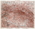
 Karte des Deutschen Reichs (Vogel) - Blattschnitt.png 800 × 659; 393 KB
-
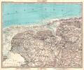
 Karte des Deutschen Reichs (Vogel) - Section 01 - Schleswig.png 4,980 × 4,170; 10.08 MB
-
 Karte des Deutschen Reichs (Vogel) - Section 02 - Stralsund.png 4,980 × 4,170; 9.59 MB
-
 Karte des Deutschen Reichs (Vogel) - Section 03 - Rügenwalde.png 4,980 × 4,170; 7.97 MB
-
 Karte des Deutschen Reichs (Vogel) - Section 04 - Danzig.png 4,980 × 4,170; 7.39 MB
-
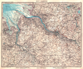
 Karte des Deutschen Reichs (Vogel) - Section 05 - Königsberg.png 4,980 × 4,332; 11.65 MB
-
 Karte des Deutschen Reichs (Vogel) - Section 06 - Emden.png 4,980 × 4,170; 9.38 MB
-
 Karte des Deutschen Reichs (Vogel) - Section 07 - Hamburg.png 4,980 × 4,170; 11.55 MB
-
 Karte des Deutschen Reichs (Vogel) - Section 08 - Schwerin.png 4,980 × 4,170; 11.81 MB
-
 Karte des Deutschen Reichs (Vogel) - Section 09 - Stettin.png 5,238 × 4,170; 12.18 MB
-
 Karte des Deutschen Reichs (Vogel) - Section 10 - Bromberg.png 4,980 × 4,170; 11.93 MB
-
 Karte des Deutschen Reichs (Vogel) - Section 11 - Allenstein.png 4,980 × 4,170; 12.35 MB
-
 Karte des Deutschen Reichs (Vogel) - Section 12 - Münster.png 5,238 × 4,170; 12.21 MB
-
 Karte des Deutschen Reichs (Vogel) - Section 13 - Hannover.png 4,980 × 4,170; 13.6 MB
-
 Karte des Deutschen Reichs (Vogel) - Section 14 - Berlin.png 4,980 × 4,170; 12 MB
-
 Karte des Deutschen Reichs (Vogel) - Section 15 - Frankfurt Oder.png 4,980 × 4,170; 12.48 MB
-
 Karte des Deutschen Reichs (Vogel) - Section 16 - Posen.png 4,980 × 4,170; 11.95 MB
-
 Karte des Deutschen Reichs (Vogel) - Section 17 - Köln.png 4,980 × 4,170; 13.59 MB
-
 Karte des Deutschen Reichs (Vogel) - Section 18 - Frankfurt Main.png 4,980 × 4,170; 14.5 MB
-
 Karte des Deutschen Reichs (Vogel) - Section 19 - Dresden.png 4,980 × 4,170; 13.33 MB
-
 Karte des Deutschen Reichs (Vogel) - Section 20 - Görlitz.png 4,980 × 4,170; 13.82 MB
-
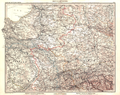
 Karte des Deutschen Reichs (Vogel) - Section 21 - Breslau.png 4,980 × 4,170; 13.22 MB
-
 Karte des Deutschen Reichs (Vogel) - Section 22 - Strassburg.png 5,238 × 4,170; 14.28 MB
-
 Karte des Deutschen Reichs (Vogel) - Section 23 - Stuttgart.png 4,980 × 4,170; 13.92 MB
-
 Karte des Deutschen Reichs (Vogel) - Section 24 - Regensburg.png 4,980 × 4,170; 14.47 MB
-
 Karte des Deutschen Reichs (Vogel) - Section 25 - Mülhausen.png 4,980 × 4,170; 14.19 MB
-
 Karte des Deutschen Reichs (Vogel) - Section 26 - Augsburg.png 4,980 × 4,170; 13.25 MB
-
 Karte des Deutschen Reichs (Vogel) - Section 27 - München.png 4,980 × 4,170; 12.92 MB
-
 Kr Heydekrug.png 1,027 × 849; 1.96 MB
-
 Kr Memel.png 658 × 1,270; 1.64 MB
-
 Kr Niederung.png 1,047 × 871; 1.98 MB

_-_Blattschnitt.png)
_-_Section_01_-_Schleswig.png)
_-_Section_02_-_Stralsund.png)
_-_Section_03_-_R%C3%BCgenwalde.png)
_-_Section_04_-_Danzig.png)
_-_Section_05_-_K%C3%B6nigsberg.png)
_-_Section_06_-_Emden.png)
_-_Section_07_-_Hamburg.png)
_-_Section_08_-_Schwerin.png)
_-_Section_09_-_Stettin.png)
_-_Section_10_-_Bromberg.png)
_-_Section_11_-_Allenstein.png)
_-_Section_12_-_M%C3%BCnster.png)
_-_Section_13_-_Hannover.png)
_-_Section_14_-_Berlin.png)
_-_Section_15_-_Frankfurt_Oder.png)
_-_Section_16_-_Posen.png)
_-_Section_17_-_K%C3%B6ln.png)
_-_Section_18_-_Frankfurt_Main.png)
_-_Section_19_-_Dresden.png)
_-_Section_20_-_G%C3%B6rlitz.png)
_-_Section_21_-_Breslau.png)
_-_Section_22_-_Strassburg.png)
_-_Section_23_-_Stuttgart.png)
_-_Section_24_-_Regensburg.png)
_-_Section_25_-_M%C3%BClhausen.png)
_-_Section_26_-_Augsburg.png)
_-_Section_27_-_M%C3%BCnchen.png)


