Category:1893 maps of Germany
Jump to navigation
Jump to search
Federal states of Germany:
Subcategories
This category has the following 4 subcategories, out of 4 total.
'
- 1893 maps of Lower Saxony (2 F)
- 1893 maps of Schleswig-Holstein (11 F)
K
Media in category "1893 maps of Germany"
The following 7 files are in this category, out of 7 total.
-

-
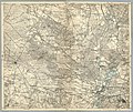
 Deutsches Kaiserreich 1893.jpg 3,049 × 2,411; 1.71 MB
-
 Karte des Deutschen Reiches - Composite 41, Wiek auf Rugen.jpg 10,636 × 9,332; 34.43 MB
-
 Karte des Deutschen Reiches von 1893 (268) Spandau 5820268c.jpg 11,106 × 9,328; 27.47 MB
-
 Karte des Deutschen Reiches von 1893 (444) Königstein 5820444c.jpg 11,935 × 10,839; 37.55 MB
-
 Karte des Deutschen Reiches von 1893 (659) Konstanz , Ausschnitt Reichenau.jpg 2,563 × 1,922; 5.35 MB
-
 Verenahof.jpg 1,235 × 824; 1.49 MB
%27_(16403182070).jpg)


_Spandau_5820268c.jpg)
_K%C3%B6nigstein_5820444c.jpg)
_Konstanz_,_Ausschnitt_Reichenau.jpg)
