Category:Islands of Ireland
Jump to navigation
Jump to search
Wikimedia category | |||||
| Upload media | |||||
| Instance of | |||||
|---|---|---|---|---|---|
| Category combines topics | |||||
| Ireland | |||||
island in the North Atlantic Ocean .jpg)   Kaart vun Irland | |||||
| Pronunciation audio | |||||
| Instance of | |||||
| Part of | |||||
| Location | British Isles, Europe, Northern hemisphere | ||||
| Located in or next to body of water | |||||
| Width |
| ||||
| Length |
| ||||
| Highest point |
| ||||
| Population |
| ||||
| Area |
| ||||
| Different from | |||||
 | |||||
Multimedia files about Irish islands.
Subcategories
This category has the following 10 subcategories, out of 10 total.
Media in category "Islands of Ireland"
The following 35 files are in this category, out of 35 total.
-
 A man and the sea (269552564).jpg 1,840 × 1,240; 1.55 MB
-
 Achillbeg.jpg 676 × 348; 136 KB
-
 AONBSUK.png 886 × 915; 37 KB
-
 Arranmore, Co. Donegal (Aerial 2007).jpg 2,770 × 2,098; 1.86 MB
-
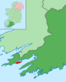 Bere Island within Ireland.png 1,450 × 1,806; 814 KB
-
 Britske ostrovy 01.PNG 510 × 710; 16 KB
-

-
 Bullock Island and Loch Hyne entrance - geograph.org.uk - 97770.jpg 640 × 401; 94 KB
-
 Clew Bay, June 2015.jpg 1,564 × 1,010; 2.01 MB
-
 Coney Island Sign, Co. Sligo.jpg 4,032 × 3,024; 5.46 MB
-
 End of Bartraw Strand - geograph.org.uk - 187233.jpg 640 × 480; 96 KB
-
 Illaunglass - geograph.org.uk - 14837.jpg 640 × 480; 207 KB
-
 Inchbofin, Lough Ree - geograph.org.uk - 412925.jpg 640 × 480; 57 KB
-
 Inis Seimir Island.jpg 2,560 × 1,920; 1.41 MB
-
 Island landscape island.jpg 1,050 × 700; 89 KB
-

-

-
 Knocklane Promontory Fort.JPG 3,488 × 2,616; 1.43 MB
-
 Long Hole-Ireland's Eye.jpg 560 × 595; 130 KB
-
 Lough Gill - geograph.org.uk - 188480.jpg 640 × 480; 61 KB
-
 Magharees kerry.jpg 5,136 × 1,940; 3.42 MB
-
 Panorama Dursey Island.jpg 6,415 × 1,626; 2.09 MB
-
 Skellig Michael map.png 4,320 × 4,320; 19.67 MB
-
 Swan Island, Garadice Lough - geograph.org.uk - 1309575.jpg 640 × 480; 101 KB
-
 That's some back garden... (8764827950).jpg 2,000 × 1,319; 1.28 MB
-
 Tory Island 1.jpg 3,264 × 2,448; 4.82 MB
-
 Tory Island 2.jpg 3,264 × 2,448; 4.81 MB
-
 Tory Island 3.jpg 3,264 × 2,448; 4.63 MB
-
 Tory Island 4.jpg 3,264 × 2,448; 4.89 MB
-
 Tory Island 5.jpg 3,264 × 2,448; 4.38 MB
-
 Tory Island Generators.jpg 3,264 × 2,448; 5.06 MB
-
 Tory Island OpenStreetMaps.svg 2,963 × 1,958; 3.13 MB
-

-
 View from Beenarouke to Deenish and Scariff Island Co Kerry Ireland Aug13 2018.jpg 5,152 × 3,864; 6.93 MB
-

.jpg)


.jpg)


.jpg)


