Category:North Channel
Jump to navigation
Jump to search
strait in the United Kingdom between northeast Northern Ireland and the Scottish Kintyre peninsula | |||||
| Upload media | |||||
| Instance of | |||||
|---|---|---|---|---|---|
| Part of |
| ||||
| Named after | |||||
| Location | Britain | ||||
| Has part(s) | |||||
| Inflows | |||||
 | |||||
Media in category "North Channel"
The following 12 files are in this category, out of 12 total.
-
Admiralty Chart No 1577 Western approaches to the Firth of Clyde, Published 1913.jpg 16,242 × 11,122; 53.29 MB
-
Admiralty Chart No 2199 North Channel Northern Part, Published 1966.jpg 18,326 × 11,113; 12.45 MB
-
Admiralty Chart No 2201 North Channel Mull of Kintyre to Belfast Lough, Published 1946.jpg 11,001 × 16,148; 44.88 MB
-
Admiralty Chart No 2724 Approaches to the Firth of Clyde, Published 1970.jpg 11,280 × 16,334; 22.32 MB
-
Beaufort's Dyke, cropped from Admiralty Chart No 1577, Published 1913.jpg 4,634 × 3,039; 4.52 MB
-
Earth from Space- North Channel ESA25201665.jpg 1,781 × 2,000; 1.95 MB
-
Earth from Space- North Channel ESA25201665.tiff 7,124 × 8,000; 163.08 MB
-
Lake Huron in winter.jpg 2,400 × 2,400; 883 KB
-
North Channel (MODIS 2018-05-19).jpg 1,632 × 1,379; 291 KB
-
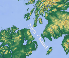
North Channel.png 972 × 821; 1.14 MB
-
North-Channel-Naval-Duel.svg 736 × 431; 31 KB
-
Warren Sheppard - Antrim Coastline.jpg 1,500 × 995; 254 KB


