Category:Invalid SVG created with Adobe Illustrator:Maps
Jump to navigation
Jump to search
Subcategories
This category has the following 10 subcategories, out of 10 total.
Media in category "Invalid SVG created with Adobe Illustrator:Maps"
The following 200 files are in this category, out of 1,133 total.
(previous page) (next page)-
 Blank Map of France, with Communes.svg 1,000 × 900; 12.03 MB
-
 Goreh-Jask Pipeline.svg 1,747 × 1,088; 2.21 MB
-
 Kymijoki drainage basin map.svg 948 × 1,700; 16.64 MB
-
 Köln Fortifikatorische Entwicklung.svg 1,697 × 2,471; 246 KB
-
 La red de ferrocarriles.svg 853 × 691; 1.82 MB
-
 Map of communes of France where at least one road in named after Paris.svg 1,000 × 900; 8.51 MB
-
 Map of Communes of France without Church.svg 1,000 × 900; 8.51 MB
-
 Mogontiacum Plan.svg 3,442 × 2,189; 3.87 MB
-
 Blank Map of Seine-et-Marne Department, France, with Communes.svg 1,000 × 1,296; 194 KB
-
 Communes-guyane-blank.svg 587 × 729; 117 KB
-
 Indogermaische Ursprache 3500BC.svg 960 × 582; 367 KB
-
 Localisation de la communauté d'agglomération de Val d'Europe.svg 1,000 × 1,296; 195 KB
-
 Maroc sans cadre.svg 406 × 388; 249 KB
-
 Sooty Shearwater-map-localisation-fr.svg 1,200 × 684; 753 KB
-
 Ukraine census 2001 Russian.svg 621 × 477; 796 KB
-
 Ukraine census 2001 Ukrainians.svg 605 × 465; 533 KB
-
 Arpanet 1974.svg 818 × 515; 246 KB
-
 Celts.svg 1,068 × 891; 322 KB
-
 ChichesterWards2010.svg 328 × 415; 171 KB
-
 Europa Germanen 50 n Chr.svg 941 × 655; 710 KB
-
 Plates tect2 it.svg 4,217 × 3,169; 673 KB
-
 Tectonic plates (empty).svg 681 × 461; 356 KB
-
 Europe lt.svg 506 × 670; 535 KB
-
 Europe-fr.svg 506 × 670; 544 KB
-
 Europe-hu-Malev-destinations.svg 506 × 670; 1,018 KB
-
 Guangzhou Metro Plan Map zh-hans.svg 2,180 × 1,723; 273 KB
-
 Haneda Expansion en.svg 562 × 448; 1.07 MB
-
 Keltisch Sprachen.svg 352 × 519; 164 KB
-
 Morocco Protectorate.svg 406 × 388; 815 KB
-
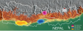 Nepal Apis laboriosa.svg 823 × 306; 937 KB
-
 91 CA Communauté Paris Saclay 2016.svg 1,000 × 1,110; 72 KB
-
 Battle of Castillon.svg 580 × 443; 252 KB
-
 Haneda Expansion ja.svg 562 × 448; 817 KB
-
 Morocco Protectorate-hu.svg 406 × 388; 708 KB
-
 Protected Areas in Paris, France.svg 2,000 × 900; 1.77 MB
-
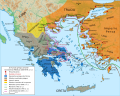
 Griechenland Dialekte.svg 800 × 700; 594 KB
-
 Gyeongbu High Speed.svg 350 × 500; 248 KB
-
 Artemis Orthia location en.svg 991 × 784; 536 KB
-
 Australian renewable power plants map-en.svg 1,146 × 808; 1.35 MB
-
 Australian renewable power plants map-fr.svg 1,146 × 808; 1.32 MB
-
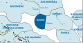 Nauru-EEZ-fr.svg 539 × 277; 174 KB
-
 Albania District.svg 508 × 1,002; 276 KB
-
 Centralny okrug, Omsk, locator map.svg 500 × 400; 288 KB
-
 Historical regions of Britanny ru.svg 765 × 570; 1.07 MB
-
 Kirovsky okrug, Omsk, locator map.svg 500 × 400; 288 KB
-
 Leninsky okrug, Omsk, locator map.svg 500 × 400; 288 KB
-
 Oktyabrsky okrug, Omsk, locator map.svg 500 × 400; 288 KB
-
 Russia, Omsk administrative divisions.svg 500 × 400; 293 KB
-
 Southeast asia.svg 506 × 598; 729 KB
-
 İzmir location Aliağa.svg 873 × 814; 252 KB
-
 Cobbler creek reserve south australia.svg 1,495 × 1,268; 179 KB
-
 Galizien Israeliten 1910 ES.svg 1,075 × 700; 491 KB
-
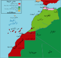 Morocco Protectorate-ar.svg 433 × 414; 943 KB
-
 CAPres08.svg 512 × 857; 673 KB
-
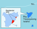 Yeonpyeong residential area.svg 415 × 329; 616 KB
-
 US-IL-Chicago-CA47.svg 491 × 600; 301 KB
-
 Zonas Abono Transportes Madrid.svg 680 × 768; 346 KB
-
 10May-16May1940-Fall Gelb.svg 888 × 686; 395 KB
-
 Conquête de l'Islam à la chute des Omeyyades-es.svg 1,146 × 588; 839 KB
-
 Map Greco-Persian Wars-blank.svg 993 × 794; 3.12 MB
-
 Map Greco-Persian Wars-es.svg 992 × 794; 4.63 MB
-
 Andorra, administrative divisions - de - colored.svg 1,161 × 1,019; 399 KB
-
 Kaitak japanese.svg 494 × 600; 192 KB
-
 Rymill park adelaide.svg 2,129 × 1,201; 103 KB
-
 Abkhazia ethnic map 2009 es.svg 1,008 × 786; 3.29 MB
-
 Yeonpyeong residential area ja.svg 415 × 329; 582 KB
-

-

-
 Neufrankreich.svg 1,530 × 1,090; 694 KB
-
 Vatican Map.svg 303 × 260; 526 KB
-
 Italian East Africa (1938–1941) he.svg 1,012 × 908; 229 KB
-
 WestBengalDistricts numbered bn.svg 768 × 1,159; 215 KB
-
 Elizabeth Vale Adelaide streetmap.svg 838 × 732; 154 KB
-
 Nord und Sued Euro.svg 1,031 × 780; 302 KB
-
 Beitrittskandidaten.svg 680 × 520; 261 KB
-
 Monetazione campana III secolo.svg 1,088 × 944; 448 KB
-
 RomanEmpire 117 - Moesia Superior and Moesia Inferior.svg 2,180 × 1,600; 1.87 MB
-
 PINNmap1 ArM.svg 559 × 750; 2.33 MB
-
 Oklahoma Tribal Statistical Area.svg 828 × 400; 1.49 MB
-
 Japan large full.svg 1,397 × 1,593; 279 KB
-
 CrassusSpartacus.svg 2,280 × 2,470; 305 KB
-
 Municipalities in UL.svg 675 × 676; 697 KB
-
 Theoretical Search Area MH370.en.svg 1,090 × 702; 1.62 MB
-
 India literacy rate map en.svg 1,639 × 1,852; 878 KB
-
 Nacionalisme espanya castellà.svg 1,035 × 783; 179 KB
-
 Currents.svg 330 × 311; 376 KB
-
 Italy Labelled Map Scalable.svg 1,200 × 1,500; 1.2 MB
-
 Anzac Highway adelaide map.svg 974 × 2,373; 336 KB
-
 Austria, administrative divisions - de - colored.svg 1,256 × 700; 653 KB
-
 Grand junction road adelaide map.svg 974 × 2,373; 336 KB
-
 Jury points to ukraine esc16.svg 680 × 540; 333 KB
-
 Ningbo Rail Transit Plan (2020) en.svg 512 × 499; 121 KB
-
 Port road adelaide map.svg 974 × 2,373; 336 KB
-
 Televote points to ukraine esc16.svg 680 × 540; 333 KB
-
 Maas Memel Etsch Belt (svg).svg 1,138 × 1,135; 558 KB
-
 Strandfaraskip route map.svg 748 × 944; 91 KB
-
 India earthquake zone map.svg 1,639 × 1,852; 259 KB
-
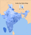 India sex ratio map.svg 1,639 × 1,852; 802 KB
-
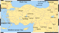 Turkey-ocm2.svg 553 × 309; 396 KB
-
 Western Sahara situation January 1976 en.svg 1,472 × 1,304; 159 KB
-
 CERA-USGS-labeled.svg 535 × 383; 843 KB
-
 India decadal growth rate map.svg 1,639 × 1,852; 805 KB
-
 1798bataafscherepubliek es.svg 605 × 754; 390 KB
-
 Map of the Azerbaijani language.svg 3,721 × 3,411; 62 KB
-
 Metro map seville.svg 802 × 695; 667 KB
-
 SpanienGuadalquivir.svg 1,356 × 980; 860 KB
-
 Assam Marigaon locator map.svg 419 × 565; 317 KB
-
 Paris Metro line 2 map (with land cover).svg 1,371 × 893; 3.42 MB
-
 Yinfeng Line, Ningbo Rail Transit.svg 512 × 878; 7 KB
-
 15 poorest countries in 2013.svg 1,369 × 1,320; 210 KB
-
 Berlin Bezirk Pankow (labeled).svg 1,400 × 1,151; 1.32 MB
-
 Brasilia Metro Map.svg 871 × 649; 357 KB
-
 Columbiarivermap.svg 612 × 612; 15.91 MB
-
 Bezirksvertretungswahlkarte Wien 1996.svg 780 × 615; 228 KB
-
 H1N1 in Indonesia.svg 1,322 × 620; 261 KB
-

-
 Bundespräsidentenwahl Österreich 2016 2. Runde (22. Mai 2016) annulliert.svg 1,218 × 661; 327 KB
-
 Kroatien - Politische Gliederung (Karte).svg 701 × 562; 1,008 KB
-
 Levels of Freedom of Panorama in Europe.svg 658 × 680; 210 KB
-
 Map of fertile crescent-ar.svg 1,987 × 2,441; 781 KB
-
 Arabic speaking world.svg 1,200 × 800; 1.59 MB
-

-
 Indochina 1954 to 55 map de.svg 543 × 771; 1.9 MB
-
 West Bank and Gaza Strip location map.svg 639 × 736; 98 KB
-
 Word for Sunday in European Languages.svg 1,486 × 1,215; 955 KB
-
 COVID-19 Outbreak Intensive care in France 13 Regions & DomTom.svg 725 × 604; 815 KB
-
 Münsterland topo.svg 313 × 247; 3.18 MB
-
 Word for Saturday in European Languages.svg 1,486 × 1,215; 954 KB
-
 Abkhazia in Europe (de-facto) (-rivers -mini map).svg 1,401 × 1,198; 1.38 MB
-
 Abkhazia in Europe (de-facto).svg 1,401 × 1,198; 4.04 MB
-
 Abkhazia in Europe (natural) (-mini map).svg 1,401 × 1,198; 7.16 MB
-
 Abkhazia in Europe (natural).svg 1,401 × 1,198; 8.42 MB
-
 Abkhazia in Europe (relief) (-mini map).svg 1,401 × 1,198; 8.09 MB
-
 Abkhazia in Europe (relief).svg 1,401 × 1,198; 8.62 MB
-
 Adelie Land in Antarctica.svg 1,200 × 1,200; 917 KB
-
 Albania in Europe (natural) (-mini map).svg 1,401 × 1,198; 7.16 MB
-
 Albania in Europe (natural).svg 1,401 × 1,198; 8.42 MB
-
 Albania in Europe (relief) (-mini map).svg 1,401 × 1,198; 8.09 MB
-
 Albania in Europe (relief).svg 1,401 × 1,198; 8.62 MB
-
 Andorra in Europe (zoomed).svg 1,401 × 1,198; 4.05 MB
-
 Bad Bayersoien in GAP.svg 649 × 540; 1.31 MB
-
 Bad Kohlgrub in GAP.svg 649 × 540; 1.31 MB
-
 Eschenlohe in GAP.svg 649 × 540; 1.31 MB
-
 Ettal in GAP.svg 649 × 540; 1.31 MB
-
 Ettaler Forst in GAP.svg 649 × 540; 1.31 MB
-
 Farchant in GAP.svg 649 × 540; 1.31 MB
-
 Grainau in GAP.svg 649 × 540; 1.31 MB
-
 Großweil in GAP.svg 649 × 540; 1.31 MB
-
 Krün in GAP.svg 649 × 540; 1.31 MB
-
 Map Greece expansion 1832-1947 ja.svg 2,000 × 2,621; 3.37 MB
-
 Mittenwald in GAP.svg 649 × 540; 1.31 MB
-
 Municipalities in GAP.svg 649 × 540; 1.31 MB
-
 Murnau am Staffelsee in GAP.svg 649 × 540; 1.31 MB
-
 Oberammergau in GAP.svg 649 × 540; 1.31 MB
-
 Oberau in GAP.svg 649 × 540; 1.31 MB
-
 Ohlstadt in GAP.svg 649 × 540; 1.31 MB
-
 Riegsee in GAP.svg 649 × 540; 1.31 MB
-
 Saulgrub in GAP.svg 649 × 540; 1.31 MB
-
 Schwaigen in GAP.svg 649 × 540; 1.31 MB
-
 Seehausen am Staffelsee in GAP.svg 649 × 540; 1.31 MB
-
 Spatzenhausen in GAP.svg 649 × 540; 1.31 MB
-
 Uffing am Staffelsee in GAP.svg 649 × 540; 1.31 MB
-
 Unterammergau in GAP.svg 649 × 540; 1.31 MB
-
 Verwaltungsgemeinschaft Ohlstadt in GAP.svg 649 × 540; 1.31 MB
-
 Verwaltungsgemeinschaft Saulgrub in GAP.svg 649 × 540; 1.31 MB
-
 Verwaltungsgemeinschaft Seehausen am Staffelsee in GAP.svg 649 × 540; 1.31 MB
-
 Verwaltungsgemeinschaft Unterammergau in GAP.svg 649 × 540; 1.31 MB
-
 Wallgau in GAP.svg 649 × 540; 1.31 MB
-
 Aztecexpansion-pt.svg 2,066 × 1,095; 348 KB
-
 Puke in Albania.svg 688 × 1,002; 509 KB
-
 Word for Friday in European Languages.svg 1,486 × 1,215; 954 KB
-
 Word for Wednesday in European Languages.svg 1,486 × 1,215; 955 KB
-
 Aichtal in ES.svg 226 × 189; 884 KB
-
 Aichwald in ES.svg 226 × 189; 884 KB
-
 Altbach in ES.svg 226 × 189; 884 KB
-
 Altdorf (Landkreis Esslingen) in ES.svg 226 × 189; 884 KB
-
 Altenriet in ES.svg 226 × 189; 884 KB
-
 Amt Halle Map.svg 724 × 688; 188 KB
-
 Baltmannsweiler in ES.svg 226 × 189; 884 KB
-
 Bempflingen in ES.svg 226 × 189; 884 KB
-
 Beuren in ES.svg 226 × 189; 884 KB
-
 Bissingen an der Teck in ES.svg 226 × 189; 884 KB
-
 Chongqing1.svg 948 × 969; 1.76 MB
-
 Deizisau in ES.svg 226 × 189; 884 KB
-
 Denkendorf in ES.svg 226 × 189; 884 KB
-
 Dettingen unter Teck in ES.svg 226 × 189; 884 KB
-
 Erkenbrechtsweiler in ES.svg 226 × 189; 884 KB
-
 Esslingen am Neckar in ES.svg 226 × 189; 884 KB
-
 Filderstadt in ES.svg 226 × 189; 884 KB
-
 Frickenhausen in ES.svg 226 × 189; 884 KB
-
 Garmisch-Partenkirchen in GAP.svg 649 × 540; 1.31 MB
-
 Gemeindeverwaltungsverband Lenningen in ES.svg 226 × 189; 884 KB
-
 Gemeindeverwaltungsverband Neckartenzlingen in ES.svg 226 × 189; 884 KB
-
 Gemeindeverwaltungsverband Plochingen in ES.svg 226 × 189; 884 KB
-
 Gemeindeverwaltungsverband Reichenbach an der Fils in ES.svg 226 × 189; 884 KB
-
 Gemeindeverwaltungsverband Wendlingen am Neckar in ES.svg 226 × 189; 884 KB
-
 Großbettlingen in ES.svg 226 × 189; 884 KB
-
 Hochdorf in ES.svg 226 × 189; 884 KB
-
 Holzmaden in ES.svg 226 × 189; 884 KB
-
 Indochina 1979 map de.svg 1,088 × 1,544; 1.96 MB


,_administrative_divisions_-_russian_(single_zoom).svg)
,_administrative_divisions_-_russian_(single_zoom).svg)


_he.svg)


.svg)


.svg)

.svg)


_annulliert.svg)
.svg)


_(-rivers_-mini_map).svg)
.svg)
_(-mini_map).svg)
.svg)
_(-mini_map).svg)
.svg)

_(-mini_map).svg)
.svg)
_(-mini_map).svg)
.svg)
.svg)


_in_ES.svg)


.svg)
_en.svg)