Category:Invalid SVG created with Adobe Illustrator:Locator maps
Jump to navigation
Jump to search
Subcategories
This category has the following 12 subcategories, out of 12 total.
Media in category "Invalid SVG created with Adobe Illustrator:Locator maps"
The following 192 files are in this category, out of 192 total.
-
Localisation de la communauté d'agglomération de la Baie de Somme.svg 1,000 × 677; 268 KB
-
Localisation de la communauté de communes Avre Luce Noye.svg 1,000 × 677; 268 KB
-
Localisation de la communauté de communes de la Haute-Somme.svg 1,000 × 677; 268 KB
-
Localisation de la communauté de communes du Grand Roye.svg 1,000 × 677; 268 KB
-
Localisation de la communauté de communes du Pays du Coquelicot.svg 1,000 × 677; 268 KB
-
Localisation de la communauté de communes Ponthieu-Marquenterre.svg 1,000 × 677; 268 KB
-
Localisation de la communauté de communes Somme Sud-Ouest.svg 1,000 × 677; 270 KB
-
Localisation de la communauté d'agglomération de Marne-et-Gondoire.svg 1,000 × 1,296; 206 KB
-
Localisation de la communauté d'agglomération de Melun-Val de Seine.svg 1,000 × 1,296; 210 KB
-
Localisation de la communauté d'agglomération du Pays de Fontainebleau.svg 1,000 × 1,296; 220 KB
-
Localisation de la communauté d'agglomération du Pays de Meaux.svg 1,000 × 1,296; 214 KB
-
Localisation de la communauté de communes de l'Orée de la Brie.svg 1,000 × 1,296; 198 KB
-
Localisation de la communauté de communes de la Brie des Rivières et Châteaux.svg 1,000 × 1,296; 219 KB
-
Localisation de la communauté de communes de la Brie Nangissienne.svg 1,000 × 1,296; 212 KB
-
Localisation de la communauté de communes de Moret Seine et Loing.svg 1,000 × 1,296; 208 KB
-
Localisation de la communauté de communes des Deux Morin.svg 1,000 × 1,296; 220 KB
-
Localisation de la communauté de communes des Plaines et Monts de France.svg 1,000 × 1,296; 210 KB
-
Localisation de la communauté de communes des Portes briardes entre villes et forêts.svg 1,000 × 1,296; 199 KB
-
Localisation de la communauté de communes du Bassée-Montois.svg 1,000 × 1,296; 229 KB
-
Localisation de la communauté de communes du Gâtinais-Val de Loing.svg 1,000 × 1,296; 212 KB
-
Localisation de la communauté de communes du Pays Créçois.svg 1,000 × 1,296; 208 KB
-
Localisation de la communauté de communes du Pays de l'Ourcq.svg 1,000 × 1,296; 214 KB
-
Localisation de la communauté de communes du Pays de Montereau.svg 1,000 × 1,296; 214 KB
-
Localisation de la communauté de communes du Pays de Nemours.svg 1,000 × 1,296; 210 KB
-
Localisation de la communauté de communes du Pays Fertois.svg 1,000 × 1,296; 210 KB
-
Localisation de la communauté de communes du Provinois.svg 1,000 × 1,296; 229 KB
-
Localisation de la communauté de communes du Val Briard.svg 1,000 × 1,296; 215 KB
-
Localisation EPCI de Paris - Vallée de la Marne en Seine-et-Marne, France.svg 1,000 × 1,296; 203 KB
-
Papaloapan River.svg 800 × 800; 1.35 MB
-
Localisation EPCI de Mimizan dans les Landes, France.svg 1,000 × 873; 143 KB
-
Localisation EPCI le Marsan Agglomération dans les Landes, France.svg 1,000 × 873; 144 KB
-
Ways of St-2. James in Europe.svg 2,955 × 2,080; 1.94 MB
-
Localisation de la communauté d'agglomération du Cœur d’Essonne.svg 1,000 × 1,110; 72 KB
-
Localisation de la communauté d'agglomération du Val d'Yerres-Val de Seine.svg 1,000 × 1,110; 72 KB
-
Localisation de la communauté de communes du Pays de Limours.svg 1,000 × 1,110; 72 KB
-
Localisation de la communauté de communes du Val d’Essonne.svg 1,000 × 1,110; 72 KB
-
Localisation EPCI de l'Étampois sud Essonne dans l'Essonne, France.svg 1,000 × 1,110; 72 KB
-
Angmering & Findon.svg 776 × 574; 1.46 MB
-
Arundel & Wick.svg 776 × 574; 1.46 MB
-
Benin - Alibori.svg 828 × 1,559; 172 KB
-
Benin - Atakora.svg 828 × 1,559; 172 KB
-
Benin - Atlantique.svg 828 × 1,559; 172 KB
-
Benin - Borgou.svg 828 × 1,559; 172 KB
-
Benin - Collines.svg 828 × 1,559; 172 KB
-
Benin - Donga.svg 828 × 1,559; 172 KB
-
Benin - Kouffo.svg 828 × 1,559; 172 KB
-
Benin - Littoral.svg 828 × 1,559; 172 KB
-
Benin - Mono.svg 828 × 1,559; 172 KB
-
Benin - Ouémé.svg 828 × 1,559; 172 KB
-
Benin - Plateau.svg 828 × 1,559; 172 KB
-
Benin - Zou.svg 828 × 1,559; 172 KB
-
FF in Brandenburg.svg 825 × 826; 78 KB
-
Locator map HD in Germany.svg 1,075 × 1,273; 578 KB
-
Bashkortostan in Russia.svg 1,181 × 637; 6.47 MB
-
Tomsk in Russia.svg 1,181 × 637; 6.47 MB
-
East Berlin in East Germany.svg 554 × 727; 216 KB
-
Goshute rez map.svg 512 × 423; 576 KB
-
Regiao Centro in Portugal (with subregions).svg 188 × 157; 135 KB
-
Regiao de Lisboa in Portugal (with subregions).svg 345 × 241; 145 KB
-
Regiao do Alentejo in Portugal (with subregions).svg 188 × 167; 132 KB
-
Regiao do Algarve in Portugal (with subregions).svg 516 × 225; 145 KB
-
Regiao Norte in Portugal (with subregions).svg 188 × 105; 132 KB
-
Lugansk and Donetsk province location map.svg 512 × 675; 126 KB
-
Aubstadt in NES.svg 672 × 550; 1.98 MB
-
Burglauer in NES.svg 672 × 550; 1.98 MB
-
Forst Schmalwasser-Süd in NES.svg 672 × 550; 1.98 MB
-
Großbardorf in NES.svg 672 × 550; 1.98 MB
-
Großeibstadt in NES.svg 672 × 550; 1.98 MB
-
Hausen in NES.svg 672 × 550; 1.98 MB
-
Herbstadt in NES.svg 672 × 550; 1.98 MB
-
Heustreu in NES.svg 672 × 550; 1.98 MB
-
Hohenroth in NES.svg 672 × 550; 1.98 MB
-
Hollstadt in NES.svg 672 × 550; 1.98 MB
-
Höchheim in NES.svg 672 × 550; 1.98 MB
-
Niederlauer in NES.svg 672 × 550; 1.98 MB
-
Nordheim vor der Rhön in NES.svg 672 × 550; 1.98 MB
-
Oberelsbach in NES.svg 672 × 550; 1.98 MB
-
Ostheim vor der Rhön in NES.svg 672 × 550; 1.98 MB
-
Rödelmaier in NES.svg 672 × 550; 1.98 MB
-
Saal an der Saale in NES.svg 672 × 550; 1.98 MB
-
Salz in NES.svg 672 × 550; 1.98 MB
-
Sandberg in NES.svg 672 × 550; 1.98 MB
-
Schönau an der Brend in NES.svg 672 × 550; 1.98 MB
-
Sondheim vor der Rhön in NES.svg 672 × 550; 1.98 MB
-
Strahlungen in NES.svg 672 × 550; 1.98 MB
-
Sulzdorf an der Lederhecke in NES.svg 672 × 550; 1.98 MB
-
Sulzfeld in NES.svg 672 × 550; 1.98 MB
-
Trappstadt in NES.svg 672 × 550; 1.98 MB
-
Unsleben in NES.svg 672 × 550; 1.98 MB
-
Willmars in NES.svg 672 × 550; 1.98 MB
-
Wollbach in NES.svg 672 × 550; 1.98 MB
-
Wülfershausen an der Saale in NES.svg 672 × 550; 1.98 MB
-
Antalya districts borders.svg 778 × 419; 392 KB
-
Municipalities in CLP.svg 1,804 × 1,804; 1.27 MB
-
India Andhra Pradesh locator map (1956-2014).svg 1,574 × 1,738; 836 KB
-
India Kerala locator map.svg 1,574 × 1,738; 836 KB
-
India Tamil Nadu locator map.svg 1,574 × 1,738; 836 KB
-
Bad Königshofen im Grabfeld in NES.svg 672 × 550; 1.98 MB
-
Bad Neustadt an der Saale in NES.svg 672 × 550; 1.97 MB
-
Benin - Littoral (+special marker).svg 828 × 1,559; 165 KB
-
Municipalities in LM.svg 688 × 594; 604 KB
-
Adelshofen in FFB.svg 446 × 390; 976 KB
-
Bavaria in Germany.svg 1,073 × 1,272; 1.59 MB
-
Beilngries in EI.svg 804 × 580; 1.12 MB
-
Berlin in Germany.svg 1,073 × 1,272; 1.59 MB
-
Bremen in Germany.svg 1,073 × 1,272; 1.59 MB
-
Erlensee in MKK.svg 1,360 × 860; 918 KB
-
Hanau in HU.svg 1,360 × 860; 918 KB
-
Hesse in Germany.svg 1,073 × 1,272; 1.59 MB
-
Hesse MKK.svg 868 × 1,164; 693 KB
-
Lauf an der Pegnitz in LAU.svg 461 × 638; 1.12 MB
-
Magstadt in BB.svg 243 × 243; 727 KB
-
Oberstdorf in OA.svg 590 × 892; 1.39 MB
-
Offenbach an der Queich in SÜW.svg 254 × 254; 483 KB
-
Rhineland-Palatinate in Germany.svg 1,073 × 1,272; 1.59 MB
-
Saarland in Germany.svg 1,073 × 1,272; 1.59 MB
-
Thuringia in Germany.svg 1,073 × 1,272; 1.59 MB
-
United States, administrative divisions - de - colored.svg 1,181 × 731; 2.72 MB
-
Weilerbach in KL.svg 296 × 205; 371 KB
-
Africa on the globe (red).svg 797 × 797; 176 KB
-
Akrotiri and Dhekelia in its region (de-facto).svg 298 × 168; 6.81 MB
-
Al Wakra in Qatar.svg 1,039 × 987; 143 KB
-
Alterkülz in SIM.svg 889 × 903; 574 KB
-
Andalucia in Spain (including Canarias) (special marker).svg 1,184 × 1,016; 1.16 MB
-
Andalucia in Spain (special marker).svg 1,184 × 1,016; 1.11 MB
-
Belg in SIM.svg 889 × 903; 574 KB
-
Belize in Belize.svg 788 × 1,092; 176 KB
-
Belize in its region.svg 472 × 265; 6.87 MB
-
Bell (Hunsrück) in SIM.svg 889 × 903; 574 KB
-
Beltheim in SIM.svg 889 × 903; 574 KB
-
Cadiz in Spain (plus Canarias).svg 1,184 × 1,016; 3.01 MB
-
Cadiz in Spain.svg 1,184 × 1,016; 3.01 MB
-
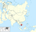
Cambodia in Asia (-mini map -rivers).svg 1,181 × 1,050; 6.95 MB
-
Cambodia in Asia.svg 1,181 × 1,050; 8.2 MB
-
Cambodia in its region.svg 472 × 265; 6.89 MB
-
Cayo in Belize.svg 788 × 1,092; 176 KB
-
Corozal in Belize.svg 788 × 1,092; 176 KB
-
Crimea in Ukraine.svg 1,547 × 1,041; 1.27 MB
-
Deutschsprachige Gemeinschaft in Belgium.svg 1,136 × 988; 250 KB
-
Doha in Qatar.svg 1,039 × 987; 143 KB
-
Federally Administered Tribal Areas in Pakistan.svg 2,365 × 1,890; 1.16 MB
-
Frankfurt Stadtteil Niederrad.svg 921 × 921; 1.82 MB
-
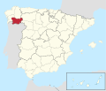
Galicia in Spain (including Canarias).svg 1,184 × 1,016; 1.16 MB
-
Galicia in Spain.svg 1,184 × 1,016; 1.1 MB
-
Glasgow City in Scotland.svg 1,128 × 1,483; 1.57 MB
-
Greenland in North America (-mini map -rivers).svg 1,181 × 1,185; 5.96 MB
-
Greenland in North America.svg 1,181 × 1,185; 6.92 MB
-
Greenland in the Kingdom of Denmark.svg 626 × 352; 6.89 MB
-
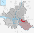
Hamburg Stadtteil Billstedt.svg 560 × 549; 635 KB
-
Hamburg Stadtteil Billwerder.svg 560 × 549; 635 KB
-
Islamabad Capital Territory in Pakistan (special marker) (claims hatched).svg 2,365 × 1,890; 1.15 MB
-
Islas Baleares in Spain (including Canarias).svg 1,184 × 1,016; 1.16 MB
-
Jönköpings län in Sweden.svg 954 × 1,837; 2.21 MB
-
Khojavend in Azerbaijan (semi-secession).svg 1,200 × 919; 268 KB
-
Lebanon in its region.svg 323 × 179; 6.8 MB
-
Lugo in Spain.svg 1,184 × 1,016; 3.01 MB
-
Orange Walk in Belize.svg 788 × 1,092; 176 KB
-
Ourense in Spain (plus Canarias).svg 1,184 × 1,016; 3.01 MB
-
Pontevedra in Spain (plus Canarias).svg 1,184 × 1,016; 3.01 MB
-
Pontevedra in Spain.svg 1,184 × 1,016; 3.01 MB
-
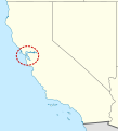
San francisco bay.svg 346 × 381; 688 KB
-
Spain location map with provinces.svg 1,184 × 1,016; 3.01 MB
-
Stann Creek in Belize.svg 788 × 1,092; 176 KB
-
Steinmauern in RA.svg 494 × 533; 669 KB
-
Stuttgart Stadtteil Hofen.svg 760 × 760; 2.1 MB
-
Ternopil in Ukraine.svg 1,547 × 1,041; 1.27 MB
-
Toledo in Belize.svg 788 × 1,092; 176 KB
-
Trentino-South Tyrol in Italy.svg 1,034 × 1,299; 1.81 MB
-
Umm Slal in Qatar.svg 1,039 × 987; 143 KB
-
United Kingdom in its region (Guernsey special).svg 383 × 216; 6.85 MB
-
Vlaamse Gemeenschap in Belgium.svg 1,136 × 988; 257 KB
-
Western Australia in Australia.svg 2,055 × 1,846; 929 KB
-
Cambodia in Asia (relief) (-mini map).svg 1,181 × 1,050; 5.63 MB
-
Hillen in Recklinghausen.svg 958 × 885; 2.17 MB
-
Hillerheide in Recklinghausen.svg 958 × 885; 2.17 MB
-
Hochlar in Recklinghausen.svg 958 × 885; 2.17 MB
-
Trentino-South Tyrol location map.svg 1,034 × 1,299; 1.79 MB
-
Afghanistan Praesidentschaftswahl erste Runde.svg 900 × 668; 183 KB
-
Azad Kashmir in Pakistan (claims hatched).svg 2,365 × 1,890; 1.19 MB
-
España-Canarias-loc.svg 512 × 462; 919 KB
-
Goamap.svg 633 × 820; 159 KB
-
Kherson oblast location map.svg 533 × 403; 184 KB
-
Kleinlichtenhain Gebietsbereinigung 1976.svg 836 × 1,163; 234 KB
-
Localización de Andalusia.svg 690 × 522; 560 KB
-
Localización de Galicia2.svg 690 × 522; 560 KB
-
Luhansk in Ukraine (claims hatched).svg 1,546 × 1,038; 835 KB
-
Mozambique, administrative divisions - de - colored 2018.svg 1,134 × 1,706; 561 KB
-
Nepal COVID-19 outbreak map (5 April 2020).svg 1,033 × 595; 856 KB
-
Russia Kaliningrad location map.svg 1,047 × 654; 74 KB
-
USA location map - counties - no water.svg 13,310 × 6,935; 9.24 MB
-
Valencia-loc.svg 2,003 × 2,195; 443 KB


