Category:Interstate 90 in Ohio
Jump to navigation
Jump to search
States of the United States: Idaho · Illinois · Indiana · Massachusetts · Minnesota · Montana · New York · Ohio · Pennsylvania · South Dakota · Washington · Wisconsin · Wyoming
section of Intersate Highway in Ohio, United States  _map.svg) | |||||
| Upload media | |||||
| Instance of | |||||
|---|---|---|---|---|---|
| Location | Ohio | ||||
| Transport network |
| ||||
| Owned by | |||||
| Maintained by | |||||
| Inception |
| ||||
| Length |
| ||||
| Terminus | |||||
| Partially coincident with | |||||
| |||||
English: Media related to Interstate 90 in Ohio, a 244.75-mile (393.89 km) section of Interstate Highway in Ohio, United States.
Subcategories
This category has the following 5 subcategories, out of 5 total.
Media in category "Interstate 90 in Ohio"
The following 55 files are in this category, out of 55 total.
-

-

-

-
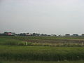 Billboards and fields in Perrysburg Township.jpg 2,272 × 1,704; 1.1 MB
-
 Cleveland Burke Waterfront Airport from the cockpit.jpg 4,032 × 3,024; 1.03 MB
-
 Cleveland Dead Man's Curve 1 Mile Warning sign.jpg 5,472 × 3,648; 7.46 MB
-
 Cleveland Interstate Highways map.svg 440 × 258; 224 KB
-
 Cleveland, Ohio 1955 Yellow Book.jpg 800 × 801; 239 KB
-
 Deadmans.JPG 648 × 486; 68 KB
-
 EXODUS FROM CLEVELAND TO THE SUBURBS - NARA - 550089.jpg 3,000 × 2,030; 822 KB
-
 EXODUS FROM CLEVELAND TO THE SUBURBS - NARA - 550089.tif 3,000 × 2,030; 17.42 MB
-
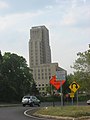 Fenn Tower.jpg 1,704 × 2,272; 1.26 MB
-
 Fields and woods in Groton Township.jpg 2,272 × 1,704; 1.02 MB
-
 Fields of Berlin Township.jpg 2,272 × 1,704; 1.02 MB
-
 Fields of Rice Township in Sandusky County.jpg 2,272 × 1,704; 1.01 MB
-
 Florence Township, Erie County, Ohio.jpg 2,272 × 1,704; 1.01 MB
-
 Harris Township, Ottawa County, Ohio.jpg 2,272 × 1,704; 1.06 MB
-
 I-90 (OH 1957).svg 600 × 600; 16 KB
-
 I-90 (OH) map.svg 1,475 × 860; 413 KB
-
 I-90 wb entering Ohio from Pennsylvania, June 2024.jpg 3,648 × 2,234; 1.4 MB
-
 I-90i-71junction.jpg 448 × 153; 33 KB
-
 I75 I80-I90 Interchange.jpg 4,168 × 2,249; 3.09 MB
-
 In90eRoadOH-Exit175-Marginal-Exit176-OH283w (32640758316).jpg 2,400 × 1,600; 1.65 MB
-
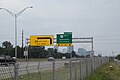
 Int80wInt90w-Exit118-US250 (37315287086).jpg 2,400 × 1,600; 1.48 MB
-
 Int80wInt90w-MergeRightLightsEvening (23510814598).jpg 2,400 × 1,600; 1.35 MB
-
 Int80wInt90wOhioTurnpikeSignsRoad (37315282596).jpg 2,400 × 1,600; 1.33 MB
-
 Int80wInt90wTollEZpassLanesStorm-ToUS250 (36692713473).jpg 2,400 × 1,600; 1.47 MB
-
 Int90eOHRoad-Exit188-Int271s (32640759146).jpg 2,400 × 1,600; 1.55 MB
-
 Int90eRoadOH-Exit223-OH45buttonCopy (32640760066).jpg 2,400 × 1,600; 1.78 MB
-
 Interstate 80-90-75.jpg 3,264 × 2,448; 2.78 MB
-
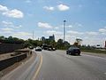
 Interstate 90, Carnegie.jpg 4,032 × 3,024; 1.53 MB
-
 INTERSTATE 90-UNDER CONSTRUCTION FOR SEVERAL YEARS - NARA - 550282.jpg 3,000 × 2,030; 733 KB
-
 Lake in Lake Township.jpg 2,272 × 1,704; 1.08 MB
-
 Milan Township from the Ohio Turnpike.jpg 2,272 × 1,704; 1.01 MB
-
 OH Turnpike.JPG 2,592 × 1,944; 1.16 MB
-
 Ohio (7695533362).jpg 2,400 × 1,600; 2.79 MB
-
 Ohio 420 End I-280 Begin.jpg 4,080 × 3,072; 1.88 MB
-
 Ohio Turnpike December 2020 (2).jpg 3,014 × 4,018; 1.44 MB
-
 Ohio Turnpike December 2020.jpg 4,032 × 3,024; 1.51 MB
-
 Ohio Turnpike in West Unity - panoramio.jpg 3,949 × 2,963; 1.4 MB
-
 Ohio Turnpike January 2021.jpg 2,993 × 3,328; 708 KB
-
 Ohio Turnpike map.png 3,425 × 2,031; 62 KB
-
 Ohio Turnpike Service Area Dscn7189.jpg 1,600 × 800; 86 KB
-
 Ohio Turnpike westbound.jpg 1,984 × 1,488; 1.88 MB
-
 Panhandle of Woodville Township.jpg 2,272 × 1,704; 1.11 MB
-
 Pilgrim UCC, Cleveland, in the fog.jpg 2,816 × 2,112; 903 KB
-
 Plains in Clay Township.jpg 2,272 × 1,704; 1.05 MB
-
 Plains of Townsend Township.jpg 2,272 × 1,704; 1.03 MB
-
 Riley Township, Sandusky County, Ohio.jpg 2,272 × 1,704; 1,021 KB
-
 RR & Turnpike P2190005.jpg 3,072 × 2,304; 1.14 MB
-
 Sandusky River below Fremont.jpg 2,272 × 1,704; 1.02 MB
-
 Sandusky, Ohio 90 East Cleveland OH-4 7695530624 o.jpg 2,400 × 1,600; 2.55 MB
-
 Toledo, Ohio 1955 Yellow Book.jpg 800 × 765; 178 KB
-
 Washington Township's wide fields.jpg 2,272 × 1,704; 1.04 MB
-
 Western Amherst Township.jpg 2,272 × 1,704; 1.11 MB
_to_Northwest_Township,_Williams_County,_Ohio_(on_the_Ohio_Turnpike).jpg)
_in_Washington_Township,_Sandusky_County,_Ohio.jpg)
_in_Riley_Township,_Sandusky_County,_Ohio.jpg)


.svg)


.jpg)
.jpg)
.jpg)
.jpg)
.jpg)
.jpg)
.jpg)


.jpg)

.jpg)


