Category:Interstate 90 in Washington (state)
Jump to navigation
Jump to search
| « First · 31 · 90 · 92 · 96 · 99 · 100 · Last » |
| I-5 · I-82 · I-90 · I-182 · I-205 · I-405 · I-605 · I-705 |
| US-2 · US-10 · US-12 · US-95 · US-97 · US-99 · US-101 · US-195 · US-197 · US-295 · US-395 · US-730 · US-830 |
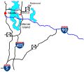
English: This category should contain files related to Interstate 90 in Washington. (State route number 90 in Washington per RCW 47.17.140)
States of the United States: Idaho · Illinois · Indiana · Massachusetts · Minnesota · Montana · New York · Ohio · Pennsylvania · South Dakota · Washington · Wisconsin · Wyoming
section of Interstate Highway in Washington (state), United States | |||||
| Upload media | |||||
| Instance of | |||||
|---|---|---|---|---|---|
| Location | Washington, Pacific Northwest, Washington, Pacific States Region | ||||
| Transport network | |||||
| Owned by | |||||
| Maintained by | |||||
| Inception |
| ||||
| Length |
| ||||
| Terminus | |||||
| |||||
Subcategories
This category has the following 19 subcategories, out of 19 total.
A
- Aubrey Davis Park (6 F)
B
- Benvenuto Viewpoint (3 F)
E
- East Channel Bridge (8 F)
I
- I-90 Trail (11 F)
J
- Judkins Park station (9 F)
K
L
M
- Mercer Island station (10 F)
- Mount Baker Ridge Tunnels (24 F)
- Mountains to Sound Greenway (10 F)
S
- Sam Smith Park (Seattle) (3 F)
- Sunset Highway (21 F)
V
- Vantage Bridge (41 F)
W
- Winchester Rest Area (2 F)
Media in category "Interstate 90 in Washington (state)"
The following 124 files are in this category, out of 124 total.
-
12th Avenue Bridge, Seattle.JPG 3,888 × 2,592; 4.12 MB
-
2022-05-09, Interstate 90 over Upper Preston Rd SE, Issaquah, Washington, 01.jpg 4,032 × 3,024; 2.65 MB
-
2022-05-09, Interstate 90 over Upper Preston Rd SE, Issaquah, Washington, 02.jpg 4,032 × 3,024; 2.78 MB
-
2022-05-09, Interstate 90 over Upper Preston Rd SE, Issaquah, Washington, 03.jpg 4,032 × 3,024; 2.62 MB
-
2022-05-09, Interstate 90 over Upper Preston Rd SE, Issaquah, Washington, 04.jpg 14,218 × 3,870; 16.93 MB
-
Aerial - eastern Lincoln County, WA with Sprague in foreground 01 (9795802465).jpg 4,288 × 2,848; 5.27 MB
-
Aerial - Liberty Lake, WA 01 (9795307523).jpg 2,848 × 4,288; 4.81 MB
-
Aerial - Liberty Lake, WA 01 - white balanced (9795270364).jpg 2,848 × 4,288; 6.43 MB
-
Aerial - Ritzville, WA 01 (9794372215).jpg 4,288 × 2,848; 4.3 MB
-
Aerial - Ritzville, WA 01 - white balanced (9794496583).jpg 4,288 × 2,848; 9.76 MB
-
Aerial - Ritzville, WA 02 (9794310865).jpg 4,288 × 2,848; 4.53 MB
-
Aerial - Ritzville, WA 02 - white balanced (9794382696).jpg 4,288 × 2,848; 8.46 MB
-
Aerial - Spokane, WA 01 (9793764213).jpg 4,288 × 2,848; 4.79 MB
-
Aerial - Spokane, WA 01 - white balanced (9793765636).jpg 4,288 × 2,848; 6.99 MB
-
Aerial - Spokane, WA 02 (9793610145).jpg 4,288 × 2,848; 4.41 MB
-
Aerial - Spokane, WA 02 - white balanced (9793684406).jpg 4,288 × 2,848; 6.38 MB
-
Aerial view of Cle Elum Lake 01.jpg 2,448 × 3,264; 2.08 MB
-
Aerial view of farms in Central Washington 01.jpg 3,264 × 2,448; 1.76 MB
-
Aerial view of farms in Central Washington 01A.jpg 3,264 × 2,448; 2.71 MB
-
Aerial view of Moses Lake & Potholes Reservoir, Washington 01.jpg 3,264 × 2,448; 1.62 MB
-
Aerial view of Moses Lake & Potholes Reservoir, Washington 01A.jpg 3,264 × 2,448; 3.02 MB
-
Aerial view of Winchester Reservoir, Washington 01.jpg 2,448 × 3,264; 1.6 MB
-
Aerial view of Winchester Reservoir, Washington 01A.jpg 2,448 × 3,264; 2.03 MB
-
Along Iron Horse Trail. I-90 below. (10508310035).jpg 2,048 × 1,536; 1.14 MB
-
Aubrey Davis Park, Mercer Island lid - aerial view.png 2,000 × 1,500; 4.68 MB
-
Bellevue to Seattle pano.jpg 4,019 × 1,880; 2.41 MB
-
Boehm's Candies sign 01.jpg 3,264 × 2,448; 1.76 MB
-
Bridges crossing Latah Creek.jpg 720 × 960; 212 KB
-
Downtown Seattle Transit Tunnel south portal, from Seattle Blvd.JPG 4,320 × 3,240; 2.54 MB
-
East Link tracks and catenary on East Channel Bridge, July 2019.jpg 3,452 × 2,300; 2.82 MB
-
EllensburgWA I-82&90 Junction.jpg 5,184 × 3,888; 3.42 MB
-
Future Judkins Park Station (43844952555).jpg 3,036 × 4,048; 2.19 MB
-
Garden Springs Creek Tunnel.jpg 4,032 × 3,024; 17.29 MB
-
Going west on Interstate 90 between Snoqualmie Pass and Denny Creek - Asahel Curtis exit.jpg 6,000 × 4,000; 9.73 MB
-
Going west on Interstate 90 east of Snoqualmie Pass - Denny Creek - Asahel Curtis exit.jpg 6,000 × 4,000; 13.59 MB
-
Going west on Interstate 90 east of Snoqualmie Pass - Hyak exit.jpg 6,000 × 4,000; 13.49 MB
-
Going west on Interstate 90 east of Snoqualmie Pass, near Keechelus Lake 01.jpg 6,000 × 3,368; 6.89 MB
-
Going west on Interstate 90 east of Snoqualmie Pass, near Keechelus Lake 02.jpg 6,000 × 4,000; 11.2 MB
-
Going west on Interstate 90 in Snoqualmie Pass 01.jpg 6,000 × 3,664; 9 MB
-
Guye Peak at Snoqualmie Pass from Interstate 90.jpg 6,000 × 4,000; 10.51 MB
-
Heading east (8167934507).jpg 982 × 982; 308 KB
-
Heading east on I-90 bike path (7967359192).jpg 1,536 × 1,152; 486 KB
-
Highway 10 under construction, 1939 (3884486199).gif 1,188 × 872; 929 KB
-
Hitch a free ride 110328-F-XR500-021.jpg 2,100 × 1,500; 1.81 MB
-
I-90 (WA) Metric.svg 601 × 601; 22 KB
-
I-90 (WA).svg 601 × 601; 22 KB
-
I-90 and I-5 cloverleaf seattle washington.jpg 1,006 × 1,408; 434 KB
-
I-90 and wind turbines at Ryegrass Summit - 01.jpg 3,364 × 2,156; 2 MB
-
I-90 and wind turbines at Ryegrass Summit - 02.jpg 4,912 × 3,264; 3.67 MB
-
I-90 as seen from Mount Si.jpg 1,500 × 1,000; 2.01 MB
-
I-90 bike path (10508469384).jpg 2,048 × 1,536; 774 KB
-
I-90 bike path (10508643873).jpg 2,048 × 1,536; 813 KB
-
I-90 east at WA-18, near Snoqualmie.jpg 1,280 × 960; 152 KB
-
I-90 east from Preston, WA.jpg 3,264 × 2,448; 1.98 MB
-
I-90 eastbound at Keechelus Lake.jpg 3,404 × 2,224; 2.69 MB
-
I-90 headed east approaching Island Crest Way, Mercer Island.jpg 2,592 × 1,944; 670 KB
-
I-90 headed east on Mercer Island WA.jpg 2,592 × 1,944; 667 KB
-
I-90 is empty! (3794606882).jpg 3,888 × 2,592; 4.44 MB
-
I-90 leaving the Columbia River Gorge, from near Vantage, WA.jpg 3,344 × 2,130; 1.94 MB
-
I-90 Seattle terminus update.svg 640 × 320; 20 KB
-
I-90 Seattle WA.svg 560 × 480; 70 KB
-
I-90 Snoqualmie Ridge East of North Bend, Washington.jpg 3,264 × 2,448; 3.73 MB
-
I-90 WA-1.svg 800 × 800; 94 KB
-
I-90 Wenatchee Winter.png 1,024 × 570; 446 KB
-
I-90 west at Ryegrass.jpg 2,560 × 1,920; 1.25 MB
-
I90 and I5 intersection.JPG 3,056 × 2,296; 2.7 MB
-
I90Spokane.jpg 1,140 × 700; 108 KB
-
I90ThruSnoqualmiePass.jpg 2,000 × 1,367; 633 KB
-
Idaho Highway 41 map.png 433 × 322; 26 KB
-
Interstate 5 and Interstate 90 interchange, seen from Columbia Center (2022).jpg 4,858 × 3,180; 7.25 MB
-
Interstate 5 Seattle01 2008-02-22.jpg 2,592 × 1,944; 1.31 MB
-
Interstate 90 at Snoqualmie Pass.jpg 2,272 × 1,343; 655 KB
-
Interstate 90 floating bridges from East Portal Viewpoint, Sept. 2019.jpg 5,191 × 2,256; 4.59 MB
-
Interstate 90 Mercer East span from Luther Burbank Park.jpg 3,264 × 2,448; 1.82 MB
-
Interstate 90 underpass on Mercer Island.jpg 6,000 × 4,000; 10.86 MB
-
Issaquah aerial, April 2023.png 2,000 × 1,500; 5.49 MB
-
Issaquah, Washington (3599950503).jpg 3,264 × 2,448; 4.09 MB
-
Issaquah, Washington (3600759940).jpg 3,264 × 2,448; 4.1 MB
-
JeffersonStreetSpokane.jpg 4,592 × 3,056; 5.34 MB
-
Judkins Park Station from Beacon Hill, Feb. 2020.jpg 3,456 × 2,304; 3.65 MB
-
Kingdome at night with I-90.jpg 1,124 × 768; 795 KB
-
Mercer Island East Link under construction 01.jpg 4,000 × 2,672; 3.72 MB
-
Mercer Island East Link under construction 02.jpg 2,672 × 4,000; 3.47 MB
-
Mercer Island East Link under construction 03.jpg 2,672 × 4,000; 3.68 MB
-
Mercer Island East Link under construction 04.jpg 4,000 × 2,672; 3.72 MB
-
Mercer Island East Link under construction 05.jpg 4,000 × 2,672; 3.59 MB
-
Mercer Island East Link under construction 06.jpg 4,000 × 2,672; 3.72 MB
-
Mercer Island East Link under construction 07.jpg 4,000 × 2,672; 3.89 MB
-
Mercer Island East Link under construction 09.jpg 4,000 × 2,672; 3.6 MB
-
Mercer Island East Link under construction 10.jpg 2,672 × 4,000; 3.14 MB
-
Mercer Island Link station construction, October 2017.jpg 4,676 × 3,048; 4.93 MB
-
Mercer Island, WA - Luther Burbank Park floating docks.jpg 3,264 × 2,448; 2.01 MB
-
Mercer Lid (10508630923).jpg 2,048 × 1,536; 983 KB
-
North Bend and Mount SI view From 5000 feet - panoramio.jpg 4,208 × 3,120; 6.35 MB
-
Outbound 550 (5140050987).jpg 5,184 × 3,456; 5.35 MB
-
Pac Med, SODO and The Stadiums (14976939385).jpg 7,739 × 2,948; 9.47 MB
-
Panorama of Lake Washington with I-90, Mount Rainier, and the Cascades.JPG 5,776 × 2,518; 2.77 MB
-
Rainier Freeway Station from 15th Avenue (38168230412).jpg 4,746 × 3,158; 4.37 MB
-
Safeco Field and CenturyLink Field in Seattle, WA.jpg 3,039 × 1,575; 983 KB
-
Seattle - Rainier Avenue overpass, 1954 (22651065004).gif 1,400 × 1,080; 1.05 MB
-
Seattle Interstate 90 mile 0.jpg 1,159 × 733; 752 KB
-
Seattle, Washington 1955 Yellow Book.jpg 800 × 1,311; 303 KB
-
Smart highway signs on Interstate 90 in Mercer Island, Washington.jpg 4,750 × 3,166; 3.94 MB
-
Smokey view of I-90 floating bridges in Seattle - Sept 11, 2020.jpg 3,454 × 2,302; 1.86 MB
-
Snow accident, Interstate 90.jpg 3,015 × 2,699; 530 KB
-
South Seattle from Columbia Center (3794602704).jpg 3,888 × 2,592; 3.97 MB
-
Spokane aerial, May 2023 (cropped).png 2,000 × 1,000; 3.54 MB
-
Spokane aerial, May 2023.png 2,000 × 1,500; 5.35 MB
-
Turning North - View of Rattlesnake Ridge.jpg 3,264 × 2,448; 3.1 MB
-
Under I-90 in Issaquah (7319116920).jpg 2,304 × 1,728; 755 KB
-
Vantage Crossing (NoEst View).jpg 19,722 × 2,772; 7.45 MB
-
WA 2 I90 FHWA 1964 24.jpg 1,395 × 1,108; 203 KB
-
WA 7 I90 FHWA 1967 1004.jpg 1,996 × 2,519; 990 KB
-
WA 903 Spur Interchange-2.jpg 436 × 390; 113 KB
-
WA 903 Spur Interchange.jpg 1,000 × 800; 159 KB
-
Washington Interstate 90.svg 1,152 × 640; 1.17 MB
-
Wild Horses Monument aka Grandfather Cuts Loose the Ponies.jpg 736 × 552; 254 KB
-
Wildlife Overpass east of Snoqualmie Pass on Interstate 90.jpg 5,992 × 3,552; 10.63 MB
-
Wrecked truck on Interstate 90 east of Snoqualmie Pass 01.jpg 6,000 × 4,000; 11.45 MB
-
Wrecked truck on Interstate 90 east of Snoqualmie Pass 02.jpg 6,000 × 4,000; 13.91 MB
-
Xerophyllum tenax - Red, White and Blue garden on Granite Mountain.jpg 3,072 × 2,304; 1.35 MB


