Category:Inondation risk maps of Loiret (department)
Jump to navigation
Jump to search
Departments of Metropolitan France: Ain [01] · Alpes-de-Haute-Provence [04] · Hautes-Alpes [05] · Alpes-Maritimes [06] · Aude [11] · Aveyron [12] · Bouches-du-Rhône [13] · Charente [16] · Charente-Maritime [17] · Corrèze [19] · Dordogne [24] · Eure-et-Loir [28] · Gers [32] · Hérault [34] · Loir-et-Cher [41] · Haute-Loire [43] · Loiret [45] · Maine-et-Loire [49] · Puy-de-Dôme [63] · Hautes-Pyrénées [65] · Pyrénées-Orientales [66] · Seine-et-Marne [77] · Vienne [86]
Subcategories
This category has the following 2 subcategories, out of 2 total.
I
Media in category "Inondation risk maps of Loiret (department)"
The following 14 files are in this category, out of 14 total.
-
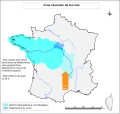
45-Crue-cevenole.svg 1,930 × 1,824; 2.67 MB
-
45-Crue-mixte.svg 1,930 × 1,824; 4.51 MB
-
45-PPRI.svg 843 × 597; 1.12 MB
-
45-TRI.jpg 3,507 × 2,480; 513 KB
-
45-TRI.svg 843 × 597; 6.07 MB
-
45-ZI-Vals-Giennois.png 5,457 × 3,559; 863 KB
-
45-ZI-Vals-Orléanais.png 5,457 × 3,559; 760 KB
-
45-ZI-Vals.png 5,457 × 3,543; 1,022 KB
-
ZI-Giennois-Nevoy.png 5,457 × 3,543; 1.29 MB
-
ZI-Giennois-Poilly-lez-Gien.png 5,457 × 3,543; 1.29 MB
-
ZI-Giennois-Saint-Brisson-sur-Loire.png 5,457 × 3,543; 1.29 MB
-
ZI-Giennois-Saint-Firmin-sur-Loire.png 5,457 × 3,543; 1.28 MB
-
ZI-Giennois-Saint-Gondon.png 5,457 × 3,543; 1.29 MB
-
ZI-Giennois-Saint-Martin-sur-Ocre.png 5,457 × 3,543; 1.29 MB


