Category:Information boards in Osterode am Harz
Jump to navigation
Jump to search
Subcategories
This category has only the following subcategory.
D
Media in category "Information boards in Osterode am Harz"
The following 48 files are in this category, out of 48 total.
-
Altes Rathaus (Osterode am Harz) Infotafeln.jpg 3,508 × 4,597; 4.56 MB
-
Am Röddenberg 12 (Osterode am Harz) Infotafel Siechenhof.jpg 1,944 × 2,260; 2.69 MB
-
Amtshof 20 (Osterode am Harz) Infotafel.jpg 1,921 × 2,273; 2.35 MB
-
B241 Kaiserteichbrücke (Osterode am Harz) Infotafel Karstwanderweg.jpg 3,344 × 2,468; 5.57 MB
-
Baumhofstraße KZ-Aussenlager (Osterode am Harz) Infotafel.jpg 3,123 × 2,483; 2.76 MB
-
Berliner Straße Abgunst Denkmal Berliner Mauer (Osterode am Harz) 03.jpg 3,560 × 2,650; 6.58 MB
-
Die Pipinsburg Informationstafel Karstwanderweg.jpg 4,582 × 3,135; 2.5 MB
-
Edelhof Dorste 03.jpg 3,796 × 5,356; 11.68 MB
-
Edelhof Dorste 04.jpg 3,622 × 4,819; 11.49 MB
-
Erdfälle Bauernberg Infotafel Karstwanderweg.jpg 4,836 × 3,798; 12.69 MB
-
Geopark Harz Scheerenberger Straße (Osterode am Harz).jpg 2,891 × 3,855; 4.56 MB
-
Harzkornmagazin Infotafel 02.jpg 2,989 × 3,480; 2.34 MB
-
Harzkornmagazin Infotafel.jpg 3,449 × 4,105; 5.52 MB
-
Harzkornmagazin Infotafeln Städtepartnerschaften.jpg 4,466 × 3,558; 10.32 MB
-
Herzberger Straße 5 (Osterode am Harz) Landratsamt Plakette Landkreis 1885-2016.jpg 3,330 × 4,208; 9.49 MB
-
Herzberger Straße 6 (Osterode am Harz) Infotafel Schule.jpg 1,390 × 1,710; 1.66 MB
-
Hinweistafel "Alte Burg".jpg 2,439 × 3,464; 1.19 MB
-
Im Badegarten (Osterode am Harz) Stadtmauer Karstwanderweg.jpg 5,139 × 3,876; 12.66 MB
-
Infotafel Geschichte Marke.jpg 4,620 × 3,493; 9.98 MB
-
Infotafel-Vorsperre-Sösestausee.jpg 1,707 × 1,625; 228 KB
-
Johannistorplatz (Osterode am Harz) Ausgrabungen Johannistor 09.jpg 3,864 × 2,940; 7.06 MB
-
Johannistorplatz Mühlengraben Info (Osterode am Harz).jpg 3,715 × 4,591; 4.08 MB
-
Karstwanderweg Erdfälle Bauernberg Infotafel.jpg 4,222 × 3,321; 4.89 MB
-
Marienkirche (Osterode am Harz) Info.jpg 2,492 × 3,007; 2.58 MB
-
Marktkirche (Osterode am Harz) Info.jpg 1,644 × 1,905; 1.16 MB
-
Martin-Luther-Platz 7 (Osterode am Harz) Infotafel.jpg 1,691 × 1,997; 1.66 MB
-
Mühlenteich Infotafel Karstwanderweg (Förste).jpg 5,860 × 3,820; 13.06 MB
-
ND OHA00001 Fuchshaller Steinbruch Infotafel Geopark Harz.jpg 5,184 × 3,888; 8.11 MB
-
Osterode am Harz Stolpersteine Infotafel.jpg 2,673 × 2,038; 1.96 MB
-
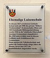
Osterode Infotafel Ehemalige Luisenschule.jpg 2,149 × 2,519; 1.16 MB
-
Osteröder Kalkberge Informationstafel Karstwanderweg.jpg 3,659 × 2,581; 1.93 MB
-
Petersilienstraße 18 (Osterode am Harz) Infotafel.jpg 2,769 × 3,201; 5.56 MB
-
Rollberg 32 (Osterode am Harz) Infotafel.jpg 3,245 × 3,944; 6.27 MB
-
Rotemühlenweg 2 (Osterode am Harz) Kupferhammer Jorns Infotafel.jpg 1,837 × 2,194; 2.72 MB
-
Schilder Gottesdienste OE Osterode B498.jpg 3,586 × 4,952; 3.64 MB
-
Schildwache (Osterode am Harz) Stadtmauer Infotafeln.jpg 6,000 × 4,000; 7.56 MB
-
Schildwache (Osterode am Harz) Stadtmauer Karstwanderweg.jpg 5,055 × 3,879; 11.47 MB
-
Schloßplatz St. Jacobi (Osterode am Harz) Infotafel.jpg 1,829 × 2,142; 1.29 MB
-
Spritzenhausplatz 9 (Osterode am Harz) Infotafel.jpg 1,713 × 1,970; 2.3 MB
-
Stadtmauer (Osterode am Harz) Info.jpg 2,698 × 3,115; 2.85 MB
-
Sösetalsperre im Harz bei Osterode IMG 9163.jpg 4,493 × 3,000; 4.06 MB
-
Sösetalsperre im Harz bei Osterode IMG 9190.jpg 3,000 × 4,500; 3.61 MB
-
Uehrde 14 0893.jpg 3,883 × 3,309; 7.9 MB
-
Uehrde Infotafel 0883.jpg 4,745 × 3,395; 9.58 MB
-
Untere Neustadt 1 (Osterode am Harz) Infotafel.jpg 3,053 × 3,579; 7.04 MB
-
Waagestraße 2 (Osterode am Harz) Infotafel.jpg 2,899 × 3,413; 6.88 MB
-
Ührde 14 Stadtdorf Uehrde.jpg 3,188 × 2,668; 4.62 MB


