Category:Information boards in Landkreis Göttingen
Jump to navigation
Jump to search

Subcategories
This category has the following 7 subcategories, out of 7 total.
D
- Dennert-Tannen in Zorge (15 F)
O
Media in category "Information boards in Landkreis Göttingen"
The following 39 files are in this category, out of 39 total.
-
002 Naturdenkmal Wiedensee bei Scharzfeld in Niedersachsen 01.JPG 5,184 × 3,456; 13.12 MB
-
Am Edelhof 6 (Hörden) Informationstafel.jpg 5,796 × 3,944; 13.4 MB
-
Auf dem Klimp (Herzberg am Harz) 0471.jpg 5,800 × 3,896; 13.18 MB
-
BadLauterberg-Kupferhütte-4.jpg 1,355 × 960; 381 KB
-
Bahnhof Tettenborn Infotafel Karstwanderweg.jpg 5,744 × 3,880; 13.38 MB
-
Bahnstrecke Gittelde-Bad Grund Informationstafel.jpg 4,665 × 3,147; 8.6 MB
-
Dennert-Tanne zu Ida Arenhold.jpg 2,592 × 3,456; 3.81 MB
-
Dennert-Tanne zum Gericht Galgenberg.jpg 2,592 × 3,456; 4.23 MB
-
Dennert-Tanne zum sog. Freudenstein.pdf 1,239 × 1,752; 522 KB
-
Der Iberg und der Hüppelweg (Bad Grund).jpg 5,672 × 3,844; 12.78 MB
-
Diemarden - Tafel - Alter Friedhof.jpg 2,048 × 1,536; 2.01 MB
-
Diemarden - Tafel - Gartetalbahn 1897-1957.jpg 2,048 × 1,536; 1.94 MB
-
Diemarden - Tafel - Neuer Friedhof.jpg 2,048 × 1,536; 1.78 MB
-
Dransfeld ehemalige Synagoge mit Infotafel von W.JPG 3,024 × 4,032; 3.98 MB
-
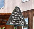
EsperantoLonau.jpg 4,000 × 3,000; 3.81 MB
-
Finnenbruch, Großes Butterloch, Schwimmende Insel.JPG 5,184 × 3,456; 10.88 MB
-
Former Synagoge in Dransfeld, district Göttingen, Lower Saxony 03.jpg 2,484 × 3,312; 1.32 MB
-
Gerichtslinde (Pöhlde) Informationstafel Karstwanderweg.jpg 4,543 × 3,073; 8.38 MB
-
Goettingen Forstbotan Garten Infotafel (2017).jpg 3,968 × 2,232; 3.06 MB
-
Info board Hurkutstein, Reinhausen-Gleichen.jpg 2,181 × 2,473; 954 KB
-
Informationstafel Basaltsteinbruch.jpg 3,264 × 2,448; 2.57 MB
-
Informationstafel Hinüberbuche.jpg 4,320 × 3,240; 2.92 MB
-
Informationstafel „Auf dem Tanzwerder“.jpg 3,240 × 4,320; 2.62 MB
-
Infotafel bei der Rieswarte.jpg 2,048 × 1,536; 1.75 MB
-
Infotafel Rieswarte - Detail Ring der Warttürme usw um Göttingen.jpg 1,536 × 2,048; 1.08 MB
-
Karstwanderweg Beginn Nordroute (Förste).jpg 6,000 × 4,000; 7.17 MB
-
Kleinbahn Osterode-Kreiensen Infotafel Karstwanderweg Posthof Badenhausen 01.jpg 3,998 × 2,970; 7.11 MB
-
Spahnberg (Hörden) Informationstafel Karstwanderweg.jpg 5,920 × 3,972; 14.57 MB
-
Tieberg (Wulften) Infotafel.jpg 2,922 × 2,538; 4.17 MB
-
View of the valley, Pferdeberg, Borderlandmuseum Eichsfeld 04 Information board.jpg 2,284 × 2,460; 1,013 KB
-
Waldschmiede Walkenried Info.jpg 4,000 × 6,000; 6.26 MB
-
Wendebachstausee-03.jpg 2,048 × 1,536; 2.64 MB
-
Wendebachtal (34).jpg 4,320 × 3,240; 4.73 MB
-
Westersteine bei Bartolfelde Nordseite Informationstafel Geopark und HWN.jpg 4,634 × 3,615; 9.76 MB
-
Westersteine bei Bartolfelde Nordseite Informationstafel Geopark.jpg 5,088 × 3,701; 11.17 MB
-
Wieda Versinkung bei Walkenried Karstwanderweg.jpg 5,380 × 3,856; 12.14 MB
-
Winterberg Steinbruch (Bad Grund) 06.jpg 6,000 × 4,000; 5.95 MB
-
Winterberg Steinbruch (Bad Grund) 07.jpg 6,000 × 4,000; 6.15 MB


