Category:Holywood, Dumfries and Galloway
Jump to navigation
Jump to search
village in Dumfries and Galloway, Scotland, UK | |||||
| Upload media | |||||
| Instance of | |||||
|---|---|---|---|---|---|
| Location |
| ||||
 | |||||
Subcategories
This category has the following 2 subcategories, out of 2 total.
F
- Fourmerkland Tower (2 F)
Media in category "Holywood, Dumfries and Galloway"
The following 45 files are in this category, out of 45 total.
-

-
 At Killylung, near Dumfries - geograph.org.uk - 773774.jpg 640 × 337; 29 KB
-
 At the Crossroads - geograph.org.uk - 1156793.jpg 480 × 640; 65 KB
-
 Birkhall, Holywood - geograph.org.uk - 702573.jpg 640 × 480; 70 KB
-
 Blackpark Farm - geograph.org.uk - 383430.jpg 640 × 480; 87 KB
-
 Bridge over the Cluden Water at Newbridge - geograph.org.uk - 383443.jpg 640 × 508; 103 KB
-
 Broomrig Railway Bridge - geograph.org.uk - 702468.jpg 640 × 480; 72 KB
-
 Broomrigg Farm in August - geograph.org.uk - 1463079.jpg 640 × 445; 48 KB
-
 Broomrigg Farm, Dumfries - geograph.org.uk - 773830.jpg 640 × 480; 71 KB
-
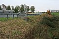
 Cairn Valley Railway embankment, Holywood, Dumfries and Galloway.jpg 4,856 × 2,341; 1.85 MB
-
 Culvert Under the A76 - geograph.org.uk - 598840.jpg 640 × 427; 75 KB
-
 Disused ford, Hardlawbank - geograph.org.uk - 58604.jpg 480 × 360; 22 KB
-
 East Cluden - geograph.org.uk - 715329.jpg 640 × 480; 65 KB
-
 East Crossleys Woodlands - geograph.org.uk - 702500.jpg 640 × 480; 129 KB
-
 Farm road to Heathfield - geograph.org.uk - 409521.jpg 640 × 480; 122 KB
-
 Farmland near Kirkland. - geograph.org.uk - 12815.jpg 640 × 480; 44 KB
-

-
 Fields at Boatrig - geograph.org.uk - 662055.jpg 640 × 480; 62 KB
-
 Fields near Sandbed Farm - geograph.org.uk - 773785.jpg 640 × 480; 48 KB
-

-
 Grazing field - geograph.org.uk - 383433.jpg 640 × 480; 92 KB
-
 Holm Farm, Holywood - geograph.org.uk - 702487.jpg 640 × 480; 77 KB
-
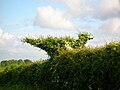 Holywood hedge bird.JPG 2,288 × 1,712; 1.18 MB
-
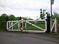 Holywood level crossing gate.JPG 2,288 × 1,712; 1.21 MB
-
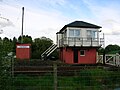 Holywood signal box Dumfries.JPG 2,288 × 1,712; 1.22 MB
-
 Icy Field - geograph.org.uk - 638747.jpg 640 × 480; 209 KB
-
 Junction on the B729 at Nether Gribton - geograph.org.uk - 409542.jpg 640 × 480; 134 KB
-
 Loch Foot Burn Bridge - geograph.org.uk - 702523.jpg 640 × 480; 91 KB
-
 Mapa dg holywood.jpg 2,004 × 1,363; 599 KB
-
 New windfarm access road - geograph.org.uk - 435390.jpg 480 × 640; 103 KB
-
 Newington, A76 - geograph.org.uk - 598844.jpg 640 × 427; 79 KB
-
 Old School buildings plaque, Holywood, Dumfries and Galloway.jpg 3,261 × 1,946; 1.53 MB
-
 Old School buildings, Holywood, Dumfries and Galloway.jpg 4,333 × 2,740; 2.64 MB
-
 Pasture and trees - geograph.org.uk - 383435.jpg 640 × 480; 105 KB
-
 Pretty Galloway cottage - geograph.org.uk - 409517.jpg 640 × 480; 133 KB
-
 Road to Cormaddie - geograph.org.uk - 909300.jpg 640 × 403; 69 KB
-
 Ruins in the forest - geograph.org.uk - 610420.jpg 640 × 480; 145 KB
-
 Steilston House - geograph.org.uk - 702598.jpg 640 × 480; 104 KB
-
 The Cairn Valley Railway bridge and embankment, Holywood, Dumfries and Galloway.jpg 4,896 × 2,752; 3.56 MB
-
 The Cairn Valley Railway bridge, Holywood, Dumfries and Galloway. View west.jpg 4,812 × 2,485; 3.02 MB
-
 The Cairn Valley Railway embankment, Holywood, Dumfries and Galloway. View east.jpg 3,621 × 2,696; 2.39 MB
-
 The Cairn Valley Railway embankment, Holywood, Dumfries and Galloway.jpg 4,896 × 2,752; 3.23 MB
-
 The old School buildings, Holywood, Dumfries and Galloway.jpg 4,896 × 2,752; 3.1 MB
-
 The trig point on Wardlaw - geograph.org.uk - 435404.jpg 640 × 480; 96 KB
-
 Wardlaw - geograph.org.uk - 435408.jpg 640 × 480; 112 KB


