Category:History of indigenous peoples of the Great Lakes Region
Jump to navigation
Jump to search
| NO WIKIDATA ID FOUND! Search for History of indigenous peoples of the Great Lakes Region on Wikidata | |
| Upload media |
English: History of the Great Lakes tribes in what is now known as the United States and Canada.
Subcategories
This category has the following 21 subcategories, out of 21 total.
Media in category "History of indigenous peoples of the Great Lakes Region"
The following 22 files are in this category, out of 22 total.
-
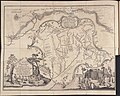
 1744 bellin map Carte des lacs du Canada.jpg 5,827 × 3,642; 7.82 MB
-
 1755 Bellin Map of the Great Lakes - Geographicus - GreatLakes-bellin-1755.jpg 4,000 × 3,215; 3.49 MB
-
 1825 Prairie du Chien Line.jpg 1,275 × 1,650; 495 KB
-
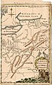 A Map of the Western parts of the Colony of Virginia, 1754.jpg 952 × 1,544; 1.78 MB
-
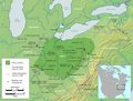
 Anishinaabe-Anishinini Distribution Map.svg 1,022 × 993; 89 KB
-
-

-
 Hopewell Exchange Network HRoe 2010.jpg 808 × 1,000; 582 KB
-

-
 Mascouten01.png 1,366 × 1,140; 2.31 MB
-
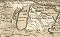 Michigan 1718.jpg 1,006 × 625; 374 KB
-
 Migration Map.jpg 560 × 345; 117 KB
-
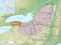
 Ohio Country de.png 1,217 × 920; 1.42 MB
-
 Ohio Country en.png 1,217 × 920; 1.41 MB
-
 Ojibwe map pre-contact blur.svg 1,368 × 802; 896 KB
-
 Pt Peninsula and Saugeen complexes map HRoe 2010.jpg 600 × 500; 267 KB
-

-
 The Great Indian Council.jpg 987 × 645; 281 KB
-
 Thomas Hutchins Map of Henry Bouquet's 1764 Expedition.jpg 9,706 × 7,739; 20.11 MB
-

-
 Wenro Territory ca1630 map-en.svg 2,300 × 1,700; 9.76 MB
-


.jpg)

_(14755982396).jpg)


_(14782566514).jpg)

_(cropped).jpg)