Category:Hakatai Shale slopes
Jump to navigation
Jump to search
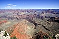
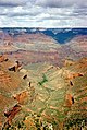
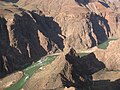
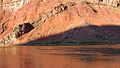
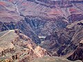
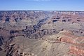
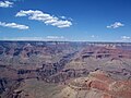
Photos showing the most typical showing of the w:Hakatai Shale, often shown above w:Bass Formation, or below massive vertical cliffs of en:Shinumo Quartzite
Media in category "Hakatai Shale slopes"
The following 47 files are in this category, out of 47 total.
-
 2012.09.14.084856 View Mather Point Grand Canyon Arizona.jpg 1,920 × 1,280; 1.09 MB
-
 2012.09.14.121803 View Yavapai Point Grand Canyon Arizona.jpg 1,920 × 1,280; 1.47 MB
-
 2012.09.14.161647 View South Rim Trail Grand Canyon Arizona.jpg 1,920 × 1,280; 1.1 MB
-
 2012.09.14.172516 View Maricopa Point Grand Canyon Arizona.jpg 1,920 × 1,280; 1.17 MB
-
 25-Indian Gardens View3.tif 1,624 × 1,071; 4.98 MB
-
 ARIZONA (4547398222).jpg 3,648 × 2,736; 3.89 MB
-
 Bright Angel Creek canyon from Rim Trail in Grand Canyon NP.jpeg 1,000 × 663; 100 KB
-
 Bright Angel Trail, Grand Canyon - panoramio.jpg 2,960 × 1,050; 3.01 MB
-
 Colorado River view from South Kaibab Trail.JPG 5,184 × 3,456; 7.97 MB
-
 Deep chasm - Grand Canyon National Park.jpeg 1,280 × 960; 695 KB
-
 Desert View Grandview 2 (15359257880).jpg 5,184 × 3,456; 11.7 MB
-
 Desert View Grandview 3 (15358762918).jpg 3,456 × 4,973; 8.69 MB
-
 Desert View Grandview 4 (14924164204).jpg 5,184 × 3,456; 8.79 MB
-
 DSC3863 HDR - panoramio.jpg 2,456 × 1,638; 2.79 MB
-
 FDuffieldGrandCanyon101.jpg 6,000 × 3,376; 17.7 MB
-
 First River Sighting (17217975992).jpg 3,968 × 2,976; 4.43 MB
-
 Gcnp symmetry.jpg 2,000 × 1,500; 2.92 MB
-
 Geologic Symbols and Color coding - Flickr - brewbooks (1).jpg 1,753 × 3,029; 1.79 MB
-
 Grand Canyon (1).jpg 3,000 × 2,000; 2.64 MB
-
 Grand Canyon cloud.jpg 603 × 900; 211 KB
-
 Grand Canyon from Plateau Point - Flickr - brewbooks (1).jpg 3,264 × 2,448; 4.49 MB
-
 Grand Canyon geologic column.jpg 600 × 836; 68 KB
-
 Grand Canyon Mather Point 2013.jpg 4,928 × 3,264; 8.53 MB
-
 Grand Canyon National Park 02.jpg 2,400 × 1,600; 2.57 MB
-

-
 Grand Canyon NP Ar Granite Gorge Plateau Point ne PICT0075 19941027.jpg 1,680 × 2,520; 2.25 MB
-
 Grand Canyon Ooh Aah Point.png 9,115 × 3,628; 46.76 MB
-
 Grand Canyon Powell Point 26-09-2012 13-49-37.jpg 4,278 × 2,406; 8.04 MB
-
 Grand Canyon Supergroup Bass and Hakatai Transition 0017 - Flickr - Grand Canyon NPS.jpg 3,008 × 2,000; 1.16 MB
-
 Grand Canyon Supergroup Hakatai Shale with Basalt Dike.jpg 2,180 × 1,228; 650 KB
-
 Grand Canyon Supergroup with basalt dike in Hakatai Shale.JPG 800 × 526; 104 KB
-
 Grand Canyon Vincent Bloch.jpg 2,560 × 1,920; 3.28 MB
-
 Grand Canyon with Snow 4.JPG 4,000 × 3,000; 10.02 MB
-
 Grand Canyon, from Mather Point (7901981906).jpg 4,272 × 2,848; 5.63 MB
-
 Grand Canyon, Near El Tovar Hotel.JPG 3,264 × 2,448; 2.25 MB
-
 Grand Canyon, South Rim IMG 4575.jpg 6,000 × 4,000; 8.35 MB
-
 Grand Canyon, South Rim IMG 4579.jpg 4,014 × 3,605; 4.14 MB
-
 Grand Canyon. North Rim. Grand Canyon Lodge 06.JPG 2,239 × 3,194; 1.43 MB
-
 Grand Canyon2017.jpg 1,509 × 1,885; 685 KB
-
 Grand canyons hill.jpg 1,280 × 960; 311 KB
-
 Heading Down, Grand Canyon 9-15 (22083254922).jpg 2,800 × 2,526; 2.99 MB
-
 Hopi Point (8052507434).jpg 4,256 × 2,832; 3.6 MB
-
 Hopi Point Grand Canyon 3 (15544283645).jpg 3,456 × 5,184; 13.03 MB
-
 Plateau Point - Pipe Springs Rapids (I think) - Flickr - brewbooks.jpg 3,264 × 2,448; 3.91 MB
-
 Plateau Point in Grand Canyon National Park.jpg 4,032 × 3,024; 4.08 MB
-
 The Grand Canyon. (12124856486).jpg 3,232 × 1,732; 5.78 MB
-
 TheGrandCanyon.JPG 2,304 × 1,728; 2.2 MB


.jpg)


.jpg)
.jpg)
.jpg)


.jpg)

.jpg)
.jpg)

.jpg)


.jpg)


.jpg)
.jpg)
.jpg)
_-_Flickr_-_brewbooks.jpg)

.jpg)
