Category:German-language maps of Poland
Jump to navigation
Jump to search
Media in category "German-language maps of Poland"
The following 18 files are in this category, out of 18 total.
-
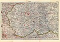
 (1838) KARTE VOM KÖNIGREICH POLEN.jpg 2,605 × 3,301; 4.42 MB
-
 Ausschnitt Flötzkarte Antonienhütte.jpg 2,273 × 1,670; 793 KB
-
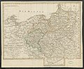
 Charte vom Königreiche Preussen oder Ost- West- Süd Und Neu- Ost-Preussen.jpg 8,382 × 6,966; 17.88 MB
-

-
 FF 1965 Strecke.jpg 763 × 605; 72 KB
-
 Flüsse in Polen (Karte).png 1,409 × 1,276; 291 KB
-
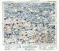
 Grossblatt Nr. 377 Chelm 1940.jpg 14,183 × 11,097; 35.36 MB
-
-
 KdwR O38 Wladimir Wolynsk 1915 400dpi.jpg 6,354 × 5,485; 10.74 MB
-
 Kongresspolen BV036670536.jpg 7,050 × 5,844; 6.43 MB
-
 Polen (Russisches Reich) 1916r. Mapa niemiecka.jpg 9,802 × 6,804; 16.33 MB
-
 Polen - historische Regionen.png 2,430 × 2,596; 891 KB
-
 Polen bis zu seinem Untergang 1795.jpg 5,008 × 3,499; 12.16 MB
-
 Polen map german.png 3,508 × 2,479; 330 KB
-
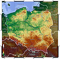 Polen topo.jpg 1,400 × 1,364; 758 KB
-
 Polen und Litauen 1125 bis zu ihrer Vereinigung 1386.jpg 5,008 × 3,499; 12.54 MB
-
 Preußisches Urmeßtischblatt 1828.jpg 1,533 × 1,109; 499 KB
-
 Szczecin - Stettin - Map (1879) - high resolution.jpg 5,231 × 4,522; 12.01 MB
_KARTE_VOM_K%C3%96NIGREICH_POLEN.jpg)


.jpg)

.png)


_1916r._Mapa_niemiecka.jpg)


_-_high_resolution.jpg)