Category:Geography of Ventura County, California
Jump to navigation
Jump to search
Counties of California: Alameda · Alpine · Amador · Butte · Calaveras · Colusa · Contra Costa · Del Norte · El Dorado · Fresno · Glenn · Humboldt · Imperial · Inyo · Kern · Kings · Lake · Lassen · Los Angeles · Madera · Marin · Mariposa · Mendocino · Merced · Modoc · Mono · Monterey · Napa · Nevada · Orange · Placer · Plumas · Riverside · Sacramento · San Benito · San Bernardino · San Diego · San Joaquin · San Luis Obispo · San Mateo · Santa Barbara · Santa Clara · Santa Cruz · Shasta · Sierra · Siskiyou · Solano · Sonoma · Stanislaus ·Sutter · Tehama · Trinity · Tulare · Tuolumne · Ventura · Yolo · Yuba – Consolidated city-county: San Francisco
Wikimedia category | |||||
| Upload media | |||||
| Instance of | |||||
|---|---|---|---|---|---|
| Category combines topics | |||||
| Ventura County | |||||
county in California, United States of America | |||||
| Instance of | |||||
| Named after | |||||
| Location | California, Pacific States Region | ||||
| Capital | |||||
| Inception |
| ||||
| Population |
| ||||
| Area |
| ||||
| official website | |||||
 | |||||
Subcategories
This category has the following 23 subcategories, out of 23 total.
Media in category "Geography of Ventura County, California"
The following 37 files are in this category, out of 37 total.
-
Ca-1 between Oxnard and Malibu.JPG 3,264 × 2,448; 1.73 MB
-
Camarillo April 2010.jpg 3,008 × 2,000; 1.42 MB
-
Channel islands web.jpg 788 × 452; 73 KB
-
Curama Valley, California.jpg 4,000 × 3,000; 10.64 MB
-
CuyamaValleySpringtime.jpg 1,600 × 1,200; 447 KB
-
FSDF in June 2005.jpg 432 × 324; 28 KB
-
Laguna Peak equipment.JPG 750 × 600; 615 KB
-
Whale with Laguna Peak, California, in background.jpg 2,874 × 2,310; 1.09 MB
-
Looking at Sandstone Peak from Inspiration Point.jpg 1,280 × 960; 260 KB
-
NBVC Point Mugu at dawn.jpg 1,105 × 884; 268 KB
-
Newbury Park Area Panorama.jpg 10,652 × 2,296; 12.23 MB
-
Newbury Park Area.jpg 2,776 × 600; 247 KB
-
Oak-Park-Simi-Valley.jpg 8,192 × 1,788; 16.08 MB
-
Pacific Coast Highway Point Mugu.jpg 2,816 × 2,112; 2.02 MB
-
Point Magu (8306951789).jpg 2,000 × 3,000; 2.75 MB
-
Sanjon Rd exit off the 101 in Ventura County.jpg 4,032 × 3,024; 1.48 MB
-
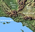
Wpdms shdrlfi020l santa susana mountains.jpg 300 × 270; 44 KB
-
Sespe Wilderness.JPG 4,000 × 3,000; 3.89 MB
-
SespeCA.jpg 2,560 × 1,920; 5.42 MB
-
SespeCreek.jpg 1,583 × 987; 346 KB
-
Simi Valley surroundings.jpg 560 × 420; 32 KB
-
Simi-Valley-from-Sage-Ranch-Park.jpg 3,264 × 2,448; 7.44 MB
-
Simi-Valley-Panoramic-from-Sage-Ranch-Park.jpg 9,408 × 2,111; 14.36 MB
-
SouthMountain1 (cropped).jpg 2,504 × 1,698; 1.97 MB
-
SouthMountain1.jpg 2,520 × 2,168; 2.44 MB
-
SR33-Pinos.JPG 1,600 × 1,200; 407 KB
-
Ssfl cdc atsdr figure1.gif 701 × 531; 158 KB
-
Ventura Harbor.jpg 4,272 × 2,848; 6.1 MB
-
Ventura Oxnard poster.jpg 588 × 853; 239 KB
-
Ventura River Dec 68 (28392929694).jpg 1,600 × 1,030; 127 KB
-
Ventura River Lagoon Dec 71 (28936704631).jpg 1,600 × 1,043; 130 KB
-
Ventura River Lagoon downstream from northern road crossing Dec 71 (28936708081).jpg 1,584 × 1,051; 139 KB
-
Westlake Village from Sandstone Peak.jpg 2,805 × 1,869; 1.53 MB
-
Wildwood Cyn NewburyParkCA.jpg 2,560 × 1,920; 3.58 MB


