Category:Election maps of the United States (2018)
Jump to navigation
Jump to search
Subcategories
This category has the following 7 subcategories, out of 7 total.
2
B
H
S
Media in category "Election maps of the United States (2018)"
The following 7 files are in this category, out of 7 total.
-
Control of US State Governments after the 2018 Midterm Elections.svg 512 × 298; 43 KB
-
Georgia Secretary of State Election Results by County, 2018.svg 810 × 810; 90 KB
-
MedicaidExpansion2018.png 1,513 × 983; 40 KB
-
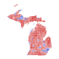
MI SOS 2018.svg 744 × 744; 13.42 MB
-
Redistrictingafter2018.png 1,513 × 983; 42 KB
-
UT 2018 SN SS.svg 1,300 × 1,050; 425 KB


