Category:Election maps of the United States (2014)
Jump to navigation
Jump to search
Subcategories
This category has the following 7 subcategories, out of 7 total.
2
B
H
Media in category "Election maps of the United States (2014)"
The following 13 files are in this category, out of 13 total.
-
2014 Cuyahoga County Council election results map.svg 1,110 × 850; 44 KB
-
2014 Illinois Secretary of State election results map by county.svg 744 × 744; 284 KB
-
2014 United States Lower House Elections.png 804 × 526; 49 KB
-
2014 United States Upper House Elections V2.png 780 × 532; 49 KB
-
2014 United States Upper House Elections.png 951 × 599; 122 KB
-
2014 US State Lower House Gains.svg 959 × 593; 40 KB
-
2014 Arizona Superintendent of Public Instruction election.png 955 × 1,120; 150 KB
-
2014ArizonaSecretaryofStateRepublicanPrimaryElection.png 1,248 × 1,080; 168 KB
-
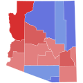
Arizona Secretary of State Election, 2014.svg 810 × 810; 17 KB
-
Florida House of Representatives 2014.png 2,900 × 2,400; 1.25 MB
-
Florida Senate 2014.png 2,900 × 2,400; 974 KB
-
Keystone Pipeline vote, House of Representatives, Nov. 14th 2014.png 2,254 × 1,470; 177 KB


