Category:Election maps of the United Kingdom
Jump to navigation
Jump to search
Wikimedia category | |||||
| Upload media | |||||
| Instance of | |||||
|---|---|---|---|---|---|
| Category combines topics | |||||
| |||||
Subcategories
This category has the following 11 subcategories, out of 11 total.
E
U
Media in category "Election maps of the United Kingdom"
The following 85 files are in this category, out of 85 total.
-
1975 referendum results by nation.svg 1,062 × 1,964; 10.55 MB
-
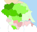
1997 Yorkshire Devolution Referendum.svg 1,425 × 1,212; 1.22 MB
-
2011 United Kingdom Alternative Vote referendum results by local voting area.svg 800 × 1,481; 1.24 MB
-
2013 UK Local Elections - Ward and Council Control.svg 623 × 569; 7.82 MB
-
2016 referendum results district.svg 1,062 × 1,964; 97.75 MB
-
2017 UK local elections - Ward and Council Control.svg 967 × 821; 13.23 MB
-
2019 uk election with MMP.svg 620 × 900; 929 KB
-
2019 UK general election, countries and regions.svg 512 × 640; 2.02 MB
-
2019 UK Local Elections by Ward.svg 589 × 730; 13.23 MB
-
2019LDS GE.svg 1,248 × 1,039; 7.64 MB
-
2022 UK Local Elections Control.svg 512 × 768; 2.5 MB
-
2023 UK Constituencies Blank Map.svg 1,118 × 1,266; 11.3 MB
-
2023 UK Local Elections Control.svg 807 × 813; 2.79 MB
-
2023 UK Local Elections.svg 807 × 813; 2.7 MB
-
2023 United Kingdom local elections, control.svg 512 × 768; 2.61 MB
-
2024 Durham Police and Crime Commissioner Election.svg 126 × 91; 102 KB
-
2024 Humberside Police and Crime Commissioner Election.svg 145 × 144; 162 KB
-
2024 UK Local Elections Control.svg 807 × 813; 2.69 MB
-
Bowdon 1971.png 721 × 670; 42 KB
-
Bowdon 1972.png 701 × 693; 42 KB
-
ElectionUK.png 5,080 × 4,980; 3.2 MB
-
England Summary (42140583855).png 4,380 × 2,476; 527 KB
-
English council election 2018.svg 1,108 × 1,345; 509 KB
-
EU Ref Leave Remain RedBlue 52Split.png 5,080 × 4,980; 3.52 MB
-
Hale 1964.png 1,117 × 793; 67 KB
-
Hale 1965.png 1,187 × 800; 67 KB
-
Hale 1969.png 1,147 × 813; 71 KB
-
Hale 1970.png 757 × 558; 43 KB
-
Hale 1971.png 757 × 582; 43 KB
-
Hale 1972.png 1,147 × 807; 70 KB
-
Labour gains 2019.png 5,080 × 4,980; 3.6 MB
-
Labour Leadership Election 2010 Results by Constituency.png 2,588 × 1,953; 1.04 MB
-
Map of the results of the United Kingdom local elections 2009.png 2,400 × 2,700; 228 KB
-
Noah-05-map.png 800 × 1,139; 343 KB
-
Noah-08-map.png 800 × 1,139; 339 KB
-
Results for 1975 UK referendum on EEC by county.svg 1,062 × 1,964; 20.89 MB
-
Results of the Lambton-Kent-Middlesex By-Election.png 1,080 × 1,350; 284 KB
-
Size of electorate in each United Kingdom house of commons constituency 2023.png 9,600 × 7,200; 2.16 MB
-
South Holland District Council wards.svg 2,191 × 1,549; 673 KB
-
Stretford 1967.png 956 × 757; 62 KB
-
Stretford 1968.png 927 × 737; 62 KB
-
Stretford 1969.png 982 × 755; 62 KB
-
Stretford 1970.png 991 × 777; 62 KB
-
Stretford 1971.png 1,003 × 771; 62 KB
-
Stretford 1972.png 1,015 × 762; 62 KB
-
Test GB Wahlkreise.png 306 × 621; 64 KB
-
Tyron West pre (29171340638).png 1,748 × 1,996; 208 KB
-
Tyron West SF hold (42140588345).png 1,748 × 1,996; 202 KB
-
UK countries and dependencies by political party.svg 721 × 1,356; 2.54 MB
-
UK Local Authorities 2023.svg 512 × 768; 2.6 MB
-
UK local authorities, largest party post 2023 elections.svg 512 × 768; 2.7 MB
-
United Kingdom AV Referendum 2011 Regional Results.svg 886 × 1,369; 959 KB
-
United Kingdom AV referendum area results.svg 871 × 1,289; 4.45 MB
-
United Kingdom EU referendum 2016 area results (3).svg 871 × 1,289; 5.04 MB
-
United Kingdom EU referendum 2016 area results 2-tone.svg 871 × 1,289; 4.66 MB
-
United Kingdom EU referendum 2016 area results 2.svg 871 × 1,289; 5.01 MB
-
United Kingdom EU referendum 2016 area results BrB.svg 871 × 1,289; 4.63 MB
-
United Kingdom EU referendum 2016 area results-en.svg 871 × 1,289; 4.55 MB
-
United Kingdom EU referendum 2016 voting regions results.svg 886 × 1,369; 2.67 MB
-
United Kingdom local elections 2019 map.png 1,296 × 1,356; 385 KB
-
United Kingdom local elections, 1977.svg 289 × 540; 4.28 MB
-
United Kingdom local elections, 1981.svg 289 × 540; 4.28 MB
-
United Kingdom local elections, 1985.svg 289 × 540; 4.41 MB
-
United Kingdom local elections, 1993.svg 289 × 540; 4.41 MB
-
United Kingdom local elections, 1995.svg 321 × 600; 9.59 MB
-
United Kingdom local elections, 1997.svg 289 × 540; 3.04 MB
-
United Kingdom local elections, 2000.svg 321 × 600; 8.57 MB
-
United Kingdom local elections, 2001.svg 289 × 540; 3.04 MB
-
United Kingdom local elections, 2002.svg 321 × 600; 8.58 MB
-
United Kingdom local elections, 2003.svg 321 × 600; 8.61 MB
-
United Kingdom local elections, 2004.svg 321 × 600; 8.62 MB
-
United Kingdom local elections, 2005.svg 289 × 540; 3.04 MB
-
United Kingdom local elections, 2006.svg 321 × 600; 8.62 MB
-
United Kingdom local elections, 2007.svg 321 × 600; 8.66 MB
-
United Kingdom local elections, 2008.svg 247 × 461; 7.81 MB
-
United Kingdom local elections, 2017 - Control Change.svg 142 × 263; 4.07 MB
-
United Kingdom local elections, 2017 - Previous Control.svg 142 × 263; 4.1 MB

