Category:Election maps of Jersey
Jump to navigation
Jump to search
| NO WIKIDATA ID FOUND! Search for Election maps of Jersey on Wikidata | |
| Upload media |
Constituent countries of the United Kingdom: England · Northern Ireland · Scotland · Wales – British Crown dependencies: Isle of Man · Jersey
British overseas territories: Anguilla · Bermuda · British Virgin Islands · Cayman Islands · Falkland Islands · Gibraltar · Montserrat · Turks and Caicos Islands
British overseas territories: Anguilla · Bermuda · British Virgin Islands · Cayman Islands · Falkland Islands · Gibraltar · Montserrat · Turks and Caicos Islands
Media in category "Election maps of Jersey"
The following 6 files are in this category, out of 6 total.
-
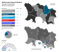
2022 Jersey general election map.svg 1,000 × 1,600; 350 KB
-
2022 Jersey States Assembly Election Map.svg 1,800 × 1,600; 454 KB
-
Blank Jersey general election map.svg 1,000 × 1,600; 263 KB
-
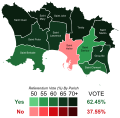
Jersey electoral reform referendum, 2014 results by parish.svg 414 × 406; 194 KB
-
Jersey Island States Assembly Districts Map 2022.svg 957 × 1,417; 294 KB
-
Jersey.png 1,253 × 868; 42 KB


