Category:Election maps of Bolivia
Jump to navigation
Jump to search
Countries of the Americas: Antigua and Barbuda · Argentina · The Bahamas · Barbados · Belize · Bolivia · Brazil · Canada · Chile · Colombia · Costa Rica · Cuba · Dominica · Dominican Republic · Ecuador · El Salvador · Grenada · Guatemala · Guyana · Haiti · Honduras · Jamaica · Mexico · Nicaragua · Panama · Paraguay · Peru · Saint Kitts and Nevis · Saint Lucia · Saint Vincent and the Grenadines · Suriname · Trinidad and Tobago · United States of America · Uruguay · Venezuela
Other areas: Anguilla · Bermuda · British Virgin Islands · Cayman Islands · Falkland Islands · French Guiana · Greenland · Guadeloupe · Martinique · Montserrat · Puerto Rico · Saint Barthélemy · Saint-Martin · Saint Pierre and Miquelon · Turks and Caicos Islands · United States Virgin Islands
Other areas: Anguilla · Bermuda · British Virgin Islands · Cayman Islands · Falkland Islands · French Guiana · Greenland · Guadeloupe · Martinique · Montserrat · Puerto Rico · Saint Barthélemy · Saint-Martin · Saint Pierre and Miquelon · Turks and Caicos Islands · United States Virgin Islands
Subcategories
This category has the following 2 subcategories, out of 2 total.
R
Media in category "Election maps of Bolivia"
The following 50 files are in this category, out of 50 total.
-
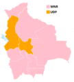
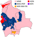
1979 Bolivian elections map.png 1,856 × 2,067; 148 KB
-
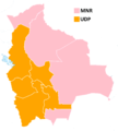
1980 Bolivian elections map.png 1,856 × 2,067; 149 KB
-
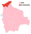
1985 Bolivian elections map.png 1,856 × 2,067; 151 KB
-
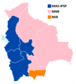
1989 Bolivian elections map.png 1,856 × 2,067; 155 KB
-
1993 Bolivian elections map.png 1,856 × 2,067; 146 KB
-
1997 Bolivian elections map.png 1,856 × 2,067; 159 KB
-
1997 Bolivian elections map (by province).png 992 × 1,056; 54 KB
-
2002 Bolivian elections map.png 1,856 × 2,067; 150 KB
-
2002 Bolivian elections map (by province).png 992 × 1,056; 54 KB
-
2005 Bolivian elections map.png 1,856 × 2,067; 152 KB
-
2005 Bolivian elections map (by province).png 992 × 1,056; 52 KB
-
2009 Bolivian elections map.png 1,856 × 2,067; 133 KB
-
2009 Bolivian elections map (by province).png 992 × 1,056; 51 KB
-
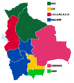
2010 Bolivian governors elections map.png 1,856 × 2,067; 152 KB
-
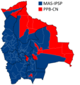
2014 Bolivian elections map.png 1,856 × 2,067; 144 KB
-
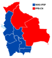
2014 Bolivian elections map (by province).png 992 × 1,056; 49 KB
-
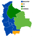
2015 Bolivian governors elections map.png 1,856 × 2,067; 152 KB
-
2017 Bolivian judicial elections map (Consejo de la Magistratura).png 2,552 × 2,067; 201 KB
-
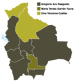
2017 Bolivian judicial elections map (Tribunal Agroambiental).png 1,856 × 2,067; 174 KB
-
2019 Bolivian elections map (by municipality).png 2,720 × 2,644; 251 KB
-
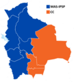
2019 Bolivian elections map.png 1,856 × 2,067; 162 KB
-
2020 Bolivian elections map (by municipality).png 1,379 × 1,379; 173 KB
-
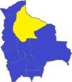
2020 Bolivian elections map.png 1,379 × 1,379; 69 KB
-
2020 Bolivian general election - Vote Strength.svg 872 × 990; 498 KB
-
2021 Bolivian governors elections map.png 1,280 × 1,426; 247 KB
-
2014 Bolivian elections map.jpg 594 × 598; 134 KB
-
2009 Bolivian elections map.jpg 594 × 598; 140 KB
-
Bolivian governors elections map 2010.png 1,403 × 1,551; 479 KB
-
Elecciones Bolivia 2014.png 611 × 693; 43 KB
-
Elecciones Bolivia 2020 exterior.png 6,000 × 3,046; 2.16 MB
-
Elecciones Bolivia 2020 exterior.svg 2,754 × 1,398; 1.19 MB
-
Elecciones generales de Bolivia 2002.png 1,856 × 2,067; 137 KB
-
Elecciones Generales de Bolivia 2005.png 792 × 838; 65 KB
-
Elecciones generales de Bolivia 2009.png 763 × 837; 69 KB
-
Elección Diputados Uninominales - Bolivia 2020.png 3,913 × 3,843; 787 KB
-
Mapa Electoral - Bolivia - Elecciones 1985 - Provincias.png 992 × 1,056; 51 KB
-
Mapa Electoral - Bolivia - Elecciones 1989 - Provincias.png 992 × 1,056; 51 KB
-
Mapa Electoral - Bolivia - Elecciones 1993 - Provincias.png 992 × 1,056; 55 KB
-
Mapa Electoral de Bolivia 2020 Bolivia.svg 512 × 512; 39 KB
-
Mapa Electoral de Bolivia por departamentos.svg 512 × 512; 30 KB
-
Mapa Electoral de Bolivia por municipios 2020.svg 512 × 512; 212 KB
-
Mapa Electoral de Bolivia por municipios.svg 512 × 512; 204 KB
-
Mapa Electoral de Bolivia por provincias 2020.png 992 × 1,056; 60 KB
-
Mapa Electoral de Gobernaciones Bolivia 2021.svg 512 × 512; 41 KB
-
Élection générales boliviennes 2019.png 832 × 809; 426 KB
-
Χάρτης Βολιβιανών εκλογών 2020 (Βουλή των Αντιπροσώπων).png 1,024 × 1,024; 139 KB
-
Χάρτης Βολιβιανών εκλογών 2020 (Γερουσία).png 1,024 × 1,024; 87 KB
-
Χάρτης Βολιβιανών εκλογών 2020 (ψήφοι ανά περιφέρεια).png 872 × 990; 254 KB
