Category:Election maps of Grenada
Jump to navigation
Jump to search
Countries of North America: Antigua and Barbuda · The Bahamas · Barbados · Belize · Canada · Costa Rica · Cuba · Dominica · Dominican Republic · El Salvador · Grenada · Guatemala · Haiti · Honduras · Jamaica · Mexico · Nicaragua · Panama · Saint Kitts and Nevis · Saint Lucia · Saint Vincent and the Grenadines · Trinidad and Tobago‡ · United States of America‡
Other territories: Anguilla · Bermuda · British Virgin Islands · Cayman Islands · Greenland · Guadeloupe · Martinique · Montserrat · Puerto Rico · Saint Barthélemy · Saint-Martin · Saint Pierre and Miquelon · Turks and Caicos Islands · United States Virgin Islands
‡: partly located in North America
Other territories: Anguilla · Bermuda · British Virgin Islands · Cayman Islands · Greenland · Guadeloupe · Martinique · Montserrat · Puerto Rico · Saint Barthélemy · Saint-Martin · Saint Pierre and Miquelon · Turks and Caicos Islands · United States Virgin Islands
‡: partly located in North America
Media in category "Election maps of Grenada"
The following 35 files are in this category, out of 35 total.
-
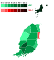
Grenadian general election map, 1951.svg 1,060 × 1,189; 45 KB
-
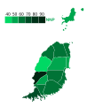
Grenadian general election map, 1954.svg 1,060 × 1,189; 47 KB
-
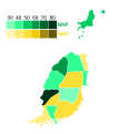
Grenadian general election map, 1957.svg 1,060 × 1,189; 49 KB
-
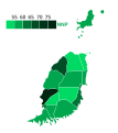
Grenadian general election map, 1961.svg 1,060 × 1,189; 58 KB
-
Grenadian general election map, 1962.svg 1,060 × 1,189; 46 KB
-
Grenadian general election map, 1967.svg 1,060 × 1,189; 45 KB
-
Grenadian general election map, 1972.svg 1,060 × 1,189; 49 KB
-
Grenadian general election map, 1976.svg 1,060 × 1,189; 49 KB
-
Grenadian general election map, 1984.svg 1,060 × 1,189; 52 KB
-
Grenadian general election map, 1990.svg 1,060 × 1,189; 59 KB
-
Grenadian general election map, 1995.svg 1,060 × 1,189; 58 KB
-
Grenadian general election map, 1999.svg 1,060 × 1,189; 48 KB
-
Grenadian general election map, 2003.svg 1,060 × 1,189; 51 KB
-
Grenadian general election map, 2008.svg 1,060 × 1,189; 50 KB
-
Grenadian general election map, 2013.svg 1,060 × 1,189; 48 KB
-
Grenadian general election map, 2018.svg 1,060 × 1,189; 48 KB
-
Grenadian general election map, 2022.svg 1,060 × 1,189; 49 KB
-
Grenada People's Alliance candidates distribution, 1976.svg 1,060 × 1,189; 47 KB
-
Carriacou and Petite Martinique Constituency Grenada.svg 1,060 × 1,189; 45 KB
-
Saint Andrew North East Constituency Grenada.svg 1,060 × 1,189; 45 KB
-
Saint Andrew North West Constituency Grenada.svg 1,060 × 1,189; 45 KB
-
Saint Andrew South East Constituency Grenada.svg 1,060 × 1,189; 45 KB
-
Saint Andrew South West Constituency Grenada.svg 1,060 × 1,189; 45 KB
-
Saint David Constituency Grenada.svg 1,060 × 1,189; 45 KB
-
Saint George North East Constituency Grenada.svg 1,060 × 1,189; 45 KB
-
Saint George North West Constituency Grenada.svg 1,060 × 1,189; 45 KB
-
Saint George South Constituency Grenada.svg 1,060 × 1,189; 45 KB
-
Saint George South East Constituency Grenada.svg 1,060 × 1,189; 45 KB
-
Saint John Constituency Grenada.svg 1,060 × 1,189; 45 KB
-
Saint Mark Constituency Grenada.svg 1,060 × 1,189; 45 KB
-
Saint Patrick East Constituency Grenada.svg 1,060 × 1,189; 45 KB
-
Saint Patrick West Constituency Grenada.svg 1,060 × 1,189; 45 KB
-
Town of Saint George Constituency Grenada.svg 1,060 × 1,189; 45 KB
-
2008ElectionofGrenada.png 777 × 669; 44 KB
-
Election Constituencies of Grenada.svg 1,060 × 1,189; 53 KB


