
Category:Central Intelligence Agency maps

Subcategories
This category has the following 10 subcategories, out of 10 total.
Media in category "Central Intelligence Agency maps"
The following 200 files are in this category, out of 875 total.
(previous page) (next page)-
 (Political map of the world). LOC 2001620596.jpg 3,260 × 2,027; 680 KB
-
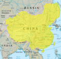 18 century Qing China.png 1,820 × 1,770; 4.79 MB
-
 1942 Pacific Ocean (30249104613).jpg 3,502 × 2,231; 567 KB
-
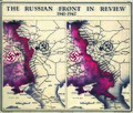 1942 Russian Front (30249103593).jpg 1,200 × 1,023; 869 KB
-
 1943 Po Valley Terrain (30249098183).jpg 3,067 × 2,327; 1.31 MB
-
 1944 Germany Population (30249096763).jpg 2,433 × 3,120; 901 KB
-
 1945 Approaches to Japan (30249095403).jpg 6,336 × 7,289; 4.16 MB
-
 1945 Berlin Zones (30249103203).jpg 1,762 × 1,330; 1.46 MB
-
 1945 Indochina Roads (30252751134).jpg 7,255 × 9,047; 5.72 MB
-
 1945 Korea & Manchuria (30249111473).jpg 5,179 × 7,696; 3.43 MB
-
 1945 Korea Administrative Divisions (30252754834).jpg 7,271 × 3,928; 3.26 MB
-
 1945 Pacific Japanese Control (30249115263).jpg 4,209 × 3,168; 1.4 MB
-
 1945 Taegu (30249115013).jpg 3,152 × 3,543; 1.27 MB
-
 1945 Venzia Giulia Italy (30249113773).jpg 4,198 × 6,433; 3.25 MB
-
 1946 Korea Zones (30583366390).jpg 1,310 × 1,791; 1.22 MB
-
 Alaska - DPLA - ce4aaf9b2d7a75850d2f12b8102590ca.jpg 4,232 × 3,332; 1.75 MB
-
 Alaska - DPLA - d9c4e2ea1a135ce7dd13324bc1444e17.jpg 11,980 × 8,818; 8.59 MB
-
 1950 International Trade (30583518780).jpg 1,366 × 876; 501 KB
-
 1950 Royal Naval Dockyard and Armament Depot, Hong Kong.jpg 6,347 × 4,100; 6.66 MB
-
 1950s CIA map of Iraq – tribes of Iraq (Iraqi Kurdistan detail).jpg 2,884 × 2,031; 1.25 MB
-
 1950s CIA map of Iraq – tribes of Iraq (margins cropped).jpg 5,841 × 5,129; 4.96 MB
-
 1950s CIA map of Iraq – tribes of Iraq.jpg 6,510 × 5,705; 3.62 MB
-
 1950s Mediterranean Basin Terrain (30884892905).jpg 10,800 × 4,410; 29.24 MB
-
 1950s Sinai Peninsula Terrain (30252923214).jpg 3,600 × 4,757; 8.68 MB
-
-

-
-
 1951 CIA map of Syria – principal Arab and Kurdish tribes, 1951 (margins cropped).jpg 5,260 × 4,244; 3.79 MB
-

-
 1951 CIA map of Syria – principal Arab and Kurdish tribes, 1951.jpg 5,868 × 4,776; 2.5 MB
-
 1951 Costa Rica (30583521540).jpg 2,562 × 2,423; 1.18 MB
-
 1951 H.M. Dockyard, Hong Kong, B.C.C.jpg 8,699 × 4,057; 5.75 MB
-
 1951 Hong Kong & Whampoa Dock Company.jpg 7,637 × 4,069; 7.38 MB
-
 1951 Indochina (30583518180).jpg 1,395 × 1,883; 1.44 MB
-
 1951 Middle East Oil (30583518490).jpg 1,791 × 982; 1.08 MB
-
 1957 Indonesia (30583517840).jpg 5,400 × 2,540; 2.21 MB
-
 1958 Iceland (30848666606).jpg 4,349 × 3,196; 8.14 MB
-
 1959 Horn of Africa (30884893305).jpg 2,300 × 3,141; 6.44 MB
-
 1961 British Honduras Boundary (30249402753).jpg 1,354 × 1,828; 1.13 MB
-
 1963 China-India Border (30848757436).jpg 1,472 × 956; 1.01 MB
-
 1966 Bogota (30253021294).jpg 6,889 × 6,971; 29.53 MB
-
 1967 Aden (30249402553).jpg 1,239 × 1,315; 1.04 MB
-
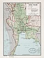 1967 Central Thailand (30848757256).jpg 3,134 × 4,156; 3.41 MB
-
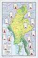 1968 Burma Climate Regions (30848755536).jpg 2,987 × 4,494; 2.85 MB
-
 1968 Central African Empire (30249402783).jpg 1,402 × 964; 878 KB
-
 1970 Khmer Empire (30583780310).jpg 3,112 × 4,122; 12.83 MB
-
 1971) East China Sea (30583779680).jpg 3,270 × 4,258; 15.07 MB
-
 1973 Bantustans (30583781200).jpg 1,238 × 1,579; 395 KB
-
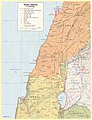
 1975 Israel (30848924286).jpg 1,302 × 1,748; 1.63 MB
-
 1977 Bophuthatswana (30796649361).jpg 4,140 × 3,177; 14.05 MB
-
 1977 South Lebanon (30583774640).jpg 2,474 × 3,231; 5.7 MB
-
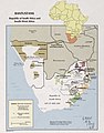
 1979 Afghanistan Ethnic Groups (30583781320).jpg 2,187 × 2,098; 2.42 MB
-
 1979 Sinai lines (30848925546).jpg 2,520 × 3,301; 1.21 MB
-
 1979 Sinai zones (30583778400).jpg 2,550 × 3,225; 586 KB
-
 1982 Jordan Water Development (30583894020).jpg 1,353 × 1,682; 454 KB
-
 1982 Pakistan Afghan Refugees (30796774281).jpg 5,294 × 5,576; 23.17 MB
-
 1984 Vatican City (30583896820).jpg 1,860 × 1,450; 438 KB
-
 1985 3D Afghanistan Panjsher Valley (30849053106).jpg 800 × 800; 287 KB
-
 1987 Korean Peninsula (30849054666).jpg 2,109 × 2,571; 2.03 MB
-
 1988 Tanzania Transport (30253288514).jpg 2,068 × 2,510; 3.46 MB
-
 1990 Namibia CIA.png 1,977 × 2,470; 7.51 MB
-
 1990 Worldwide Coca Cultivation (30885277625).jpg 7,690 × 4,202; 3.75 MB
-
 1992 Central Asia Ethnic Groups (30249738193).jpg 6,726 × 5,550; 22.5 MB
-
 1993 Caucasus Ethnoreligious (30849142976).jpg 1,137 × 1,255; 394 KB
-
 1993 CIA map of the former Yugoslavia.jpg 450 × 469; 70 KB
-
 Caucasus region Ovest.jpg 651 × 632; 94 KB
-
 1996 Ukraine Oil and Gas (30849141416).jpg 2,240 × 2,519; 3.63 MB
-
 1997 Bosnia (30253337444).jpg 1,406 × 1,316; 964 KB
-
 1997 Korean Airlines Flight (30849142566).jpg 967 × 996; 491 KB
-
 1998 Central America Hurricane Mitch Damage (30249736283).jpg 5,946 × 5,406; 22.2 MB
-
 1998 Kosovo (30249738523).jpg 836 × 1,006; 652 KB
-
 1998 Military Geography of Former Yugoslavia (30249737963).jpg 2,539 × 3,288; 6.59 MB
-
 1999 KFOR Sectors (30885277735).jpg 4,349 × 5,163; 4.75 MB
-
 2000 Arctic Region (30849229476).jpg 2,131 × 2,652; 3.43 MB
-
 2000 Central Balkan Region (30849229246).jpg 2,231 × 2,698; 2.3 MB
-
 2000 Hurricane Mitch (30249836533).jpg 4,086 × 4,816; 8.05 MB
-
 2001 Afghanistan Konar Valley 3D (30796918681).jpg 1,566 × 1,013; 1.25 MB
-
 2001 Africa Flag Cartogram (30249837003).jpg 2,013 × 1,375; 700 KB
-
 2001 Chechnya (30849140656).jpg 2,539 × 3,289; 4.39 MB
-
 2002 Kurdish Areas (30849227256).jpg 3,224 × 3,223; 6.94 MB
-
 2003 Baghdad (30249836213).jpg 4,500 × 5,587; 18.4 MB
-
 2004 Syria Reference Poster (30849226626).jpg 7,887 × 7,881; 35.16 MB
-
 2005 Singapore (30849229036).jpg 2,608 × 2,024; 1.04 MB
-
 2006 Peru Coca Cultivation (30249835523).jpg 1,990 × 2,626; 1.63 MB
-
 2007 Burma Population (30249837623).jpg 4,102 × 5,480; 9.78 MB
-
 2008 Albania Administrative (30796918861).jpg 2,008 × 2,654; 1.38 MB
-
 2008 Albania Physiography (30249836813).jpg 2,008 × 2,653; 2.18 MB
-
 2009 Golan Heights 3D (30849226396).jpg 3,400 × 4,200; 4.58 MB
-
 2010 Afghan Pakistan North Border (30249974083).jpg 7,875 × 11,475; 54.55 MB
-
 2010 Chile earthquake epicenter.png 269 × 589; 112 KB
-
 2012 Area & Projection Comparisons Calendar (30885483375).jpg 3,300 × 2,550; 1.6 MB
-
 2013 Afghan Border 3D Terrain (30249979583).jpg 1,982 × 2,411; 2.02 MB
-
 2013 Ivory Transportation (30885483595).jpg 4,258 × 2,940; 2.75 MB
-
 2013 NE India Groups Separatist Demands (30584184850).jpg 2,000 × 2,295; 1.3 MB
-
 2014 Lebanon Battle 3D (30249978553).jpg 3,939 × 2,827; 4.54 MB
-
 2015 Colombia Coca Cultivation (30584184580).jpg 1,992 × 2,564; 1.88 MB
-
 719px-CIA-FSM Micronesia Chuuk.jpg 297 × 458; 101 KB
-
 719px-CIA-FSM Micronesia-small.jpg 422 × 308; 104 KB
-
 725px-Nigeria econ 1979-fr.jpg 725 × 599; 163 KB
-
 9 dotted line.png 979 × 1,206; 1.79 MB
-
 A CIA map of the guantanamo region, as of 1996.jpg 1,769 × 1,869; 1.6 MB
-
 Abkhazia summary map.png 250 × 185; 26 KB
-
 Addu atoll 76.jpg 496 × 452; 55 KB
-
 Adriatic Sea Geographic Map.jpg 337 × 399; 129 KB
-
 Af sahara.jpg 482 × 241; 34 KB
-
 Africa.NileMap.01.png 200 × 252; 72 KB
-
 Agacher Strip CIA Map.jpg 300 × 286; 13 KB
-
 Agricultural Map of Ceylon - DPLA - 8344a0b3321eab305acc2ab8de83346f.jpg 2,819 × 4,355; 1.74 MB
-

-

-
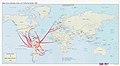
 Airline Routes in Middle America, March 1949 - DPLA - d779114cdb338448496f00e71d092f7f.jpg 12,007 × 8,849; 11.91 MB
-
 Airline Routes in South America, March,1949 - DPLA - 587ef873c1242698a31a8378f5cccb42.jpg 8,424 × 12,581; 10.42 MB
-
-
 Aj-map-lt.png 3,168 × 3,402; 254 KB
-
 Alaska - DPLA - 23c1f96fec57f16b8efa44813cc097df.jpg 4,296 × 3,361; 1.5 MB
-
 Alaska - DPLA - efccdba83b1cba9bd183d4775294196d.jpg 4,302 × 3,400; 1.79 MB
-
 Algeria and Tunisia physical regions. LOC 2015588264.jpg 2,529 × 3,265; 738 KB
-
 Allied Access Routes to West Berlin - DPLA - 58e9514df54c04c423c5829727d0ff08.jpg 2,396 × 3,118; 6.96 MB
-

-
 Andorra - DPLA - e3ecb753b871bb0dad016444cafbac18.jpg 2,556 × 3,278; 6.55 MB
-
 Anjouan in Comoros.png 262 × 194; 4 KB
-
 Anjouan-invasion-2008.png 350 × 382; 187 KB
-
 Antarktis.png 368 × 312; 14 KB
-
 Antiguabarbuda.jpg 984 × 1,238; 159 KB
-

-
 Arabian Peninsula Status of Boundaries - DPLA - 128890656127538b8e7fdd71081b48a3.jpg 4,240 × 3,956; 1.46 MB
-
 Arabian Peninsula Telecommunications - DPLA - 6a41793c3aba4d2b016a21d7e260092a.jpg 4,376 × 3,659; 1.13 MB
-
 Arafura Sea map.png 695 × 488; 186 KB
-
 Arafura, Banda, and Ceram seas - OSS - btv1b531969698.jpg 11,180 × 7,908; 8.62 MB
-
 Ararat anomaly 1973.jpg 630 × 425; 49 KB
-
 ArcticColdWarStations.png 950 × 1,056; 1.71 MB
-
 Area-51-map (1).jpg 1,200 × 1,551; 220 KB
-
-

-
 Argentina - btv1b53189495j.jpg 5,636 × 8,970; 3.18 MB
-
 Argentina - DPLA - 54617fd07edcbb8a4c17ea7228233a15.jpg 5,496 × 9,336; 4.15 MB
-
 Argentina - DPLA - ebcf6de29e14c8750967f6d658b13487.jpg 3,606 × 6,432; 2.25 MB
-
 Arguin map.jpg 1,221 × 1,659; 244 KB
-
 Arktik-Karte.png 329 × 330; 18 KB
-
 Armenia 2002 CIA map.jpg 1,944 × 2,088; 1.72 MB
-
 Armenia rel 2002.jpg 1,022 × 1,126; 268 KB
-
 Armenia. LOC 91686426.jpg 3,406 × 4,363; 1.22 MB
-
 Armenia. LOC 93680023.jpg 3,405 × 4,383; 1.27 MB
-
-
 Atbara river map.jpg 1,141 × 664; 198 KB
-
 Austria, Switzerland, and Liechtenstein - DPLA - 9da982bf8c352a7b5a28c03cf3af249e.jpg 11,345 × 7,393; 9.06 MB
-
 Azarbaijan ethnic map (1995) - English.jpg 881 × 536; 86 KB
-
 Azerbaijan 1995 CIA map.jpg 2,016 × 2,156; 1.49 MB
-

-
 Azores Central Group.jpg 512 × 256; 27 KB
-
 Azores CIA.jpg 1,433 × 966; 125 KB
-
 Azores. LOC 80694140.jpg 4,117 × 3,143; 1.9 MB
-
 Azores. LOC 80694140.tif 4,117 × 3,143; 37.02 MB
-
 BA-economic-BRA.png 640 × 450; 26 KB
-
 BA-energy-BRA.png 640 × 450; 23 KB
-
 BA-ethnic-BRA.png 640 × 449; 21 KB
-
 BA-landuse-BRA.png 640 × 449; 26 KB
-
 BA-mineral-BRA.png 640 × 450; 17 KB
-
 BA-political-BRA.png 640 × 448; 24 KB
-
 Bahamas.png 1,000 × 1,190; 256 KB
-
 Bahrain pol 2003.jpg 975 × 1,191; 241 KB
-
 Balamand Map.png 420 × 474; 144 KB
-
 Bangladesh - DPLA - a10cc3f6e95ccc0b4b5c5671b01f39bf.jpg 2,548 × 3,272; 6.81 MB
-
 Bangladesh physiography. LOC 2011588370.jpg 3,321 × 4,391; 2.29 MB
-
 Bangladesh- Administrative Divisions - DPLA - 70c96e7e3c0e40502d4ce26a11e1be2c.jpg 2,552 × 3,270; 5.47 MB
-
 Barbados.png 988 × 1,210; 264 KB
-
 Barbary coast3.jpg 974 × 582; 151 KB
-
 Bassas da india 76.jpg 946 × 646; 116 KB
-
 Belarus - DPLA - 9c7884ea62599b7fb7a1607577ca0339.jpg 2,552 × 3,270; 7.05 MB
-
 Belarus 1997 CIA map.jpg 1,601 × 1,917; 1.4 MB
-
 Belgium - DPLA - 3cdb4c0c26caba357464331212baa08d.jpg 7,354 × 6,912; 4.01 MB
-
 Belgium - DPLA - 60a92796d3a0b91b5c7cc9924b6be5f0.jpg 7,282 × 6,896; 3.96 MB
-
 Belgium - DPLA - e2631c036a68a58fe7dc5deddc356ad0.jpg 7,332 × 6,885; 3.96 MB
-
 Belgium and Luxembourg - DPLA - d582af89c9c6cef3a7da38c6f2e91dff (page 1).jpg 7,608 × 6,494; 6.14 MB
-
 Belgium and Luxembourg - DPLA - d582af89c9c6cef3a7da38c6f2e91dff (page 2).jpg 7,596 × 6,485; 5.47 MB
-
 Belgium.jpg 1,002 × 1,090; 276 KB
-
 Berlin (30249400893).jpg 1,536 × 1,296; 1.31 MB
-
 Berlin - DPLA - f951d04cc1bec49d06df2678eff05459.jpg 3,278 × 2,554; 1.94 MB
-
 Berlin Zones of Administration (Western half) - DPLA - 8422d84d198842818e2603a7cc3c6656.jpg 7,610 × 10,712; 9.15 MB
-
 Bhutan - DPLA - fdcbdc48c860b3092ee1f4e7179b3aea.jpg 3,134 × 2,412; 1.89 MB
-
 Bhutan physiography. LOC 2012586878.jpg 4,277 × 3,325; 1.97 MB
-
 Bhutan. 3-65. LOC 75695011.jpg 6,864 × 4,150; 3.87 MB
-
 Bhutan. LOC 2012586879.jpg 4,288 × 3,288; 1.72 MB
-
 Bhutan. LOC 81692503.jpg 4,170 × 3,140; 2.03 MB
-
 Bolivia - DPLA - 230dfd4b72629c7dadfa9de9c24f5ecb.jpg 3,544 × 3,860; 1.09 MB
-
 Bolivia - DPLA - bc2027fe64fe722b6ae7918fef53d56c.jpg 6,000 × 6,804; 3.57 MB
-
 Bolivia rel93.jpg 1,072 × 1,244; 300 KB
-
 Bollenstreek3.JPG 330 × 355; 22 KB
-
 Bophuthatswana. LOC 80692110.tif 4,140 × 3,177; 37.63 MB
-
 Bosnia and Hercegovina (Herzegovina) - DPLA - 0ef8ef9ab05c35ce37479dbc572c9da0.jpg 2,630 × 3,282; 5.45 MB
-
 Bosnia and Herzegovina - DPLA - 8b903054f77310e1d84cb7450772cd17.jpg 2,554 × 3,278; 5.53 MB
-
 Botswana Map.jpg 1,010 × 1,246; 279 KB
-

-

-

-
 Brazil - Coal - DPLA - 4a185d484a25fe8e5554b2aa430bfcb0.jpg 4,809 × 3,856; 2.21 MB
-
 Brazil - DPLA - 2cf0d923a7fd87548393df0bf10d5ccd.jpg 4,408 × 4,296; 1.92 MB
-
 Brazil - DPLA - 8b0006d9414bb54a462f02c2a368be58.jpg 4,415 × 3,827; 1.8 MB
-
 Brazil - DPLA - a77d4d2b0b30be974f2d5e198023a1c2.jpg 4,656 × 4,910; 1.63 MB
-
 Brazil - DPLA - af012c6f757409007323a55e1410f406.jpg 7,464 × 6,826; 4.59 MB
._LOC_2001620596.jpg)

.jpg)
.jpg)
.jpg)
.jpg)
.jpg)
.jpg)
.jpg)
.jpg)
.jpg)
.jpg)
.jpg)
.jpg)
.jpg)


.jpg)

.jpg)
.jpg)

.jpg)
.jpg)
.jpg)
.jpg)
.jpg)

.jpg)


.jpg)
.jpg)
.jpg)
.jpg)
.jpg)
.jpg)
.jpg)
.jpg)
.jpg)
.jpg)
.jpg)
.jpg)
.jpg)
_East_China_Sea_(30583779680).jpg)
.jpg)
.jpg)
.jpg)
.jpg)
.jpg)
.jpg)
.jpg)
.jpg)
.jpg)
.jpg)
.jpg)
.jpg)

.jpg)
.jpg)
.jpg)


.jpg)
.jpg)
.jpg)
.jpg)
.jpg)
.jpg)
.jpg)
.jpg)
.jpg)
.jpg)
.jpg)
.jpg)
.jpg)
.jpg)
.jpg)
.jpg)
.jpg)
.jpg)
.jpg)
.jpg)
.jpg)
.jpg)
.jpg)

.jpg)
.jpg)
.jpg)
.jpg)
.jpg)


-_Oil_Concessions_and_Facilities_-_DPLA_-_b41df0401e20ab63395314d9d414cb52.jpg)


.jpg)

._LOC_2009584259.jpg)


_-_DPLA_-_e4cf8d27156f8073ef833e602b0be29d.jpg)


_-_English.jpg)


.jpg)
.jpg)

.jpg)

_-_DPLA_-_8422d84d198842818e2603a7cc3c6656.jpg)


_-_DPLA_-_0ef8ef9ab05c35ce37479dbc572c9da0.jpg)


.jpg)
.jpg)
.jpg)
.jpg)