Category:CIA World Factbook maps of Finland
Jump to navigation
Jump to search
Media in category "CIA World Factbook maps of Finland"
The following 22 files are in this category, out of 22 total.
-
Carte de Finlande.png 329 × 707; 17 KB
-
Fenlan-ditu-zh-tw.png 328 × 713; 100 KB
-
Fenlan-ditu-zh.png 328 × 713; 97 KB
-
Fi-map-ast.png 329 × 707; 18 KB
-
Fi-map.jpg 351 × 753; 20 KB
-
Fi-map.png 329 × 707; 31 KB
-
Finland 1996 CIA map.jpg 1,662 × 2,000; 2.5 MB
-
Finland CIA map PL.png 328 × 713; 54 KB
-
Finland map.gif 324 × 709; 24 KB
-
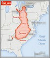
Finland – U.S. area comparison.jpg 701 × 821; 470 KB
-
Finland-CIA WFB Map.png 328 × 713; 24 KB
-
Finland-CIA-WFB-Map-thai.png 328 × 713; 31 KB
-
Finlandia-Mappa.jpg 351 × 753; 172 KB
-
Finsko-mapa cs.png 351 × 753; 84 KB
-
Finsko-mapa.png 351 × 753; 84 KB
-
Großherzogtum Finnland 1812-1917.PNG 279 × 599; 114 KB
-
Kaart Finland.png 329 × 707; 49 KB
-
Karte von Finnland.png 330 × 702; 73 KB
-
Map Finland nl.png 329 × 707; 19 KB
-
Soome kaart.png 351 × 753; 25 KB
-
World Factbook (1982) Finland.jpg 588 × 590; 111 KB
-
World Factbook (1990) Finland.jpg 511 × 560; 69 KB


