Category:Bridges in Suffolk
Appearance
Ceremonial counties of England: Bedfordshire · Berkshire · Buckinghamshire · Cambridgeshire · Cheshire · Cornwall · Cumbria · Derbyshire · Devon · Dorset · Durham · East Riding of Yorkshire · East Sussex · Essex · Gloucestershire · Greater London · Greater Manchester · Hampshire · Herefordshire · Hertfordshire · Kent · Lancashire · Leicestershire · Lincolnshire · Merseyside · Norfolk · North Yorkshire · Northamptonshire · Northumberland · Nottinghamshire · Oxfordshire · Rutland · Shropshire · Somerset · South Yorkshire · Staffordshire · Suffolk · Surrey · Tyne and Wear · Warwickshire · West Midlands · West Sussex · West Yorkshire · Wiltshire · Worcestershire
City-counties: Bristol · City of London
Former historic counties: Huntingdonshire · Westmorland · Yorkshire
Other former counties:
City-counties: Bristol · City of London
Former historic counties: Huntingdonshire · Westmorland · Yorkshire
Other former counties:
Wikimedia category | |||||
| Upload media | |||||
| Instance of | |||||
|---|---|---|---|---|---|
| Category combines topics | |||||
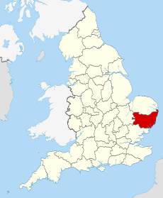
| Suffolk | |||||
county of England | |||||
| Instance of |
| ||||
| Location |
| ||||
| Capital | |||||
| Legislative body |
| ||||
| Population |
| ||||
| Area |
| ||||
| Different from | |||||
| Said to be the same as | Suffolk (historic county of England, ceremonial county of England, 1844) | ||||
| official website | |||||
 | |||||
Subcategories
This category has the following 16 subcategories, out of 16 total.
Media in category "Bridges in Suffolk"
The following 110 files are in this category, out of 110 total.
-
3 Ton weight limit - geograph.org.uk - 803966.jpg 480 × 640; 116 KB
-
A public right of way between Rattlesden and Buxhall - geograph.org.uk - 2285227.jpg 3,648 × 2,736; 1.67 MB
-
Bailey Bridge crossing Stony Ditch - geograph.org.uk - 926829.jpg 640 × 474; 71 KB
-
Barrier on bridge - geograph.org.uk - 730303.jpg 427 × 640; 216 KB
-
Barton Mills lock - geograph.org.uk - 641346.jpg 427 × 640; 96 KB
-
BealingsBridge.JPG 1,200 × 800; 508 KB
-
Brandeston Bridge - geograph.org.uk - 339602.jpg 640 × 480; 73 KB
-
Bridge - geograph.org.uk - 1778824.jpg 1,600 × 1,200; 692 KB
-
Bridge across the River Stour - geograph.org.uk - 4134591.jpg 4,000 × 3,000; 4.25 MB
-
Bridge and weir - geograph.org.uk - 1154458.jpg 640 × 480; 199 KB
-
Bridge at Kentwell Hall - geograph.org.uk - 833294.jpg 480 × 640; 83 KB
-
Bridge at Rodbridge - geograph.org.uk - 499196.jpg 640 × 480; 113 KB
-
Bridge at the Alton Water outflow - geograph.org.uk - 1602621.jpg 640 × 346; 55 KB
-
Bridge at Wamil Hall - geograph.org.uk - 923516.jpg 640 × 427; 125 KB
-
Bridge by Bridge Farmhouse - geograph.org.uk - 1046456.jpg 640 × 426; 126 KB
-
Bridge in New Road, Sibton - geograph.org.uk - 1213396.jpg 3,072 × 2,304; 1.66 MB
-
Bridge in New Road, Sibton - geograph.org.uk - 1213420.jpg 3,072 × 2,304; 1.64 MB
-
Bridge into the copse - geograph.org.uk - 983726.jpg 477 × 640; 98 KB
-
Bridge near Nether Hall - geograph.org.uk - 1598388.jpg 640 × 417; 105 KB
-
Bridge Near Nether Hall - geograph.org.uk - 2213722.jpg 1,600 × 1,200; 716 KB
-
Bridge on Church Lane, Coddenham - geograph.org.uk - 1334063.jpg 640 × 480; 99 KB
-
Bridge on new section of the A14 - geograph.org.uk - 1626137.jpg 640 × 462; 96 KB
-
Bridge over Ampton Water - geograph.org.uk - 908732.jpg 427 × 640; 110 KB
-
Bridge over Ampton Water - geograph.org.uk - 908741.jpg 640 × 427; 104 KB
-
Bridge over former Railway Line - geograph.org.uk - 5565531.jpg 4,896 × 3,672; 5.68 MB
-
Bridge over Little Ouse River, Santon Downham.JPG 5,184 × 3,456; 8.78 MB
-
Bridge over River Stour - geograph.org.uk - 817450.jpg 640 × 426; 98 KB
-
Bridge over Stream - geograph.org.uk - 948783.jpg 3,072 × 2,304; 1.67 MB
-
Bridge over the A14 - geograph.org.uk - 1625495.jpg 640 × 422; 72 KB
-
Bridge Over The Black Bourn - geograph.org.uk - 909066.jpg 640 × 480; 118 KB
-
Bridge over the Little Ouse River - geograph.org.uk - 1731638.jpg 640 × 480; 179 KB
-
Bridge over the railway - geograph.org.uk - 1281266.jpg 640 × 510; 141 KB
-
Bridge over the railway - geograph.org.uk - 1353197.jpg 427 × 640; 131 KB
-
Bridge over the River Glem - geograph.org.uk - 1088645.jpg 640 × 480; 87 KB
-
Bridge over the River Lark - geograph.org.uk - 1670312.jpg 480 × 640; 186 KB
-
Bridge over the River Stour - geograph.org.uk - 4140267.jpg 3,072 × 2,304; 2.05 MB
-
Bridge over the River Stour - geograph.org.uk - 4140309.jpg 2,304 × 3,072; 1 MB
-
Bridge over the River Yox - geograph.org.uk - 1384774.jpg 3,072 × 2,304; 1.4 MB
-
Bridge over the River Yox at Pouy Street - geograph.org.uk - 1638738.jpg 3,072 × 2,304; 1.66 MB
-
Bridge to Suffolk - geograph.org.uk - 976545.jpg 640 × 477; 105 KB
-
Bridge under the A14 - geograph.org.uk - 1216906.jpg 640 × 480; 134 KB
-
Bridge, Flatford, 2017.jpg 6,000 × 4,000; 11.44 MB
-
Brundon Bridge - geograph.org.uk - 875829.jpg 480 × 640; 167 KB
-
Brundon Mill - geograph.org.uk - 1342141.jpg 640 × 480; 124 KB
-
Clare - Railway Walk.jpg 3,000 × 1,631; 5.37 MB
-
Dalham village - geograph.org.uk - 42922.jpg 640 × 427; 95 KB
-
Entry to Blakenham Lock - geograph.org.uk - 757191.jpg 640 × 427; 117 KB
-
Flatford Bridge and Bridge Cottage - geograph.org.uk - 3586928.jpg 640 × 481; 338 KB
-
Goldbrook Bridge, Hoxne, Suffolk-geograph-2673029-by-Adrian-Cable.jpg 3,072 × 2,304; 1.65 MB
-
Hoo Lane Bridge - geograph.org.uk - 1452498.jpg 3,072 × 2,304; 1.47 MB
-
Ipswich Dock Lock - geograph.org.uk - 506641.jpg 640 × 480; 88 KB
-
Low railway bridge - geograph.org.uk - 1297508.jpg 640 × 569; 139 KB
-
Lower Road, Rattlesden - geograph.org.uk - 4985813.jpg 3,072 × 2,304; 1.78 MB
-
Lower Road, Rattlesden - geograph.org.uk - 4985839.jpg 3,072 × 2,304; 1.74 MB
-
Lower Road, Rattlesden - geograph.org.uk - 4986785.jpg 3,072 × 2,202; 2.82 MB
-
Lower Road, Rattlesden - geograph.org.uk - 4986819.jpg 3,072 × 2,304; 1.89 MB
-
Lower Street, Rattlesden - geograph.org.uk - 4704764.jpg 640 × 480; 54 KB
-
Mutford bridge.jpg 248 × 124; 8 KB
-
Old railway bridge - geograph.org.uk - 1001123.jpg 480 × 640; 132 KB
-
Old railway line - geograph.org.uk - 1000329.jpg 640 × 480; 131 KB
-
On the great Eastern Linear Park - geograph.org.uk - 11259.jpg 640 × 480; 56 KB
-
Private bridge over the River Lark - geograph.org.uk - 1639151.jpg 640 × 480; 170 KB
-
Railway Bridge - geograph.org.uk - 502092.jpg 640 × 480; 128 KB
-
River Alde at Snape Maltings - geograph.org.uk - 846478.jpg 640 × 429; 73 KB
-
River Lark and the railway bridge - geograph.org.uk - 669984.jpg 427 × 640; 77 KB
-
Road bridge at Rodbridge - geograph.org.uk - 1001127.jpg 640 × 480; 110 KB
-
Sandbag bridge in Barsham Marshes - geograph.org.uk - 3338352.jpg 640 × 480; 207 KB
-
Santon-Bridge.jpg 1,024 × 639; 96 KB
-
Steel farm bridge - geograph.org.uk - 381340.jpg 640 × 480; 124 KB
-
Stowmarket Road, heading towards Buxhall - geograph.org.uk - 2285215.jpg 3,648 × 2,736; 1.43 MB
-
Topping out Creeting Bridge and Lock - geograph.org.uk - 58984.jpg 640 × 482; 148 KB
-
A12 Bridge over B1029 Upper Street - geograph.org.uk - 993113.jpg 3,072 × 2,304; 1.27 MB
-
Village scene, Rattlesden - geograph.org.uk - 649516.jpg 640 × 422; 99 KB
-
Whale Bones - geograph.org.uk - 2053553.jpg 1,600 × 1,200; 705 KB
-
A14 bridge balcony - geograph.org.uk - 1401823.jpg 640 × 480; 110 KB
-
Ancient bridge - geograph.org.uk - 512717.jpg 640 × 480; 147 KB
-
Bridge across stream - geograph.org.uk - 439558.jpg 640 × 481; 112 KB
-
Bridge at field corner in Cranley Green - geograph.org.uk - 547565.jpg 640 × 480; 200 KB
-
Bridge Ironwork - geograph.org.uk - 499873.jpg 640 × 480; 115 KB
-
Bridge of River Alde, Bruisyard, Suffolk - geograph.org.uk - 43634.jpg 640 × 480; 175 KB
-
Bridge over Broad Water - geograph.org.uk - 696982.jpg 480 × 640; 57 KB
-
Bridge over Gulpher Road - geograph.org.uk - 1443341.jpg 640 × 424; 82 KB
-
Bridge over River Brett, Brent Eleigh - geograph.org.uk - 349552.jpg 640 × 425; 266 KB
-
Bridge Over The Little Ouse - geograph.org.uk - 499853.jpg 640 × 480; 134 KB
-
Bridge over the River at Rushmere - geograph.org.uk - 439827.jpg 640 × 480; 84 KB
-
Bridge over the River Yox near Sibton Abbey - geograph.org.uk - 761828.jpg 3,072 × 2,304; 1.36 MB
-
Bridge over the Stour - geograph.org.uk - 293660.jpg 640 × 480; 68 KB
-
Farmhouse and bridge - geograph.org.uk - 377296.jpg 640 × 480; 73 KB
-
Former Railway Bridge - geograph.org.uk - 551248.jpg 640 × 480; 86 KB
-
Hempyard Bridge - geograph.org.uk - 768316.jpg 427 × 640; 128 KB
-
Lane bridge over River Gipping - geograph.org.uk - 653777.jpg 640 × 440; 98 KB
-
Railway Bridge - geograph.org.uk - 378924.jpg 640 × 480; 114 KB
-
Railway Bridge - geograph.org.uk - 378990.jpg 640 × 480; 99 KB
-
Railway Bridge - geograph.org.uk - 380048.jpg 640 × 480; 144 KB
-
Railway bridge - geograph.org.uk - 380977.jpg 640 × 480; 105 KB
-
Railway bridge - geograph.org.uk - 380993.jpg 640 × 480; 71 KB
-
Railway bridge - geograph.org.uk - 381025.jpg 640 × 480; 39 KB
-
Road and rail bridge - geograph.org.uk - 625484.jpg 640 × 480; 106 KB
-
Road bridge at North Fen - geograph.org.uk - 467909.jpg 640 × 427; 118 KB
-
The Little Ouse at Brandon Bridge - geograph.org.uk - 306827.jpg 640 × 480; 90 KB
-
Wilford Bridge Melton - geograph.org.uk - 234904.jpg 640 × 480; 67 KB


