Category:Bridges in Rutland
Appearance
Ceremonial counties of England: Bedfordshire · Berkshire · Buckinghamshire · Cambridgeshire · Cheshire · Cornwall · Cumbria · Derbyshire · Devon · Dorset · Durham · East Riding of Yorkshire · East Sussex · Essex · Gloucestershire · Greater London · Greater Manchester · Hampshire · Herefordshire · Hertfordshire · Kent · Lancashire · Leicestershire · Lincolnshire · Merseyside · Norfolk · North Yorkshire · Northamptonshire · Northumberland · Nottinghamshire · Oxfordshire · Rutland · Shropshire · Somerset · South Yorkshire · Staffordshire · Suffolk · Surrey · Tyne and Wear · Warwickshire · West Midlands · West Sussex · West Yorkshire · Wiltshire · Worcestershire
City-counties: Bristol · City of London
Former historic counties: Huntingdonshire · Westmorland · Yorkshire
Other former counties:
City-counties: Bristol · City of London
Former historic counties: Huntingdonshire · Westmorland · Yorkshire
Other former counties:
Wikimedia category | |||||
| Upload media | |||||
| Instance of | |||||
|---|---|---|---|---|---|
| Category combines topics | |||||
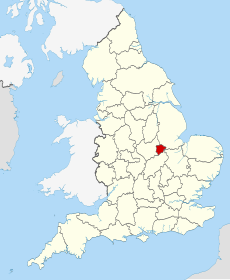
| Rutland | |||||
county and unitary authority area in the East Midlands in England, United Kingdom | |||||
| Instance of |
| ||||
| Location | East Midlands, England | ||||
| Legislative body |
| ||||
| Population |
| ||||
| Area |
| ||||
| Different from | |||||
| Said to be the same as | Rutland (historic county of England, ceremonial county of England, 1844) | ||||
| official website | |||||
 | |||||
Subcategories
This category has the following 4 subcategories, out of 4 total.
F
R
V
Media in category "Bridges in Rutland"
The following 22 files are in this category, out of 22 total.
-
A6121 bridge, A1 - geograph.org.uk - 3184742.jpg 640 × 430; 46 KB
-
A6121 overbridge, A1 - geograph.org.uk - 2511194.jpg 640 × 341; 38 KB
-
Birmingham to Stansted Railway line - geograph.org.uk - 41121.jpg 640 × 480; 163 KB
-
Brick railway bridge, Essendine, Rutland - geograph.org.uk - 4462300.jpg 4,320 × 3,240; 5.5 MB
-
Bridge on Wing Road - geograph.org.uk - 364757.jpg 640 × 427; 95 KB
-
Bridge over railway - geograph.org.uk - 168407.jpg 640 × 401; 86 KB
-
Bridge over the railway - geograph.org.uk - 4788692.jpg 5,000 × 3,333; 4.87 MB
-
Brooke Road bridges River Chater - geograph.org.uk - 207180.jpg 640 × 480; 98 KB
-
Close up of the bridge across the East Coast Main Line - geograph.org.uk - 3988544.jpg 1,600 × 1,297; 196 KB
-
Bridge over disused railway - geograph.org.uk - 5571.jpg 427 × 640; 74 KB
-
Stamford road bridge - geograph.org.uk - 4788702.jpg 5,000 × 3,333; 7.43 MB
-
Water Lane Bridge, A1 - geograph.org.uk - 3184747.jpg 640 × 430; 47 KB
-
Bridge over River Gwash - geograph.org.uk - 458028.jpg 640 × 477; 125 KB
-
Bridge over the River Chater, Rutland - geograph.org.uk - 209901.jpg 640 × 427; 84 KB
-
Bridge over the River Gwash - geograph.org.uk - 317750.jpg 640 × 480; 93 KB
-
Mole Lane crosses a stream - geograph.org.uk - 335403.jpg 640 × 480; 89 KB
-
Moor Lane Bridge - geograph.org.uk - 207195.jpg 640 × 480; 90 KB
-
Rural bridge - geograph.org.uk - 166108.jpg 640 × 480; 93 KB
-
The bridge on the boundary - geograph.org.uk - 144025.jpg 640 × 480; 87 KB
-
The road crosses North Brook by Horn Mill - geograph.org.uk - 166127.jpg 640 × 480; 116 KB
-
Track over bridge - geograph.org.uk - 160202.jpg 640 × 480; 135 KB


