Category:Blakeney, Gloucestershire
Jump to navigation
Jump to search
village in Gloucestershire, UK | |||||
| Upload media | |||||
| Instance of | |||||
|---|---|---|---|---|---|
| Location |
| ||||
 | |||||
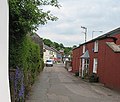
English: Blakeney is a village in Gloucestershire, England. It is the largest village in the parish of Awre. It has views of the Forest of Dean.
Subcategories
This category has the following 5 subcategories, out of 5 total.
Media in category "Blakeney, Gloucestershire"
The following 49 files are in this category, out of 49 total.
-
Blakeney Baptist Church - geograph.org.uk - 811449.jpg 640 × 480; 151 KB
-
Blakeney MMB 01 River Severn.jpg 3,795 × 1,847; 1.51 MB
-
Blakeney MMB 02 River Severn.jpg 3,789 × 1,809; 1.53 MB
-
Blakeney Post Office - geograph.org.uk - 1518442.jpg 640 × 426; 50 KB
-
Blakeney Post Office - geograph.org.uk - 811445.jpg 640 × 480; 119 KB
-
Blakeney Post Office - on a bridge - geograph.org.uk - 811443.jpg 640 × 480; 150 KB
-
Bridge at Gatcombe - June 2016 - panoramio.jpg 4,000 × 3,000; 3.5 MB
-
Bridge Street, Blakeney - geograph.org.uk - 812734.jpg 640 × 543; 162 KB
-
Cemetery, Blakeney - geograph.org.uk - 812774.jpg 480 × 640; 194 KB
-
Clarks Lane passes under disused viaduct - geograph.org.uk - 811045.jpg 640 × 480; 129 KB
-
Collins' Garden, Blakeney - geograph.org.uk - 811083.jpg 475 × 640; 215 KB
-
Daffodils by Bideford Brook - geograph.org.uk - 143732.jpg 640 × 480; 412 KB
-
Dean Mowers Ltd, Blakeney - geograph.org.uk - 812750.jpg 640 × 480; 100 KB
-
Dismantled railway bridge - geograph.org.uk - 289741.jpg 640 × 427; 105 KB
-
Farmhouse, Haiebrook Farm - geograph.org.uk - 1466452.jpg 640 × 426; 95 KB
-
General Railway Pictures 2012 195.jpg 4,000 × 3,000; 2.61 MB
-
General Railway Pictures 2012 196.jpg 4,000 × 3,000; 3.17 MB
-
Hillside homes - geograph.org.uk - 815815.jpg 640 × 449; 195 KB
-
Lane leading to the Severn at Gatcombe - June 2016 - panoramio.jpg 3,000 × 4,000; 3.15 MB
-
Leaning over the fence - Gatcombe - June 2016 - panoramio.jpg 4,000 × 3,000; 2.66 MB
-
Leaning over the fence at Gatcombe - June 2016 - panoramio.jpg 4,000 × 3,000; 2.66 MB
-
Liable to Tidal Flooding - geograph.org.uk - 143730.jpg 640 × 480; 325 KB
-
Looking towards Sharpness, Severn Beach near Gatcombe - June 2016 - panoramio.jpg 4,000 × 3,000; 1.83 MB
-
Phone box, Blakeney - geograph.org.uk - 812732.jpg 640 × 435; 133 KB
-
Railway by the Severn - geograph.org.uk - 144215.jpg 640 × 480; 108 KB
-
Road to Blakeney - geograph.org.uk - 1746463.jpg 640 × 480; 241 KB
-
Road to Blakeney - geograph.org.uk - 2237999.jpg 640 × 480; 236 KB
-
Soudley Brook - geograph.org.uk - 1466353.jpg 640 × 426; 123 KB
-
Sydenham House Residential Home, Blakeney - geograph.org.uk - 812740.jpg 640 × 480; 119 KB
-
The Cock Inn (geograph 6274415).jpg 2,697 × 1,770; 1.6 MB
-
Victorian postbox - geograph.org.uk - 164968.jpg 640 × 480; 114 KB
-
Ancient craft of hedgelaying - geograph.org.uk - 164974.jpg 640 × 480; 152 KB
-
Bends in the road, Blakeney - geograph.org.uk - 812769.jpg 640 × 480; 156 KB
-
Birmingham House, Blakeney - geograph.org.uk - 811439.jpg 640 × 464; 104 KB
-
Blakeney News, Food and Wine - geograph.org.uk - 812746.jpg 640 × 480; 116 KB
-
Disused Railway Viaduct, Blakeney - geograph.org.uk - 143734.jpg 480 × 640; 339 KB
-
Farmland - geograph.org.uk - 164524.jpg 640 × 480; 111 KB
-
Gloucester to Chepstow Railway Line - geograph.org.uk - 143728.jpg 640 × 480; 310 KB
-
Little Box, nr Blakeney - geograph.org.uk - 143731.jpg 640 × 480; 349 KB
-
Row of cottages in Blakeney - geograph.org.uk - 289743.jpg 640 × 427; 71 KB
-
View over Farmland nr Lydney - geograph.org.uk - 144221.jpg 640 × 480; 118 KB


