Category:Awre
Jump to navigation
Jump to search
village and civil parish in Gloucestershire, United Kingdom  | |||||
| Upload media | |||||
| Instance of | |||||
|---|---|---|---|---|---|
| Location | Forest of Dean, Gloucestershire, South West England, England | ||||
| Population |
| ||||
| Said to be the same as | Awre (Wikimedia duplicated page, civil parish) | ||||
| official website | |||||
 | |||||
English: Awre is a village and civil parish in the Forest of Dean district of Gloucestershire, England. According to the 2001 census it had a population of 1,644. The parish includes Awre and the larger village of Blakeney, and also Etloe, Gatcombe, Two Bridges and Viney Hill.

Subcategories
This category has the following 9 subcategories, out of 9 total.
A
- St Andrew's church, Awre (16 F)
- Awre War Memorial (3 F)
B
- Brain's Green (2 F)
E
- Etloe (2 F)
G
- Gatcombe, Gloucestershire (21 F)
O
R
- The Red Hart Inn, Awre (3 F)
V
Media in category "Awre"
The following 200 files are in this category, out of 464 total.
(previous page) (next page)-
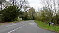
 A minor road junction near Branches Farm - geograph.org.uk - 2723009.jpg 800 × 600; 287 KB
-
 A minor road junction near Etloe - geograph.org.uk - 2722932.jpg 800 × 600; 369 KB
-
 A minor road junction near Ripple House - geograph.org.uk - 2722986.jpg 800 × 600; 235 KB
-
 A minor road towards Blakeney - geograph.org.uk - 2722936.jpg 800 × 600; 316 KB
-
 A public footpath near Cockshoot Bridge - geograph.org.uk - 2723015.jpg 800 × 600; 282 KB
-
 A public footpath near Oakfield Farm - geograph.org.uk - 2722912.jpg 800 × 600; 254 KB
-
 A Rank of Salmon Putchers - geograph.org.uk - 2942277.jpg 4,368 × 2,912; 5.43 MB
-
 A Regular Scene At No 1 The Rudge Blakeney Hill - geograph.org.uk - 2188116.jpg 2,304 × 1,728; 813 KB
-
 A Single Bluebell - geograph.org.uk - 2188540.jpg 2,304 × 1,728; 600 KB
-

-
 A Tidy Hide Away Amongst The Bluebell Walk - geograph.org.uk - 2188551.jpg 2,304 × 1,728; 1.75 MB
-
 A train on the Gloucester to Chepstow railway line - geograph.org.uk - 6051713.jpg 1,600 × 1,200; 278 KB
-

-
 A48 at Awre turn south of Bullo - geograph.org.uk - 3280687.jpg 640 × 480; 36 KB
-
 A48 at Blakeney village boundary - geograph.org.uk - 3275058.jpg 640 × 480; 80 KB
-
 A48 at Lensbrook - geograph.org.uk - 6122239.jpg 1,600 × 900; 473 KB
-
 A48 at Nibley - geograph.org.uk - 6122257.jpg 1,600 × 901; 444 KB
-
 A48 at Nibley - geograph.org.uk - 6225667.jpg 1,600 × 900; 630 KB
-
 A48 at Stretfield Hill - geograph.org.uk - 2301594.jpg 800 × 600; 388 KB
-
 A48 at the Chicknall's Lane junction - geograph.org.uk - 6110421.jpg 1,600 × 900; 673 KB
-
 A48 heading out of Blakeney - geograph.org.uk - 6301376.jpg 800 × 600; 118 KB
-
 A48 near Lensbrook Farm - geograph.org.uk - 3275056.jpg 640 × 481; 34 KB
-
 A48 northbound at Howells Lane - geograph.org.uk - 3280679.jpg 640 × 481; 58 KB
-
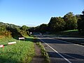
 A48 towards Gloucester - geograph.org.uk - 6301239.jpg 800 × 600; 149 KB
-
 A48 towards Gloucester - geograph.org.uk - 6301391.jpg 800 × 600; 170 KB
-
 A48 towards Gloucester - geograph.org.uk - 6301402.jpg 640 × 480; 100 KB
-
 A48, Blakeney - geograph.org.uk - 4118678.jpg 1,600 × 1,063; 488 KB
-
 A48, Nibley Green - geograph.org.uk - 6301255.jpg 800 × 600; 118 KB
-
 Abutment of old railway bridge - geograph.org.uk - 3685189.jpg 3,264 × 2,448; 5.05 MB
-
 Across the Severn - geograph.org.uk - 6023552.jpg 1,600 × 957; 401 KB
-
 Across the Severn - geograph.org.uk - 6540432.jpg 4,002 × 2,997; 1.93 MB
-
 All Saints' Church, Blakeney - geograph.org.uk - 6301366.jpg 800 × 586; 86 KB
-
 An ancient paved road - geograph.org.uk - 4341073.jpg 680 × 1,024; 368 KB
-
 Another farm track and tree - geograph.org.uk - 6504458.jpg 4,896 × 3,264; 4.12 MB
-
 Approaching Nibley Crossroads on the A48 - geograph.org.uk - 6301242.jpg 800 × 600; 116 KB
-
 Arch of the Purton Steam Carriage Road viaduct - geograph.org.uk - 6503314.jpg 3,264 × 4,896; 5.9 MB
-
 Autumnal oak - geograph.org.uk - 3170907.jpg 900 × 1,200; 564 KB
-
 Awre church from the banks of the estuary - geograph.org.uk - 6504498.jpg 4,896 × 3,264; 2.81 MB
-
 Awre Dukedog geograph-2512675-by-Ben-Brooksbank.jpg 2,122 × 1,447; 843 KB
-
 Awre Junction - geograph.org.uk - 5169291.jpg 1,024 × 768; 226 KB
-
 Awre Junction signal box - geograph.org.uk - 6502612.jpg 4,896 × 3,264; 6.9 MB
-
 Awre level crossings - geograph.org.uk - 2722970.jpg 800 × 600; 206 KB
-
 Awre Road, Blakeney - geograph.org.uk - 3685222.jpg 3,264 × 2,448; 5.29 MB
-
 Awre Road, Blakeney - geograph.org.uk - 3913691.jpg 800 × 520; 107 KB
-
 Awre Tidal Road - geograph.org.uk - 3796666.jpg 3,872 × 2,592; 4.32 MB
-
 Awre to Newnham road - geograph.org.uk - 2237867.jpg 640 × 480; 213 KB
-
 Awre village - geograph.org.uk - 5635050.jpg 1,600 × 1,076; 611 KB
-
 Awre village hall - geograph.org.uk - 2237886.jpg 640 × 480; 256 KB
-
 Awre village hall - geograph.org.uk - 6187943.jpg 1,600 × 1,200; 748 KB
-
 Awre, UK - panoramio (1).jpg 3,000 × 4,000; 3.48 MB
-
 Awre, UK - panoramio (2).jpg 4,000 × 3,000; 4.04 MB
-
 Awre, UK - panoramio (3).jpg 4,000 × 3,000; 2.95 MB
-
 Awre, UK - panoramio.jpg 4,000 × 3,000; 3.29 MB
-
 Bank of the river Severn - geograph.org.uk - 164540.jpg 640 × 480; 79 KB
-

-
 Barn on Old Hill - geograph.org.uk - 3170921.jpg 1,200 × 676; 405 KB
-
 Bend in the flood bank - geograph.org.uk - 5167692.jpg 1,024 × 768; 172 KB
-
 Bend in the track near Awre - geograph.org.uk - 5164574.jpg 1,024 × 768; 223 KB
-
 Bends in the A48, Bledisloe - geograph.org.uk - 6301394.jpg 800 × 600; 206 KB
-
 Bends in the Severn - geograph.org.uk - 3010221.jpg 3,264 × 2,448; 2.75 MB
-
 Best Kept Village sign in Blakeney - geograph.org.uk - 4024649.jpg 800 × 586; 159 KB
-
 Bideford Brook - geograph.org.uk - 2237976.jpg 640 × 480; 257 KB
-
 Bideford Brook - geograph.org.uk - 3685469.jpg 3,264 × 2,448; 4.74 MB
-
 Blackpool Brook - geograph.org.uk - 2188106.jpg 2,304 × 1,728; 1.95 MB
-
 Blackpool Brook - geograph.org.uk - 2188112.jpg 2,304 × 1,728; 1.55 MB
-
 Blackpool Brook - geograph.org.uk - 6504244.jpg 4,896 × 3,264; 6.64 MB
-
 Blackpool Brook at Wenchford - geograph.org.uk - 1092106.jpg 640 × 480; 163 KB
-

-
 Blackpool Brook, Blakeney - geograph.org.uk - 3952465.jpg 800 × 703; 214 KB
-
 Blackpool Brook, Blakeney - geograph.org.uk - 4024880.jpg 800 × 600; 211 KB
-
 Blakeney - geograph.org.uk - 3768770.jpg 1,600 × 1,071; 388 KB
-
 Blakeney Baptist Church - geograph.org.uk - 3952449.jpg 800 × 556; 126 KB
-
 Blakeney Chip-In - geograph.org.uk - 3700967.jpg 1,024 × 680; 191 KB
-
 Blakeney Post Office - geograph.org.uk - 4118670.jpg 1,600 × 1,063; 749 KB
-
 Blakeney Post Office - geograph.org.uk - 6308746.jpg 4,773 × 3,212; 2.05 MB
-
 Blakeney Post Office - geograph.org.uk - 6308748.jpg 5,184 × 3,888; 2.89 MB
-
 Blakeney Primary School - geograph.org.uk - 4024655.jpg 800 × 470; 103 KB
-
 Blakeney Recreation Field - geograph.org.uk - 4118660.jpg 1,600 × 1,063; 538 KB
-
 Blakeney Royal British Legion club - geograph.org.uk - 4024720.jpg 800 × 621; 195 KB
-
 Blakeney Youth Centre - geograph.org.uk - 3952628.jpg 800 × 596; 174 KB
-
 Bledisloe Farm - geograph.org.uk - 2729131.jpg 1,024 × 768; 725 KB
-
 Bledisloe Farm - geograph.org.uk - 6110416.jpg 1,600 × 901; 701 KB
-
 Bridge buttress, Blakeney - geograph.org.uk - 3323329.jpg 640 × 480; 74 KB
-
 Brims Pill - geograph.org.uk - 2237914.jpg 640 × 480; 247 KB
-
 Broken bench - geograph.org.uk - 6504249.jpg 4,297 × 2,864; 3.13 MB
-
 Broken gate near Underdean - geograph.org.uk - 3685305.jpg 3,264 × 2,448; 5.37 MB
-
 Buildings at Box Farm - geograph.org.uk - 2723021.jpg 800 × 600; 180 KB
-
 Buildings at Hall Farm - geograph.org.uk - 2722980.jpg 800 × 600; 231 KB
-
 Bullo Pill boatyard on the River Severn - geograph.org.uk - 2391332.jpg 3,008 × 2,000; 1.61 MB
-
 Business premises to let, Blakeney - geograph.org.uk - 3323264.jpg 640 × 456; 106 KB
-
 Butlers Mead Car Park, Blakeney - geograph.org.uk - 3835491.jpg 800 × 626; 133 KB
-
 Butlers Mead, Blakeney - geograph.org.uk - 3835472.jpg 800 × 546; 128 KB
-
 Car park at Wenchford picnic site - geograph.org.uk - 3110920.jpg 640 × 480; 93 KB
-
 Cereal land by the Severn - geograph.org.uk - 3562055.jpg 800 × 451; 210 KB
-
 Chepstow to Gloucester railway - geograph.org.uk - 1000202.jpg 640 × 427; 183 KB
-
 Cinderford Road, Blakeney - geograph.org.uk - 6301264.jpg 800 × 600; 126 KB
-
 Clark's Lane, Blakeney - geograph.org.uk - 3323318.jpg 640 × 480; 81 KB
-
 Clark's Lane, Blakeney Hill - geograph.org.uk - 2257646.jpg 800 × 600; 397 KB
-
 Clearing in Blakeneyhill Wood South - geograph.org.uk - 4341827.jpg 800 × 531; 155 KB
-
 Cockshoot Bridge - geograph.org.uk - 3686139.jpg 3,264 × 2,448; 4.56 MB
-

-

-
 Corrugated shed - geograph.org.uk - 3030041.jpg 640 × 480; 95 KB
-
 Cottages on the A48, Blakeney - geograph.org.uk - 6301369.jpg 800 × 600; 95 KB
-
 Country road approaching Awre - geograph.org.uk - 2164450.jpg 1,024 × 681; 224 KB
-
 Cowpat fungi at Awre - geograph.org.uk - 3686533.jpg 2,791 × 2,091; 3.12 MB
-
 Culvert under old railway embankment - geograph.org.uk - 6503957.jpg 3,264 × 4,896; 4.37 MB
-
 Currant bushes, Oaklands Park - geograph.org.uk - 1466442.jpg 640 × 426; 107 KB
-
 Daniel's Farm - geograph.org.uk - 2729134.jpg 1,024 × 768; 515 KB
-
 Daniel's Farm, 2019 - geograph.org.uk - 6110419.jpg 1,600 × 901; 703 KB
-
 Dean Mowers Ltd, Blakeney - geograph.org.uk - 3699665.jpg 1,024 × 680; 179 KB
-
 Dean Mowers, Blakeney - geograph.org.uk - 3952396.jpg 800 × 489; 111 KB
-
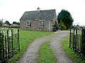
 Derelict cottage, Awre - geograph.org.uk - 5161812.jpg 1,024 × 768; 236 KB
-
 Derelict signal box at Awre Crossing - geograph.org.uk - 5131259.jpg 1,024 × 768; 265 KB
-
 Detail of Sarah Johnson's gravestone - geograph.org.uk - 6494150.jpg 3,547 × 2,374; 1.79 MB
-
 Disused filling station, Blakeney - geograph.org.uk - 3323023.jpg 640 × 466; 78 KB
-
 Disused railway embankment, Blakeney - geograph.org.uk - 3323303.jpg 640 × 480; 146 KB
-
 Disused signal box at Awre Crossing - geograph.org.uk - 3686108.jpg 3,264 × 2,448; 4.72 MB
-
 Disused viaduct near Clarks Lane - geograph.org.uk - 811054.jpg 640 × 480; 114 KB
-
 DNA Autospray, Blakeney - geograph.org.uk - 6502537.jpg 4,896 × 3,264; 6.41 MB
-
 Down to the Severn - geograph.org.uk - 999986.jpg 640 × 427; 172 KB
-
 Driftwood - geograph.org.uk - 6504488.jpg 4,896 × 3,264; 3.89 MB
-
 Early railway remnants - geograph.org.uk - 6503290.jpg 4,896 × 3,264; 4.99 MB
-
 Eastern boundary of Blakeney - geograph.org.uk - 3913729.jpg 800 × 687; 158 KB
-
 Electricity power lines in the forest - geograph.org.uk - 4341037.jpg 800 × 531; 179 KB
-
 Electricity pylons, Awre - geograph.org.uk - 2164150.jpg 681 × 1,024; 147 KB
-
 Elizabeth II postbox, Blakeney Post Office - geograph.org.uk - 6308742.jpg 2,995 × 3,856; 2.34 MB
-
 End of the 30 zone through Blakeney - geograph.org.uk - 4024753.jpg 800 × 620; 155 KB
-

-
 Entrance to Bridge House - geograph.org.uk - 3685186.jpg 3,264 × 2,448; 4.94 MB
-

-
 Entrance to Wenchford Picnic Site - geograph.org.uk - 4494443.jpg 800 × 551; 156 KB
-
 Eroding Severn bank - geograph.org.uk - 2237934.jpg 640 × 480; 233 KB
-
 Etloe Road, Nibley Green - geograph.org.uk - 2722879.jpg 800 × 600; 274 KB
-
 Etloe Road, Towards Upper Etloe - geograph.org.uk - 2722890.jpg 800 × 600; 175 KB
-

-
 Farm track and tree - geograph.org.uk - 6504258.jpg 3,264 × 4,896; 4.42 MB
-
 Farm track at Awre - geograph.org.uk - 3686540.jpg 3,264 × 2,448; 5.12 MB
-
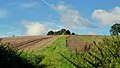
 Farmland at Awre - geograph.org.uk - 2164460.jpg 1,024 × 681; 259 KB
-
 Farmland at Awre - geograph.org.uk - 2165117.jpg 1,024 × 681; 201 KB
-
 Farmland in the Severn Vale - geograph.org.uk - 836402.jpg 640 × 481; 141 KB
-
 Farmland, Bledisloe - geograph.org.uk - 6301398.jpg 800 × 600; 150 KB
-

-

-
 Field by Bideford Brook - geograph.org.uk - 3685465.jpg 3,264 × 2,448; 4.73 MB
-
 Field edge footpath near Haie Grove - geograph.org.uk - 3029521.jpg 640 × 480; 106 KB
-
 Fields leading down to the Severn - geograph.org.uk - 3686513.jpg 3,264 × 2,448; 4.3 MB
-
 Fields near Etloe - geograph.org.uk - 2004733.jpg 640 × 480; 75 KB
-
 Fields near Ripple House - geograph.org.uk - 3686389.jpg 3,264 × 2,448; 4.64 MB
-
 Fieldscape at Awre - geograph.org.uk - 3686559.jpg 3,264 × 2,448; 5.35 MB
-
 Fishing hut by the Severn - geograph.org.uk - 2237907.jpg 640 × 480; 239 KB
-
 Flood bank near Awre - geograph.org.uk - 2162589.jpg 1,024 × 681; 209 KB
-
 Flood defence beside the Severn - geograph.org.uk - 2164146.jpg 1,024 × 681; 233 KB
-
 Flood markers near Hall Farm - geograph.org.uk - 2722975.jpg 800 × 600; 241 KB
-
 Floodmeadow by the Severn - geograph.org.uk - 2237940.jpg 640 × 480; 242 KB
-
 Flotsam on the banks of the River Severn - geograph.org.uk - 2160638.jpg 681 × 1,024; 183 KB
-

-

-
 Footpath across the fields - geograph.org.uk - 3562059.jpg 800 × 451; 204 KB
-
 Footpath along the river bank near Awre - geograph.org.uk - 5164644.jpg 1,024 × 768; 224 KB
-
 Footpath from Chicknall's Lane - geograph.org.uk - 6110414.jpg 1,600 × 901; 724 KB
-
 Footpath off the A48 - geograph.org.uk - 6301387.jpg 800 × 600; 169 KB
-
 Footpath to Bledisoe and Blakeney - geograph.org.uk - 2237990.jpg 640 × 480; 225 KB
-
 Footpath to Gatcombe - geograph.org.uk - 6504247.jpg 4,896 × 3,264; 2.86 MB
-
 Footpath to Lowfield - geograph.org.uk - 2301601.jpg 800 × 600; 375 KB
-
 Footpath towards Kingsland from east of Two Bridges - geograph.org.uk - 2013880.jpg 1,600 × 1,200; 832 KB
-
 Forest of Dean - geograph.org.uk - 3763266.jpg 1,600 × 1,071; 389 KB
-
 Forest of Dean Central Railway at Brimspill - geograph.org.uk - 6502923.jpg 4,896 × 3,264; 6.3 MB
-
 Forest path at Fowlswell Slade - geograph.org.uk - 4340495.jpg 680 × 1,024; 381 KB
-
 Forest track in Blakeneyhill Wood - geograph.org.uk - 4341043.jpg 800 × 531; 167 KB
-
 Forestry on Blakeney Hill - geograph.org.uk - 4340511.jpg 800 × 531; 196 KB
-

-
 Forge Brook, Blakeney - geograph.org.uk - 3913654.jpg 800 × 770; 242 KB
-
 Former bridge for the Forest of Dean Central Railway - geograph.org.uk - 6184193.jpg 1,600 × 1,200; 969 KB
-
 Former railway bridge - geograph.org.uk - 4341058.jpg 800 × 531; 142 KB
-
 Former school on the A48, Blakeney - geograph.org.uk - 6301373.jpg 800 × 600; 122 KB
-
 Fowlswell Slade - geograph.org.uk - 3685148.jpg 3,264 × 2,448; 5.3 MB
-
 Fruit trees, Oaklands park - geograph.org.uk - 1466460.jpg 640 × 426; 107 KB
-
 Fungus on the banks of the Severn - geograph.org.uk - 2161238.jpg 1,024 × 681; 219 KB
-
 Gatcombe from across the River Severn at low tide - geograph.org.uk - 6051705.jpg 1,600 × 1,200; 266 KB
-
 Gatcombe Lane near Etloe - geograph.org.uk - 1894735.jpg 3,008 × 2,000; 1.54 MB
-
 Gate and hedge on Awre Road - geograph.org.uk - 3685230.jpg 3,264 × 2,448; 5.02 MB
-
 Gate at the end of Woodend Lane - geograph.org.uk - 5168081.jpg 1,024 × 768; 190 KB
-
 Georgian House in Blakeney - geograph.org.uk - 3696477.jpg 680 × 1,024; 220 KB
-
 Gloucester 15 Miles - geograph.org.uk - 6301378.jpg 800 × 587; 129 KB
-
 Gloucester to Cardiff train at Awre - geograph.org.uk - 6502674.jpg 4,896 × 3,264; 6.39 MB
-
 Go Ape^ this way, Blakeney - geograph.org.uk - 4024821.jpg 800 × 693; 127 KB
-

-
 Grass field near Awre - geograph.org.uk - 5164596.jpg 1,024 × 768; 141 KB
-
 Gravestone of Anna Hardwick - geograph.org.uk - 6504252.jpg 3,264 × 4,896; 5.83 MB
-
 Gravestone of Sarah Johnson - geograph.org.uk - 6493946.jpg 2,592 × 3,872; 2.64 MB
-
 Gravestones at St Andrew's Church - geograph.org.uk - 6504523.jpg 4,896 × 3,264; 3.98 MB
-
 Gravestones in Awre churchyard - geograph.org.uk - 6504515.jpg 4,896 × 3,264; 3.15 MB
-
 Grazing off the A48 - geograph.org.uk - 6301389.jpg 800 × 600; 109 KB
-
 Green lane near Awre - geograph.org.uk - 5164568.jpg 1,024 × 768; 234 KB
-
 Hagloe House - geograph.org.uk - 2897221.jpg 640 × 427; 274 KB
-
 Hall Farm house - geograph.org.uk - 2237966.jpg 640 × 480; 239 KB
-
 Hall Farm, Awre - geograph.org.uk - 3686119.jpg 3,264 × 2,448; 5.18 MB
-
 Happy Birthday - geograph.org.uk - 6503207.jpg 4,896 × 3,264; 6.38 MB
-
 Hedges and lush grass near Awre - geograph.org.uk - 3686392.jpg 3,264 × 2,448; 5.35 MB


.jpg)
.jpg)
.jpg)


