Category:Bathymetric maps of the North Atlantic
Jump to navigation
Jump to search
Media in category "Bathymetric maps of the North Atlantic"
The following 27 files are in this category, out of 27 total.
-
2023 Titan submersible incident map.svg 512 × 512; 667 KB
-
Batimetriezh ar Mor Keltiek ha Pleg-mor Gwaskogn.svg 3,478 × 3,804; 4.92 MB
-
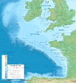
Celtic Sea and Bay of Biscay bathymetric map-en.svg 3,479 × 3,805; 4.93 MB
-
Celtic Sea and Bay of Biscay bathymetric map-fr.svg 3,478 × 3,804; 4.93 MB
-
Galicia & Galicia Bank-en.svg 1,491 × 663; 4.46 MB
-
Gorringe Bank bathymetric map.png 1,921 × 1,200; 2.34 MB
-
Greenland scotland-ridge-de.svg 962 × 593; 1.08 MB
-
Itsaso Zeltikoko eta Bizkaiko Golkoko mapa batimetrikoa.svg 3,479 × 3,805; 4.93 MB
-
Maritime boundaries between UK and France in Antilles-fr.svg 1,502 × 1,332; 403 KB
-
N-Atlantic-topo (de).png 502 × 354; 288 KB
-
N-Atlantic-topo.png 504 × 352; 288 KB
-
North Atlantic Brightened.png 10,151 × 4,210; 65.5 MB
-
North Atlantic Ocean laea relief location map.jpg 1,181 × 958; 1.13 MB
-
Northeast Atlantic bathymetry.png 413 × 323; 347 KB
-
Physiographic map of the North Atlantic, 1957.jpg 3,000 × 1,545; 1.32 MB
-
Porcupine Bank and Seabight, NE Atlantic.png 413 × 323; 292 KB
-
RainbowVentFieldLocationOnMap.png 807 × 453; 677 KB
-
Rockall Plateau and Trough, NE Atlantic.png 413 × 323; 295 KB
-
Saint-Pierre and Miquelon EEZ map-en.svg 750 × 800; 315 KB
-
Sénégal drainage basin map-fr.svg 1,296 × 830; 3.53 MB
-
SMNT-735N-0091W-Vesteris Seamount.jpg 901 × 981; 259 KB
-
StLawrence Gulf bathymetry.jpg 820 × 505; 90 KB
-
The Bell System technical journal (1922) (14569527447).jpg 3,462 × 1,928; 1.43 MB
-
The Bell System technical journal (1922) (14755984285).jpg 3,436 × 2,663; 3.12 MB
-
The Bell System technical journal (1922) (14775874393).jpg 3,480 × 2,738; 3.59 MB
-
Vlaamse Banken.png 1,087 × 746; 1.15 MB


