Category:Bathymetric maps of the Atlantic Ocean
Jump to navigation
Jump to search
Subcategories
This category has the following 3 subcategories, out of 3 total.
Media in category "Bathymetric maps of the Atlantic Ocean"
The following 200 files are in this category, out of 213 total.
(previous page) (next page)-
GEBCO-OpenSeaMap-Water-depts-Nordatlantic.jpg 1,024 × 513; 76 KB
-
119 of 'Eclectic Physical Geography' (11292865466).jpg 1,315 × 1,373; 474 KB
-
1755 Lisbon Earthquake Location.png 331 × 420; 100 KB
-
2012-08-12 Heligoland Ausflug, b Unterland 004.JPG 4,752 × 3,168; 8.61 MB
-
2012-08-12 Heligoland Ausflug, b Unterland 005.JPG 4,752 × 3,168; 7.3 MB
-
85 of '(The Story of our Planet ... Illustrated.)' (11245408603).jpg 1,495 × 2,488; 953 KB
-
AF447SeaBottom-it.jpg 2,808 × 2,500; 3.8 MB
-
AF447SeaBottom.jpg 2,808 × 2,500; 4.16 MB
-
Alpha Reef Map.png 7,800 × 5,714; 2.1 MB
-
Anvil Rock Reef map.png 4,000 × 3,772; 1,013 KB
-
Ark Rock and wrecks.png 4,166 × 7,799; 2.85 MB
-
Ark Rock map.png 6,780 × 5,332; 1.66 MB
-
Atlantic bathymetry.jpg 4,000 × 5,000; 9.12 MB
-
Atlantis Reef map.png 7,800 × 4,738; 2.97 MB
-
Bakleiplaasmap.png 7,790 × 6,424; 1.65 MB
-
Bakoven Rock Reef Map.png 7,313 × 5,081; 2.74 MB
-
Bantry Bay Pinnacles map.png 3,000 × 2,673; 483 KB
-
BasenyAtlantyku.svg 751 × 824; 39 KB
-
Batsata Maze map.png 7,791 × 5,797; 2.96 MB
-
Biscaynemap.jpg 200 × 398; 18 KB
-
Blue Flame Pinnacles map.png 3,000 × 3,697; 560 KB
-
Blue Flash Reefs map.png 7,125 × 5,621; 2.68 MB
-
Boardroom pinnacle map.png 4,998 × 4,944; 897 KB
-
Bruce's Mark reef map.png 8,779 × 5,994; 1.46 MB
-
Canhão da Nazaré mapa batimétrico.png 1,921 × 1,200; 2.32 MB
-
CanyonsbathyLG USGS.jpg 1,040 × 1,255; 375 KB
-
Cape Verde Rise.jpg 1,825 × 2,000; 1.22 MB
-
Carte bathymétrique.jpg 489 × 370; 95 KB
-
Castor Rock Reef map.png 7,312 × 5,522; 4.72 MB
-
Choirboys Reef Map.png 3,000 × 3,086; 583 KB
-
Cleeve's Tunnel map.png 1,597 × 1,910; 279 KB
-
Congo canyon.png 1,200 × 828; 689 KB
-
Contour map of Gulf of Mexico 1888.jpg 700 × 462; 137 KB
-
Coral Gardens offshore pinnacles map.png 7,800 × 4,632; 1.34 MB
-
Coral Gardens Rooi-els dive site map.png 3,000 × 2,000; 540 KB
-
CP and FB topographical map with dive sites.png 1,236 × 1,236; 234 KB
-
Dangerous Doug Reefs Map.png 7,800 × 7,000; 3.01 MB
-
Deep South Whittle Reef map.png 3,000 × 2,969; 521 KB
-
Die Josie map.png 7,800 × 5,969; 1.39 MB
-
Die Perd map.png 6,998 × 6,773; 1.79 MB
-
Dive sites of Batsata Reef.png 5,529 × 6,406; 4.33 MB
-
Dive sites of Cape Town.png 3,068 × 3,202; 2.19 MB
-
Dive sites of Caravan Reef.png 7,087 × 7,312; 4.57 MB
-
Dive sites of Rocklands Point.png 3,000 × 3,097; 1.59 MB
-
Dive sites of the Castle Rocks area Map.png 7,313 × 6,167; 6.74 MB
-
Dive sites of the Seaforth area.png 8,076 × 4,273; 3.12 MB
-
Dive Sites of the Steenbras Deep Ridge.png 2,902 × 3,893; 631 KB
-
Dive sites of the Whittle Rock area Hi-Res for mobile.png 7,020 × 4,965; 4.87 MB
-
Dive sites of the Whittle Rock area.png 7,019 × 5,742; 3.08 MB
-
Dive sites of the Whittle Rock Reef high resolution.png 14,040 × 9,930; 10.26 MB
-
Dome Rock Reef map.png 2,999 × 2,293; 707 KB
-
Dreadlocks Reef map.png 1,852 × 1,321; 277 KB
-
Drop Zone Reef Map.png 2,988 × 2,851; 524 KB
-
Duiker Point Canyon map.png 5,000 × 4,084; 2.57 MB
-
Duiker Point dive sites map with Geoscience contours all depths.svg 8,494 × 13,222; 5.71 MB
-
Duiker Point dive sites map.png 7,313 × 8,670; 6.87 MB
-
Dusky Pinnacles detail map.png 7,800 × 6,066; 2.53 MB
-
Ecology and Geology of the Mona Passage Region – The View from D2 and Seirios.jpg 2,985 × 2,336; 3.87 MB
-
False Bay Bathymetry.png 8,288 × 8,106; 4.33 MB
-
False Bay offshore dive sites.png 1,224 × 1,206; 124 KB
-
FAMOUS on MAR.svg 917 × 784; 3.85 MB
-
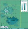
Fan Reef Map.png 7,391 × 7,486; 2.7 MB
-
Fernando de Noronha map by Philippe Buache 1737.jpg 9,773 × 7,829; 14.27 MB
-
Finlay's Point dive sites map.png 3,684 × 1,878; 874 KB
-
Finlay's Point dive sites.png 3,000 × 1,693; 584 KB
-
Fish Hoek Reef.png 7,800 × 6,058; 1.71 MB
-
Fish Tank reef map.png 7,795 × 6,398; 1.96 MB
-
FMIB 43869 Profile of the Straits of Gibraltar.jpeg 895 × 301; 38 KB
-
France relief location map.jpg 2,000 × 1,922; 907 KB
-
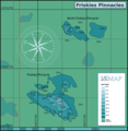
Friskies Pinnacle Map.png 2,899 × 2,983; 902 KB
-
Giant's Castle map.png 7,800 × 5,923; 2.44 MB
-
Glencairn Barge wreck.png 1,845 × 2,237; 402 KB
-
Gordons Bay dive sites.png 1,134 × 1,616; 109 KB
-
Graeme's Spot and The Jambles map.png 7,880 × 5,593; 2.41 MB
-
Graeme's spot and the Jambles, Carnaby Street and Finlay's Pinnacle map.png 8,566 × 6,064; 3.5 MB
-
Greenland-sea-bathymetrie.svg 802 × 593; 632 KB
-
Holy Island (Overview).jpg 4,512 × 3,024; 7.21 MB
-
Hout Bay and Oudekraal dive sites.png 1,128 × 1,607; 143 KB
-
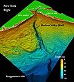
Hudson Canyon.jpg 300 × 335; 24 KB
-
Humpback Ridge map.png 3,145 × 2,801; 731 KB
-
Irish Sea – relief, ports, limits.tif 1,043 × 1,507; 4.5 MB
-
IrishSeaReliefmap.png 1,043 × 1,507; 535 KB
-
Kanobi's Reef detail map.png 3,269 × 2,477; 740 KB
-
Ker Yar Vor site map.png 7,926 × 6,795; 2.48 MB
-
Klein Tafelberg Reef map.png 7,787 × 6,129; 2.64 MB
-
Kommetjie to Olifantsbospunt map.png 1,000 × 1,863; 246 KB
-
Livingstone reef.png 7,313 × 4,455; 2.08 MB
-
Lowerbiscaynebaychart.jpg 700 × 480; 102 KB
-
M&M Pinnacles detail map.png 7,799 × 5,909; 2.79 MB
-
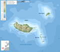
Madeira topographic map-de.svg 1,194 × 1,037; 337 KB
-
Madeira topographic map-fr.svg 1,194 × 1,037; 2.18 MB
-
Madeira topographic map-lt.svg 1,194 × 1,037; 2.18 MB
-
Madeira topographic map-mk.svg 1,194 × 1,037; 2.18 MB
-
Madeira-es.svg 870 × 702; 1.24 MB
-
Maidstone Reef and Rock.png 7,800 × 4,578; 2.26 MB
-
Map of CT dive site SS Maori.png 7,313 × 5,063; 3.53 MB
-
Map of Kalk Bay Reef and Harbour Wall.png 5,000 × 4,316; 1.33 MB
-
Map of the Canary Islands-ro.svg 3,152 × 1,400; 1.62 MB
-
Map of the CT dive site Pinnacle.png 3,008 × 1,933; 1.2 MB
-
Map of the CT dive site Pinnacle.svg 744 × 1,052; 1.69 MB
-
Map of the dive sites Photographers Reef Windmill Beach and Penguin Point.png 6,077 × 7,800; 5.35 MB
-
Map of the SS Lusitania wreck site.png 4,610 × 3,996; 1.6 MB
-
Map of Whittle Rock dive sites 2021.svg 6,771 × 4,789; 2.42 MB
-
Map00323 - Flickr - NOAA Photo Library.jpg 1,284 × 1,278; 409 KB
-
MFV Harvest Capella wreck map.png 7,773 × 5,125; 1.69 MB
-
Middelmas and Hakka Reef map.png 7,294 × 5,621; 2.65 MB
-
Millers Point dive sites.png 1,156 × 1,648; 115 KB
-
Mona Canyon.jpg 2,376 × 1,515; 994 KB
-
Mont Blanc Reef map.png 3,000 × 2,507; 528 KB
-
Muizenberg trawler wrecks.png 6,468 × 3,169; 911 KB
-
MV Daeyang Family wreck map.png 3,750 × 1,751; 748 KB
-
MV Romelia and Sunset Rocks.png 2,265 × 1,662; 394 KB
-
NAM-SAM-AFR-triple junction.jpg 800 × 800; 209 KB
-
North Lion's Paw map.png 7,880 × 5,331; 2.74 MB
-
North Oudekraal dive sites with routes.png 1,200 × 1,592; 100 KB
-
North Sea map-de.png 2,472 × 3,104; 4.03 MB
-
North Sea map-en.png 2,475 × 3,100; 3.8 MB
-
North Sea map-fi.png 2,475 × 3,100; 3.84 MB
-
North-East Pinnacle Map.png 2,463 × 1,870; 508 KB
-
Oakburn and Bos400 map.png 9,565 × 7,053; 3.83 MB
-
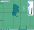
Off-Whittle Ridge.png 4,866 × 4,202; 859 KB
-
Old Harry oil field location map-fr.svg 1,655 × 1,582; 3.04 MB
-
Omega Reef Map.png 10,057 × 6,269; 4.12 MB
-
Outer Photographers and Torch Reefs Map.png 7,800 × 7,610; 3.08 MB
-
Partridge Point Big Rock.png 7,956 × 5,503; 4.09 MB
-
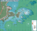
Partridge Point Peters Pinnacle.png 7,800 × 6,402; 2.8 MB
-
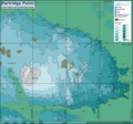
Partridge Point reef map.png 4,329 × 3,671; 3.41 MB
-
Partridge Point reef map.svg 744 × 1,052; 1.72 MB
-
Partridge Point Seal Rock and Deep Partridge.png 7,959 × 7,426; 5.22 MB
-
Percys and Kruis2.gif 1,287 × 1,234; 115 KB
-
Percys and Kruis2.png 3,000 × 2,265; 1.21 MB
-
Phoenix Shoal map.png 7,793 × 5,983; 2.22 MB
-
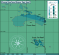
Phone Reef and Super Fan Reef.png 8,397 × 7,891; 2.56 MB
-
Phone Reef Map.png 7,798 × 5,921; 2 MB
-
Photographer's reef detail.png 2,000 × 1,488; 713 KB
-
Pie Rock Reef Map.png 7,312 × 5,954; 4.51 MB
-
Pie Rock, Outer Castle and Giant's Castle reefs map.png 10,011 × 6,107; 7.1 MB
-
Platô de São Paulo.png 896 × 592; 760 KB
-
Platô do Ceará 1.png 595 × 357; 341 KB
-
Platô do Ceará 2.png 867 × 466; 178 KB
-
Platô do Ceará Imagem 3.jpg 272 × 185; 13 KB
-
PMB Pinnacles map.png 4,977 × 3,112; 1.12 MB
-
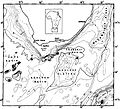
Portugal-Morocco1969epi.gif 179 × 269; 37 KB
-
Pyramid Reef Map.png 7,800 × 6,675; 4.31 MB
-
Rachel's Reef map.png 3,047 × 2,365; 590 KB
-
Rambler North-west Pinnacle Map.png 7,313 × 7,254; 2.43 MB
-
Rambler Rock Reefs map.png 5,200 × 8,488; 3.39 MB
-
Random Rocks Reefs map.png 7,800 × 5,823; 1.66 MB
-
Rocklands sites map.png 7,800 × 6,695; 4.35 MB
-
Roman Rambler and Castor rocks map.png 7,800 × 7,489; 5.17 MB
-
Roman Rock Reef Map.png 8,987 × 5,761; 4.69 MB
-
Romanche Trench.jpg 800 × 559; 215 KB
-
Rooi els dive sites.png 1,135 × 1,616; 125 KB
-
SAS Bloemfontein wreck map.png 3,837 × 6,127; 1.03 MB
-
SAS Gelderland wreck map.png 4,283 × 2,147; 927 KB
-
Schott-1940 atlantic-ocean.JPG 1,299 × 1,719; 3 MB
-
Sea Point Ridge Pinnacle map.png 2,000 × 1,782; 280 KB
-
Shark Alley Map.png 3,000 × 2,500; 1.11 MB
-
Sherwood Forest Reef map.png 7,800 × 4,738; 2.41 MB
-
Simons Town dive sites.png 1,156 × 1,648; 126 KB
-
Site map of wreck of SAS Pietermaritzburg.png 3,000 × 2,999; 868 KB
-
Smits and Batsata reef map.png 2,813 × 3,425; 1.91 MB
-
Smits reef map.png 7,774 × 8,321; 6.41 MB
-
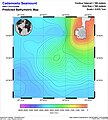
SMNT-147N-0249W-Cadamosto Seamount.jpg 693 × 773; 202 KB
-
SMNT-175N-0301W-Krylov Seamount.jpg 693 × 773; 188 KB
-
SMNT-337N-0625W-Muir Seamount.jpeg 589 × 670; 180 KB
-
SMNT-404N-0269W-Sedlo Seamount.jpg 1,004 × 1,084; 346 KB
-
South africa sea.jpg 927 × 843; 455 KB
-
South Africa South Coast Bathymetry.jpg 1,024 × 734; 69 KB
-
Southeastern United States continental shelf.jpg 462 × 374; 41 KB
-
SS Godetia site map.png 2,496 × 2,983; 501 KB
-
SS Hypatia wreck map.png 5,484 × 6,563; 1.79 MB
-
Star of Africa wreck map.png 4,640 × 6,613; 1.38 MB
-
Star Walls detail map.png 7,312 × 5,542; 4.16 MB
-
Star Walls Reef Complex map.png 7,938 × 7,183; 6.19 MB
-
Steenbras Deep North Pinnacle map.png 5,000 × 5,579; 1.02 MB
-
Steenbras Deep South Pinnacle map.png 6,000 × 5,084; 1.31 MB
-
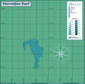
Sterretjies Reef Map.png 7,800 × 7,740; 1.66 MB
-
Stonehenge dive sites (Cape Town) map.png 7,313 × 5,956; 4.48 MB
-
Storeggaskredet.gif 438 × 324; 79 KB
-
Sunfish and Lollipop Pinnacles detail map.png 3,269 × 2,477; 781 KB
-
SURG Pinnacle detail map.png 8,755 × 6,862; 4.12 MB
-
Table Bay dive sites.png 1,116 × 1,595; 127 KB
-
Tafelberg Deep Reef map.png 3,000 × 2,212; 763 KB
-
Target Reef Map.png 1,598 × 1,527; 318 KB
-
The American journal of science (1905) (17965730509).jpg 2,068 × 3,452; 1.46 MB
-
The Bell System technical journal (1922) (14732990176).jpg 3,520 × 2,641; 3.12 MB
-
The Bell System technical journal (1922) (14755680032).jpg 3,426 × 2,778; 2.02 MB
-
The Bell System technical journal (1922) (14755685102).jpg 3,376 × 2,618; 2.68 MB
-
The Earth beneath the sea - History (1963) (21124446035).jpg 1,982 × 1,396; 445 KB
-
Tivoli Pinnacles Map.png 2,996 × 2,504; 986 KB
-
Twin barges detail.png 1,000 × 937; 55 KB
-
Twin Towers Reef map.png 3,249 × 2,251; 487 KB
-
Unidentified steamer off Robben Island.png 2,689 × 2,003; 517 KB


