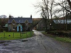
Category:Auchlyne
Jump to navigation
Jump to search
architectural structure in Stirling, Scotland, UK | |||||
| Upload media | |||||
| Instance of | |||||
|---|---|---|---|---|---|
| Located in protected area | |||||
| Location |
| ||||
| Heritage designation |
| ||||
 | |||||
English: Auchlyne ( Gaelic: Achadh Loinne) is a small hamlet in Perth and Kinross, Scotland, in the west part of the former county of Perthshire. It is located approximately five miles west of Killin on Loch Tay, off the main A85 road that runs from Perth to Oban.
Gàidhlig: 'S e baile-beag ann am Peairt agus Ceann Rois a th' ann an Achadh Loinne (Beurla: Auchlyne). 'S e seo na co-chomharran aige: 56° 26′ 6″ Tuath agus 4° 24′ 46″ W Iar.
Media in category "Auchlyne"
The following 17 files are in this category, out of 17 total.
-
Auchlyne Farm (geograph 3276607).jpg 640 × 478; 86 KB
-
House at Auchlyne.jpg 640 × 480; 91 KB
-
The Old Mill - geograph.org.uk - 329227.jpg 640 × 480; 59 KB
-
Ath Ruadh and Glen Dochart - geograph.org.uk - 827775.jpg 640 × 427; 259 KB
-
Drystone Wall and Moorland - geograph.org.uk - 342640.jpg 640 × 480; 120 KB
-
Farmland above Auchlyne - geograph.org.uk - 340307.jpg 480 × 640; 67 KB
-
Flooded Fields - geograph.org.uk - 342626.jpg 640 × 480; 112 KB
-
Knobbly ridge. - geograph.org.uk - 12286.jpg 640 × 424; 54 KB
-
Pasture Land - geograph.org.uk - 342600.jpg 640 × 480; 114 KB
-
Quartzite seams on the ridge - geograph.org.uk - 389430.jpg 640 × 480; 107 KB
-
Road to Innishewan Farm - geograph.org.uk - 342577.jpg 640 × 480; 88 KB
-
Sheep Fanks at Bovain - geograph.org.uk - 342635.jpg 640 × 480; 101 KB
-
The Back Road - geograph.org.uk - 342613.jpg 640 × 480; 101 KB
-
The Glen Dochart path - geograph.org.uk - 389418.jpg 480 × 640; 94 KB
-
The Meall an t-Seallaidh ridge - geograph.org.uk - 389439.jpg 640 × 480; 70 KB
-
The River Dochart - geograph.org.uk - 342627.jpg 640 × 480; 92 KB
-
Under Leum an Eireannaich - geograph.org.uk - 389424.jpg 640 × 480; 77 KB


