Category:Armenian-language maps showing history
Jump to navigation
Jump to search
Subcategories
This category has only the following subcategory.
Media in category "Armenian-language maps showing history"
The following 53 files are in this category, out of 53 total.
-
1263 Mediterranean Sea-hy.png 1,993 × 910; 244 KB
-
506-Castile 1210 (hy).png 474 × 506; 96 KB
-
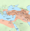
Achaemenid empire.gif 800 × 363; 183 KB
-
Alexandria in Ptolemes.jpg 1,024 × 641; 436 KB
-
Alliances militaires en Europe 1914-1918-hy.png 999 × 594; 135 KB
-
Armenia in 300 BC.png 850 × 607; 28 KB
-
Armenian map of 1784.jpg 2,048 × 1,394; 512 KB
-
Artsakh and Utiq from "Armenian Geograpfy"- 7th Century.jpg 3,308 × 2,911; 2.69 MB
-
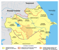
Azerbaijan Khanates (hy).png 1,200 × 1,024; 282 KB
-
Byzantine Empire Themata in 950-hy.png 744 × 456; 110 KB
-
ByzantineEmpire717+extrainfo+themeshy.png 800 × 366; 92 KB
-
ByzantineEmpire867AD4lightpurplehy.PNG 800 × 370; 41 KB
-
Byzantium1204 hy.png 512 × 357; 93 KB
-
Byzantium650ADhy.png 800 × 366; 100 KB
-
Caucasus 1213 AD map hy.png 1,268 × 985; 899 KB
-
Fall of Armenian Empire since BC 66.gif 991 × 817; 896 KB
-
Fashoda Incident map - hy.png 3,384 × 2,743; 1.7 MB
-
Frankish Empire 481 to 814-hy.png 2,551 × 1,809; 1.01 MB
-
French Mandate for Syria and the Lebanon map hy.png 800 × 661; 57 KB
-
Georgian empire with tributaries-hy.png 1,976 × 1,419; 493 KB
-
Georgian SSR 1922 hy.png 800 × 489; 97 KB
-
Georgian SSR 1957 hy.png 1,461 × 768; 44 KB
-
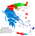
Greece in WW2 (hy).png 851 × 869; 86 KB
-
Historical map of Italy before reunification in 1494.png 830 × 1,072; 544 KB
-
History of Bagratid Armenia and region by year.gif 892 × 548; 1.69 MB
-
Kingdom of Sicily 1154-hy.png 712 × 807; 269 KB
-
Map Europe alliances 1914-hy.jpg 3,165 × 1,877; 3.21 MB
-
Map of Ancient Rome 271 AD (hy).svg 2,050 × 1,213; 344 KB
-
Map of the Georgian Empire in the beginning of the 13th century-hy.png 1,877 × 1,258; 228 KB
-
Map of the Mediterranean World in 1092 (hy).png 1,832 × 502; 639 KB
-
Maratha Empire 1674 - 1818 ad (hy).png 429 × 600; 53 KB
-
Mark Antony's campaign in Parthia, 36 BC (hy - հայերեն).png 1,110 × 714; 255 KB
-
Nouvelle-France map-hy.png 2,308 × 1,984; 477 KB
-
Orient-Express Historic Routes (hy).png 758 × 570; 180 KB
-
Romania historic regions.png 831 × 594; 133 KB
-
Romanworld271AD (hy).png 524 × 377; 197 KB
-
Second world war europe 1941-1942 map hy.png 1,090 × 1,000; 478 KB
-
Tahirid Dynasty 821 - 873 (hy).png 620 × 429; 23 KB
-
The Byzantine Empire, c.1180 (armenian).png 922 × 425; 84 KB
-
Urartu820-785-hy.png 1,770 × 926; 237 KB
-
Western part of the Achaemenid Empire (hy-հայերեն).png 1,500 × 1,524; 1.93 MB
-
Առաջին համաշխարհային պատերազմի կովկասյան ճակատ.png 3,002 × 2,162; 1.01 MB
-
Արևելյան Անատոլիան և խաչակրաց պետությունները 1101 թվականին.png 2,000 × 1,397; 1.45 MB
-
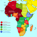
Աֆրիկան 1912 թվականին.png 767 × 767; 54 KB
-
Բրունդիզիայի պաշարում.png 800 × 599; 58 KB
-
Եվրոպայի ռազմաքաղաքական բլոկները 1914 թվականին.png 1,559 × 1,081; 706 KB
-
Եվրոպան 1914 թվական.png 1,821 × 1,149; 105 KB
-
Հարավային Կովկասը 1918 թվականին.png 592 × 477; 22 KB
-
Հունաստանի ռազմակալումը Երկրորդ աշխարհամարտում.png 794 × 770; 161 KB
-
Հռոմեական կայսրությունը մ.թ.ա. 271 թվականին.png 793 × 467; 109 KB
-
Վերդենի պայմանագիր - քարտեզ.jpg 560 × 480; 158 KB
-
Տիգրանյան նվաճումների անիմացիա.gif 732 × 572; 611 KB
-
Ֆրանսիան 1337-1453 թթ.png 425 × 519; 91 KB


