Category:Armenian-language maps
Jump to navigation
Jump to search
Subcategories
This category has the following 6 subcategories, out of 6 total.
Media in category "Armenian-language maps"
The following 200 files are in this category, out of 230 total.
(previous page) (next page)-
(Map of Black Sea and environs). LOC 2010589530.jpg 7,022 × 5,395; 5.64 MB
-
(Map of Black Sea and environs). LOC 2010589530.tif 7,022 × 5,395; 108.39 MB
-
1695 Armenian map of the world.jpg 14,002 × 11,207; 31.5 MB
-
1787 map - Asia According to New Geographical Observations by Elia Endasian.tif 8,966 × 6,479; 166.21 MB
-
2012 armenia parliamentary election results-hy.png 1,978 × 1,052; 88 KB
-
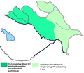
5 principalities of Artsakh.png 347 × 363; 9 KB
-
Acharian dialects map.png 4,120 × 3,331; 3.08 MB
-
AdanaVilayet.jpg 2,088 × 1,464; 579 KB
-
Adiabene.JPG 1,400 × 824; 258 KB
-
Adjar ASSR Map hy.png 634 × 354; 38 KB
-
Administrative division of First Republic of Armenia.png 997 × 705; 119 KB
-
Africa independence dates (hy).svg 1,300 × 1,000; 205 KB
-
Africa independence dates backup 2 hy.svg 1,300 × 1,000; 205 KB
-
Africa map 1939, colours-hy.png 5,000 × 4,721; 4.44 MB
-
Africa slave Regions-hy.png 8,505 × 8,011; 3.59 MB
-
African countries by GDP (PPP) per capita in 2020-hy.png 2,048 × 2,045; 508 KB
-
Africa’s wars and conflicts, 1980–96-hy.png 4,438 × 3,870; 826 KB
-
Ajara map hy.png 634 × 354; 25 KB
-
Akhaltsikhe Municipality.JPG 450 × 462; 48 KB
-
Alashkert Operation.JPG 700 × 1,200; 178 KB
-
Alliances militaires en Europe 1914-1918-hy.png 999 × 594; 135 KB
-
America According to New Geographical Observations, 1787 WDL9872.png 1,420 × 1,024; 2.39 MB
-
Ancient Egypt map-hy.png 8,881 × 18,014; 4.4 MB
-
Ani-plan.jpg 1,285 × 1,961; 543 KB
-
Annual Average Temperature Map hy.jpg 1,100 × 849; 386 KB
-
Approximate site of sinking, MV Armenia (hy).png 1,200 × 775; 327 KB
-
Armenia & First Arsacids - I c.JPG 1,754 × 1,276; 2.14 MB
-
Armenia According to the Ashkharhatsuyts.jpg 2,660 × 1,706; 4.78 MB
-
Armenian diaspora-hy.png 1,425 × 625; 26 KB
-
Armenian Highlands map 300 BC.svg 1,155 × 898; 4.45 MB
-
Armenian map (1849).jpg 720 × 487; 51 KB
-
Armenian map of 1747.jpg 1,299 × 805; 321 KB
-
Armenian map of Africa.jpg 418 × 310; 119 KB
-
Armenian map of Asia.jpg 1,594 × 1,248; 774 KB
-
ARMENIAN map of caucasus ethnic groups.jpg 984 × 1,144; 545 KB
-
Armenian map of Europe.jpg 2,048 × 1,585; 1.16 MB
-
Armenian map of geographical zones, 1621.jpeg 1,004 × 785; 356 KB
-
Armenian map of Ottoman Empire.jpg 720 × 683; 156 KB
-
Armenian map of the Ottoman Empire (2).jpg 403 × 310; 59 KB
-
Armenian map of the sea of Marmara.jpg 2,048 × 1,058; 310 KB
-
Armenian Province of Cilicia.JPG 2,028 × 1,508; 580 KB
-
Arranshahiks am.jpg 1,836 × 1,291; 609 KB
-
Arshakid Armenia ARM.JPG 1,280 × 875; 1.01 MB
-
Arshakuni Armenia (hy - հայերեն).png 1,280 × 712; 1.52 MB
-
ARTSVASHEN.JPG 940 × 613; 86 KB
-
Asia According to New Geographical Observations, 1787 WDL9871.png 1,417 × 1,024; 2.64 MB
-
Askharhatsuits.jpg 1,420 × 1,139; 932 KB
-
Australia discoveries by Europeans before 1813 hy.png 651 × 599; 652 KB
-
Australia-climate-map MJC01(hy).png 1,000 × 905; 47 KB
-
Australian agricultural map.jpg 800 × 586; 124 KB
-
Australian external territories-hy.png 644 × 376; 14 KB
-
Aymaran languages (hy).png 444 × 341; 10 KB
-
Byzantiumforecrusades(hy).png 550 × 375; 132 KB
-
Caucasian Albania map (Armenian - hy).png 836 × 728; 56 KB
-
Caucasus in 300 AD (Armenian - hy).png 1,127 × 833; 800 KB
-
Caucasus Map Karta Kavkaza (hy).png 548 × 296; 92 KB
-
Caucasus-ethnic en arm.jpg 984 × 1,144; 548 KB
-
Caucasus-political (hy).png 972 × 912; 272 KB
-
CJNG - US Influence Map -2018 (hy).png 3,840 × 2,966; 8.55 MB
-
Cnut-north-sea-empire (hy).png 907 × 715; 148 KB
-
Count of murders in Mexico's drug conflicts (hy).png 5,847 × 4,264; 1.42 MB
-
Countries by Real GDP Growth Rate in 2018 (Armenian).png 2,048 × 1,235; 628 KB
-
Crimea republic map (hy).png 1,017 × 649; 36 KB
-
Cyprus 1973 ethnic hy.png 1,088 × 775; 99 KB
-
Cyprus map in armenian.png 1,251 × 653; 123 KB
-
Czech Repablic map in armenian.png 1,004 × 611; 120 KB
-
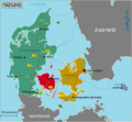
Denmark regions (hy).png 1,925 × 1,785; 580 KB
-
Detailed map of Asian regions (hy).png 1,900 × 1,874; 478 KB
-
Drug traffic routes in Mexico (hy).png 5,788 × 4,274; 1.42 MB
-
Dutch Provinces am.png 800 × 923; 229 KB
-
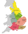
Earldoms of Anglo-Saxon England (hy).png 785 × 939; 77 KB
-
Emirates arm.png 1,429 × 1,107; 192 KB
-
Empire of Ghana.png 961 × 717; 47 KB
-
Erewani hatakagitsě 1920 tʻ. LOC 2012586642.jpg 12,988 × 9,539; 14.17 MB
-
Erewani hatakagitsě 1920 tʻ. LOC 2012586642.tif 12,988 × 9,539; 354.46 MB
-
Ersian Gulf Arab States armenian.png 623 × 599; 83 KB
-
Estonia counties hy.png 800 × 544; 66 KB
-
Ethnolinguistic groups in Afghanistan.jpg 2,048 × 1,874; 334 KB
-
European countries by Press Freedom Index, 2021 (hy).png 2,816 × 1,959; 932 KB
-
First Republic of Armenia (Հայաստանի առաջին հանրապետություն).png 1,078 × 718; 87 KB
-
France map Lambert-93 with regions and departments-occupation (hy).png 1,326 × 1,216; 571 KB
-
General map of Spain (hy).png 619 × 419; 75 KB
-
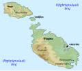
General maps of Malta hy.svg 502 × 433; 195 KB
-
Ghana reich karte-hy.png 4,221 × 4,084; 1.13 MB
-
Ghukas Injijian's map of Bosphorus.jpg 548 × 960; 137 KB
-
Grater Armenia main.jpg 4,999 × 2,657; 9.21 MB
-
Great Armenia (in Armenian).gif 2,264 × 1,292; 798 KB
-
Great Britain Dependencies map in Armenian.png 735 × 433; 93 KB
-
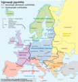
Grossgliederung Europas-hy.png 681 × 709; 175 KB
-
Hamadaradz Asharhatsuyts = Extensive world map (8540503506).jpg 800 × 569; 123 KB
-
Hayrenatirutyan day Map small.jpg 600 × 600; 443 KB
-
Japan (Armenian map).jpg 3,105 × 2,278; 1.05 MB
-
Julian's campaign-hy (հայերեն).svg 2,580 × 1,684; 209 KB
-
Kingdom of Tashir-Dzoraget (Lori).svg 2,717 × 1,595; 793 KB
-
Lake Van, 1848.jpg 720 × 420; 55 KB
-
Language families of Caucasus (Armenian).png 2,376 × 1,649; 375 KB
-
Language region maps of India (hy).png 1,594 × 1,870; 198 KB
-
Languages of South America (hy).png 3,255 × 2,295; 402 KB
-
Larus armenicus range map in Armenia (Armenian).png 7,870 × 6,540; 896 KB
-
Libro el ekspozicio de Matenadaran 88.jpg 3,454 × 2,592; 2.88 MB
-
Lion distribution (hy).png 880 × 768; 49 KB
-
Location Nagorno-Karabakh-hy.png 595 × 387; 44 KB
-
Location of Tigranocerta within the Kingdom Armenia-hy.png 1,500 × 850; 112 KB
-
Macedonia overview (hy).png 551 × 627; 76 KB
-
Map Greece Megali Idea (hy).png 868 × 624; 111 KB
-
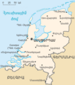
Map Nederland am.png 304 × 343; 32 KB
-
Map of African language families-hy.png 3,072 × 2,901; 666 KB
-
Map of Ani-hy.png 700 × 693; 227 KB
-
Map of Armenia and NKR (hy).svg 1,169 × 1,198; 206 KB
-
Map of Armenia from Chamchian's History of Armenia, 1784.jpeg 1,252 × 1,068; 519 KB
-
Map of Ayrarat - Soviet Armenian Encyclopedia.jpg 3,772 × 3,003; 1.61 MB
-
Map of Great Armenia, 1751.jpg 5,629 × 4,193; 6.09 MB
-
Map of hazari detailed.jpg 2,777 × 1,976; 996 KB
-
Map of hazari.jpg 2,080 × 1,502; 668 KB
-
Map of historical Armenia, 1849.jpeg 1,600 × 1,146; 691 KB
-
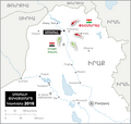
Map of Iraq - Battle of Mosul (hy).png 1,314 × 1,244; 170 KB
-
Map of Noravank.gif 500 × 438; 31 KB
-
Map of the Districts of Istanbul (hy).png 2,177 × 1,394; 497 KB
-
Map of the Legal systems of the world (HY - հայերեն).png 3,564 × 1,870; 661 KB
-
Map of Turkey (hy).png 1,268 × 728; 421 KB
-
Map of Turkey001 (hy).png 1,881 × 1,071; 225 KB
-
Matenadaran (021).jpg 7,152 × 5,368; 5.01 MB
-
Melanesia map (hy).png 497 × 500; 15 KB
-
Mexican States with mafia conflicts (hy).png 3,298 × 2,085; 474 KB
-
Morocco Protectorate (hy).png 406 × 388; 25 KB
-
Mountainous Armenia.png 450 × 377; 20 KB
-
NK-Map (hy).svg 443 × 300; 156 KB
-
Ocean .png 800 × 800; 199 KB
-
Orontid Armenia -250-hy.svg 2,717 × 1,595; 757 KB
-
Orontid Armenia.png 1,000 × 575; 42 KB
-
Plan of Yerevan WDL9873.png 1,394 × 1,024; 2.18 MB
-
Political map of Canada (hy).png 1,280 × 1,107; 264 KB
-
Population of Iceland by regions (2019) (HY).png 8,000 × 4,500; 856 KB
-
Poverty rate in Armenia by regions, 2021.png 8,347 × 8,542; 866 KB
-
Promised Land Armenian map.jpg 411 × 310; 84 KB
-
QuartersofJerusalemnogatesArmenian.png 973 × 874; 312 KB
-
Regions of Georgia (hy).png 774 × 424; 88 KB
-
Religion distribution Africa crop-hy.png 1,147 × 1,103; 213 KB
-
Rivers of Armenia and Artsakh.png 1,708 × 1,374; 946 KB
-
Roumdigin.JPG 2,175 × 2,844; 1.89 MB
-
Routes of the Spanish Armada (հայերեն - hy).png 415 × 756; 62 KB
-
Rzeczpospolita-map-hy.png 3,507 × 2,480; 3.05 MB
-
San-Stefano borders (hy).png 1,276 × 1,279; 604 KB
-
Sestieri di Venezia (Armenian).png 5,120 × 3,026; 1.34 MB
-
Sierra Leone Provinces-hy.png 443 × 442; 14 KB
-
Six Day War Territories (hy).png 800 × 1,200; 128 KB
-
South Estonian today-hy.png 531 × 356; 47 KB
-
Soviet Armenia-arm.png 936 × 754; 69 KB
-
Soviet Caucasus and adjacent areas (hy).png 871 × 403; 88 KB
-
Temperature Bar Chart Africa--1901-2020--2021-07-14-hy.png 3,072 × 1,727; 65 KB
-
The old Europe mapSL.png 745 × 615; 29 KB
-
Tigranakert (Tigranocerta) battle in 69 BC (Armenian).png 700 × 434; 53 KB
-
Tpagrichner street map, Yerevan.png 563 × 562; 313 KB
-
TreugKhalaib m (hy).png 1,979 × 1,640; 444 KB
-
Turkey koppen (hy).png 1,024 × 704; 211 KB
-
United Kingdom map in Armenian.png 276 × 598; 84 KB
-
Vegetation Africa-hy.png 2,118 × 1,279; 820 KB
-
Vinland-travel-hy.jpg 1,214 × 1,600; 488 KB
-
Western Armenia and Cilicia.png 1,636 × 984; 56 KB
-
World cup african countries best results and hosts (Armenian).png 3,072 × 2,990; 1.13 MB
-
Xarberdi vilayet.JPG 1,942 × 2,079; 1.7 MB
-
Yeremia Chelebi Keomurjian (2).jpeg 2,520 × 2,630; 2.37 MB
-
Աբբասյան խալիֆայություն.png 800 × 487; 103 KB
-
Ալեքսանդր Մակեդոնացու տիրակալության սահմանները (hy).png 1,146 × 577; 178 KB
-
Ալեքսանդրյան արշավանքներ - hy.svg 1,243 × 673; 353 KB
-
Աշխարհի քաղաքական քարտեզ.png 3,136 × 1,725; 270 KB
-
Ավստրիայի վարչական բաժանում.png 800 × 446; 66 KB
-
Արևմտյան Ֆրանսիան 10-րդ դարում.png 1,801 × 1,643; 662 KB
-
Բաթման.png 601 × 599; 105 KB
-
Բաքվի նավթի խողովակաշար.png 637 × 405; 24 KB
-
Բոսֆորի և Դարդանելի նեղուցներ (hy).png 637 × 459; 69 KB
-
Երևանի նահանգ.png 626 × 599; 50 KB
-
Եփրատի վահան ռազմագործողություն.png 1,622 × 1,032; 157 KB
-
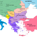
Թրակիան Հարավային Եվրոպայում.png 645 × 387; 22 KB
-
Ժողովուրդների Մեծ գաղթ.png 1,545 × 773; 233 KB
-
Լեռնային Ղարաբաղի Հանրապետությունը Հարավային Կովկասում.png 1,053 × 694; 179 KB
-
Կատարի վարչական բաժանում.png 556 × 599; 55 KB
-
Հայաստանը վաղ միջնադարում.svg 2,710 × 1,740; 830 KB
-
Հայաստանի Հանրապետություն և ԼՂՀ.png 517 × 421; 42 KB


