Category:Amisfield
Jump to navigation
Jump to search
village in Dumfries and Galloway, Scotland, UK | |||||
| Upload media | |||||
| Instance of | |||||
|---|---|---|---|---|---|
| Location |
| ||||
 | |||||
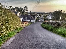
English: Amisfield is a village in the Civil Parish of Tinwald, Scotland, in en:Dumfriesshire within the District Council Region of Dumfries and Galloway, Scotland.
Subcategories
This category has the following 2 subcategories, out of 2 total.
A
- Amisfield Burn (4 F)
- Amisfield Tower (4 F)
Media in category "Amisfield"
The following 12 files are in this category, out of 12 total.
-
Amisfield Burn - geograph.org.uk - 354752.jpg 640 × 480; 175 KB
-
Amisfield sa chiardh.jpg 960 × 708; 117 KB
-
Amisfield station site geograph-3232384-by-Ben-Brooksbank.jpg 2,319 × 1,320; 2.78 MB
-
Amisfield Village Hall - geograph.org.uk - 1052082.jpg 640 × 355; 43 KB
-
Amisfield.jpg 640 × 480; 291 KB
-
Fields Near Amisfield - geograph.org.uk - 354755.jpg 640 × 480; 171 KB
-
Harleyrigg Farm - geograph.org.uk - 767601.jpg 640 × 406; 38 KB
-
Mapa dg amisfield.jpg 2,004 × 1,363; 599 KB
-
Minor Road at Mill Lands - geograph.org.uk - 287566.jpg 640 × 480; 214 KB
-
Minor Road Near Amisfield - geograph.org.uk - 354693.jpg 640 × 480; 204 KB
-
Water of Ae - geograph.org.uk - 289421.jpg 640 × 480; 189 KB


