Category:Aerial photographs of South Lanarkshire
Jump to navigation
Jump to search
Council areas (municipalities) of Scotland: Aberdeen · Aberdeenshire · Angus · Argyll and Bute · Clackmannanshire · Dumfries and Galloway · Dundee · East Ayrshire · East Dunbartonshire · East Lothian · East Renfrewshire · Edinburgh · Falkirk · Fife · Glasgow · Highland · Inverclyde · Midlothian · Moray · North Ayrshire · North Lanarkshire · Outer Hebrides · Orkney Islands · Perth and Kinross · Renfrewshire · Scottish Borders · Shetland Islands · South Ayrshire · South Lanarkshire · Stirling · West Dunbartonshire · West Lothian
Media in category "Aerial photographs of South Lanarkshire"
The following 45 files are in this category, out of 45 total.
-
-

-
 Blantyre and the River Clyde from the air (geograph 5716649).jpg 640 × 480; 249 KB
-

-

-
 Blantyre and the River Clyde from the air (geograph 5716664).jpg 640 × 480; 245 KB
-
 Blantyre Technology Park from the air (geograph 2988862).jpg 640 × 480; 173 KB
-
 Burnbank and Strathclyde Loch from the air (geograph 5716687).jpg 640 × 480; 244 KB
-
 Cambuslang from the air (geograph 4517259) (burnside).jpg 347 × 260; 88 KB
-
 Cambuslang from the air (geograph 4517259) (rglen sth).jpg 483 × 362; 149 KB
-
 Cambuslang from the air (geograph 4517259).jpg 640 × 480; 221 KB
-
 Cambuslang from the air (geograph 5374281) (eastfield).jpg 326 × 245; 62 KB
-
 Cambuslang from the air (geograph 5374281).jpg 640 × 480; 189 KB
-
 Carmyle and the east end from the air (geograph 2987415).jpg 640 × 480; 177 KB
-
 Castlemilk and Cathkin Braes from the air (geograph 4517246).jpg 640 × 480; 209 KB
-
 Cathkin Braes from the air - geograph.org.uk - 4517241.jpg 640 × 480; 188 KB
-
 East Glasgow from the air (geograph 5374271).jpg 640 × 480; 188 KB
-
 East Glasgow motorways from the air (geograph 5995108).jpg 1,024 × 768; 363 KB
-
 East Kilbride from the air (geograph 2988852).jpg 640 × 480; 164 KB
-
 East Kilbride from the air (geograph 4377822).jpg 640 × 480; 173 KB
-
 East Kilbride from the air (geograph 5379555).jpg 640 × 413; 138 KB
-
 East Kilbride from the air - geograph.org.uk - 2797672.jpg 640 × 404; 136 KB
-
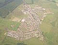
 Flying High over Biggar - geograph.org.uk - 116362.jpg 640 × 480; 133 KB
-
 Greenleeshill from the air (geograph 5379548).jpg 640 × 445; 140 KB
-
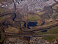
 Hamilton and Strathclyde Park from the air (geograph 5995114).jpg 1,024 × 768; 460 KB
-
 Hamilton from the air (geograph 4601078).jpg 640 × 480; 201 KB
-
 Hamilton from the air (geograph 4601082).jpg 640 × 480; 187 KB
-
 Hamilton from the air (geograph 5379561).jpg 640 × 480; 142 KB
-
 Hamilton from the air (geograph 5716697).jpg 640 × 480; 280 KB
-
 Lanark from the air (geograph 5680777).jpg 640 × 480; 216 KB
-
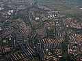
 Larkhall from the air - geograph.org.uk - 6057743.jpg 1,024 × 768; 342 KB
-
 Maryville Interchange from the air (geograph 7169753).jpg 1,600 × 1,200; 588 KB
-
 Meikle Earnock from the air (geograph 2988865).jpg 640 × 480; 167 KB
-
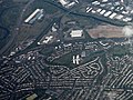
 Netherburn from the air (geograph 5995131).jpg 1,024 × 768; 332 KB
-
 New Douglas Park from the air (geograph 5716591).jpg 640 × 480; 181 KB
-
 Newton and Cambuslang from the air (geograph 2988822) (cropped).jpg 615 × 384; 157 KB
-
 Newton and Cambuslang from the air (geograph 2988822).jpg 640 × 480; 190 KB
-
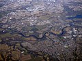
 Road, rail and river from the air (geograph 5716630).jpg 640 × 480; 219 KB
-
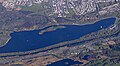 Strathclyde Loch (GBR) 2018.jpg 324 × 179; 50 KB
-
 The M74 Junction 6 (Hamilton) from the air (geograph 5719064).jpg 640 × 480; 205 KB
-
 The River Clyde and the M74 motorway (geograph 5716617) (cropped).jpg 418 × 400; 133 KB
-
 The River Clyde and the M74 motorway (geograph 5716617).jpg 480 × 640; 215 KB
-
 The River Clyde from the air (geograph 5719037).jpg 640 × 480; 223 KB
-
 Tinto Hill - geograph.org.uk - 859281.jpg 640 × 411; 91 KB
-
 Whitelee wind farm from the air - geograph.org.uk - 2988896.jpg 640 × 480; 98 KB


.jpg)
_(cropped2).jpg)
.jpg)
.jpg)
.jpg)
_(burnside).jpg)
_(rglen_sth).jpg)
.jpg)
_(eastfield).jpg)
.jpg)
.jpg)
.jpg)

.jpg)
.jpg)
.jpg)
.jpg)
.jpg)


.jpg)
.jpg)
.jpg)
.jpg)
.jpg)
.jpg)
.jpg)

.jpg)
.jpg)
.jpg)
.jpg)
_(cropped).jpg)
.jpg)
.jpg)
_2018.jpg)
_from_the_air_(geograph_5719064).jpg)
_(cropped).jpg)
.jpg)
.jpg)


_(cropped).jpg)