Category:Aerial photographs of South Ayrshire
Jump to navigation
Jump to search
Council areas (municipalities) of Scotland: Aberdeen · Aberdeenshire · Angus · Argyll and Bute · Clackmannanshire · Dumfries and Galloway · Dundee · East Ayrshire · East Dunbartonshire · East Lothian · East Renfrewshire · Edinburgh · Falkirk · Fife · Glasgow · Highland · Inverclyde · Midlothian · Moray · North Ayrshire · North Lanarkshire · Outer Hebrides · Orkney Islands · Perth and Kinross · Renfrewshire · Scottish Borders · Shetland Islands · South Ayrshire · South Lanarkshire · Stirling · West Dunbartonshire · West Lothian
Subcategories
This category has only the following subcategory.
Media in category "Aerial photographs of South Ayrshire"
The following 17 files are in this category, out of 17 total.
-
 Airshire Crossraguel Abbey Aerial Pan180.jpg 8,192 × 2,724; 19.97 MB
-
 Airshire Crossraguel Abbey Aerial topview.jpg 5,472 × 3,648; 17.16 MB
-
 Airshire Crossraguel Abbey Aerial.jpg 5,472 × 3,648; 15.74 MB
-
 Ayrshire Dunure Aerial.jpg 5,472 × 3,648; 16.19 MB
-
 Castle and Lighthouse, Ailsa Craig (cropped).jpg 572 × 399; 82 KB
-
 Castle and Lighthouse, Ailsa Craig.jpg 640 × 446; 99 KB
-
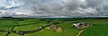
 Kirkmichael village from the air - geograph.org.uk - 992794.jpg 600 × 431; 168 KB
-
 Kirkmichael village from the air 992794.jpg 594 × 428; 66 KB
-
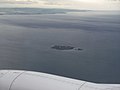 Lady Isle - geograph.org.uk - 1440445.jpg 640 × 480; 34 KB
-
 Prestwick from the air 1.jpg 1,024 × 768; 68 KB
-
 Prestwick from the air 2.jpg 680 × 680; 182 KB
-
 South Ayrshire and the Firth of Clyde - geograph.org.uk - 1714763.jpg 3,872 × 2,160; 2.02 MB
-
 South Sands at Troon (geograph 2923035).jpg 3,264 × 2,448; 3.6 MB
-
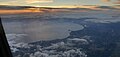 Sunset taken from an aircraft above Firth of Clyde.jpg 4,032 × 1,908; 3 MB
-
 Troon From The Air - geograph.org.uk - 1440452.jpg 640 × 480; 73 KB
-
 Troon from the air - geograph.org.uk - 2138844.jpg 2,592 × 1,429; 2.62 MB
-
 Troon town centre (geograph 2923025).jpg 3,264 × 2,448; 3.68 MB


.jpg)


.jpg)


.jpg)