Category:Aerial photographs of Mississippi
Jump to navigation
Jump to search
States of the United States: Alabama · Alaska · Arizona · Arkansas · California · Colorado · Connecticut · Delaware · Florida · Georgia · Hawaii · Idaho · Illinois · Indiana · Iowa · Kansas · Kentucky · Louisiana · Maine · Maryland · Massachusetts · Michigan · Minnesota · Mississippi · Missouri · Montana · Nebraska · Nevada · New Hampshire · New Jersey · New Mexico · New York · North Carolina · North Dakota · Ohio · Oklahoma · Oregon · Pennsylvania · Rhode Island · South Carolina · South Dakota · Tennessee · Texas · Utah · Vermont · Virginia · Washington · West Virginia · Wisconsin · Wyoming – District of Columbia: Washington, D.C.
insular area of the United States: American Samoa · Guam · Northern Mariana Islands · Puerto Rico · United States Virgin Islands – United States Minor Outlying Islands: Baker Island · Midway Atoll · Wake Island
insular area of the United States: American Samoa · Guam · Northern Mariana Islands · Puerto Rico · United States Virgin Islands – United States Minor Outlying Islands: Baker Island · Midway Atoll · Wake Island
English: Aerial photographs of the U.S. state of Mississippi
Subcategories
This category has the following 5 subcategories, out of 5 total.
A
Media in category "Aerial photographs of Mississippi"
The following 71 files are in this category, out of 71 total.
-
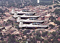 14og-t6texaniis-overcolumbus.jpg 1,000 × 714; 322 KB
-
 1927 Mississippi Flood Greenville Mississippi.jpg 1,621 × 1,193; 1.55 MB
-

-
 A maze of waterways on the Mississippi Coast near Bay St. Louis (5593934295).jpg 3,504 × 2,336; 5.75 MB
-
 A maze of waterways on the Mississippi Coast near Bay St. Louis (5594524372).jpg 2,742 × 2,074; 4.08 MB
-
 A maze of waterways on the Mississippi Coast near Bay St. Louis (5594527164).jpg 2,984 × 2,275; 5.37 MB
-
 A maze of waterways on the Mississippi Coast near Bay St. Louis (5594530248).jpg 3,504 × 2,336; 5.66 MB
-
 A maze of waterways on the Mississippi Coast near Bay St. Louis (5594556500).jpg 3,648 × 2,736; 7.83 MB
-
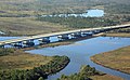
 Aerial Minneapolis and Mississippi River Bridges (17379653566).jpg 3,264 × 2,448; 6.21 MB
-

-

-

-
 Aerial shot of sandbars near Bay St.Louis, MS (5593958775).jpg 3,456 × 2,064; 4.74 MB
-
 Aerial shot of sandbars near Bay St.Louis, MS (5593961735).jpg 3,648 × 2,736; 6.05 MB
-
 Aerial shot of sandbars near Bay St.Louis, MS (5594542884).jpg 2,336 × 3,504; 4.95 MB
-
 Aerial shot of sandbars near Bay St.Louis, MS (5594552568).jpg 3,648 × 2,736; 5.84 MB
-
 Aerial, 1950 (12933469255).jpg 6,039 × 4,835; 2.34 MB
-
 FEMA - 14965 - Photograph by Mark Wolfe taken on 09-07-2005 in Mississippi.jpg 3,008 × 2,000; 1.58 MB
-
 FEMA - 16964 - Photograph by John Fleck taken on 10-04-2005 in Mississippi.jpg 2,000 × 3,008; 3.8 MB
-
 FEMA - 16965 - Photograph by John Fleck taken on 10-04-2005 in Mississippi.jpg 3,008 × 2,000; 8.76 MB
-
 FEMA - 16966 - Photograph by John Fleck taken on 10-04-2005 in Mississippi.jpg 2,000 × 3,008; 4.32 MB
-
 FEMA - 16967 - Photograph by John Fleck taken on 10-04-2005 in Mississippi.jpg 2,000 × 3,008; 4.33 MB
-
 FEMA - 16968 - Photograph by John Fleck taken on 10-04-2005 in Mississippi.jpg 3,008 × 2,000; 4.44 MB
-
 FEMA - 16970 - Photograph by John Fleck taken on 10-04-2005 in Mississippi.jpg 3,008 × 2,000; 4.95 MB
-
 FEMA - 17195 - Photograph by John Fleck taken on 10-04-2005 in Mississippi.jpg 3,008 × 2,000; 4.84 MB
-

-

-
 FEMA - 18200 - Photograph by Mark Wolfe taken on 10-30-2005 in Mississippi.jpg 3,008 × 2,000; 1.9 MB
-
 FEMA - 18202 - Photograph by Mark Wolfe taken on 10-30-2005 in Mississippi.jpg 3,008 × 2,000; 2.38 MB
-
 FEMA - 18203 - Photograph by Mark Wolfe taken on 10-30-2005 in Mississippi.jpg 3,008 × 2,000; 2.04 MB
-
 FEMA - 18204 - Photograph by Mark Wolfe taken on 10-30-2005 in Mississippi.jpg 3,008 × 2,000; 1.91 MB
-
 FEMA - 18205 - Photograph by Mark Wolfe taken on 10-30-2005 in Mississippi.jpg 3,008 × 2,000; 2.29 MB
-
 FEMA - 18206 - Photograph by Mark Wolfe taken on 10-30-2005 in Mississippi.jpg 3,008 × 2,000; 2.31 MB
-
 FEMA - 18207 - Photograph by Mark Wolfe taken on 10-30-2005 in Mississippi.jpg 3,008 × 2,000; 2.52 MB
-
 FEMA - 18258 - Photograph by Mark Wolfe taken on 10-30-2005 in Mississippi.jpg 3,008 × 2,000; 2.54 MB
-
 FEMA - 18262 - Photograph by Mark Wolfe taken on 10-30-2005 in Mississippi.jpg 3,008 × 2,000; 2.37 MB
-
 FEMA - 20821 - Photograph by Mark Wolfe taken on 12-10-2005 in Mississippi.jpg 3,008 × 2,000; 1.61 MB
-
 Fish Hatchery Ponds - Between Itta Bena and Sunflower, Mississipp.jpg 1,600 × 2,400; 1.87 MB
-
 FortMass20020410.jpg 1,856 × 1,392; 887 KB
-

-
 I-10 Aerial Facing West Near Gulfport MS (41280227225).jpg 1,600 × 2,400; 2.27 MB
-
 Int55AerialMS-Exit105-NTP-Ridgeland (38290362701).jpg 2,400 × 1,600; 2.22 MB
-
 Int55AerialMS-Exit107-ColonyParkBlvd (38290362161).jpg 2,400 × 1,600; 1.72 MB
-
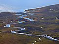
 Little Tallahatchee River Aerial (29945156501).jpg 1,600 × 2,400; 1.89 MB
-
 Louisiana - Natohez - NARA - 23940441.jpg 4,385 × 3,382; 3.09 MB
-
 Mississippi - Vicksburg - NARA - 23941725.jpg 4,385 × 3,382; 2.26 MB
-

-
 Mississippi State Capitol - Flickr - shawnzrossi.jpg 2,048 × 1,536; 673 KB
-
 MissStatePenAerialMapFeb211992Unit29.png 682 × 634; 343 KB
-
 MissStatePenAerialMapFebruary211992.png 1,472 × 1,088; 1.26 MB
-
 MS25sRoadAerial-JacksonSkyline-Nov2017 (38290364241).jpg 1,600 × 2,400; 2.14 MB
-
 MS67 Facing North Aerial (41280225405).jpg 1,600 × 2,400; 1.86 MB
-
 NAS Meridian NAN12-63.jpg 854 × 535; 163 KB
-
 New & Old Vicksburg bridge.jpg 2,672 × 1,912; 3.72 MB
-
 NorthparkMall-CountyLineRdAerial-RidgelandMS (38290363241).jpg 2,400 × 1,600; 2.11 MB
-
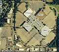 NorthparkMall.jpg 709 × 621; 144 KB
-
 On final approach to a private airstrip (5593956213).jpg 2,191 × 2,119; 2.44 MB
-
 Original LAMP Site With Existing Ingalls Shipyard In Foreground (16194793557).jpg 6,016 × 4,843; 4.23 MB
-
 ParkwayEastAerial-MadisonMS (38290361671).jpg 2,400 × 1,600; 2.5 MB
-
 Petit Bois Island.JPG 1,800 × 1,800; 678 KB
-
 Rodney Profile.jpg 3,561 × 2,250; 2.04 MB
-
 The Bay St. Louis bridge and a railroad bridge from above (5594534798).jpg 3,456 × 2,230; 4.39 MB
-
 The Bay St. Louis bridge from above (5593952797).jpg 3,466 × 1,386; 2.63 MB
-
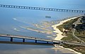
 The I-10 bridge in MS (5594519160).jpg 3,433 × 2,119; 4.8 MB
-
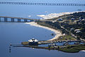 The Yacht Club and bridges near Bay St. Louis (5594532596).jpg 3,504 × 2,336; 4.67 MB
-
 Turtle Creek Mall.jpg 462 × 446; 89 KB
-

-
 US49 Aerial Facing South Towards US90 Gulfport (42180843281).jpg 1,600 × 2,400; 1.71 MB
-
 US49 Facing North Aerial (42180842021).jpg 2,400 × 1,600; 2.18 MB
-
 VA Medical Center (Gulfport, MS).jpg 465 × 381; 188 KB
-
 Vicksburg harbor aerial view.jpg 1,500 × 1,000; 515 KB


.jpg)
.jpg)
.jpg)
.jpg)
.jpg)
.jpg)


.jpg)
.jpg)
.jpg)
.jpg)
.jpg)


.jpg)
.jpg)


.jpg)
.jpg)
.jpg)
.jpg)


.jpg)
.jpg)


.jpg)

.jpg)
.jpg)
.jpg)


.jpg)
.jpg)
.jpg)


.jpg)
.jpg)
.jpg)

.jpg)