Category:Aerial photographs of Idaho
Jump to navigation
Jump to search
States of the United States: Alabama · Alaska · Arizona · Arkansas · California · Colorado · Connecticut · Delaware · Florida · Georgia · Hawaii · Idaho · Illinois · Indiana · Iowa · Kansas · Kentucky · Louisiana · Maine · Maryland · Massachusetts · Michigan · Minnesota · Mississippi · Missouri · Montana · Nebraska · Nevada · New Hampshire · New Jersey · New Mexico · New York · North Carolina · North Dakota · Ohio · Oklahoma · Oregon · Pennsylvania · Rhode Island · South Carolina · South Dakota · Tennessee · Texas · Utah · Vermont · Virginia · Washington · West Virginia · Wisconsin · Wyoming – District of Columbia: Washington, D.C.
insular area of the United States: American Samoa · Guam · Northern Mariana Islands · Puerto Rico · United States Virgin Islands – United States Minor Outlying Islands: Baker Island · Midway Atoll · Wake Island
insular area of the United States: American Samoa · Guam · Northern Mariana Islands · Puerto Rico · United States Virgin Islands – United States Minor Outlying Islands: Baker Island · Midway Atoll · Wake Island
Subcategories
This category has the following 3 subcategories, out of 3 total.
Media in category "Aerial photographs of Idaho"
The following 106 files are in this category, out of 106 total.
-

-
 160601-A-MB149-1081.JPG 3,016 × 2,480; 883 KB
-
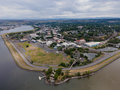
 2009-0603-11-Air-coeurdalene.jpg 2,676 × 2,082; 4.95 MB
-
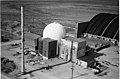
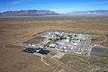 Advanced Test Reactor - Aerial View 001.jpg 1,500 × 1,000; 1.78 MB
-
 Aerial - Cabinet Gorge Dam, Idaho 01 (9968339206).jpg 4,288 × 2,848; 4.03 MB
-
 Aerial - Cabinet Gorge Dam, Idaho 01 - white balanced (9968311085).jpg 4,288 × 2,848; 6.32 MB
-
 Aerial - Clark Fork, Idaho 01 (9968332533).jpg 4,288 × 2,848; 4.78 MB
-
 Aerial - Clark Fork, Idaho 01 - white balanced (9968314236).jpg 4,288 × 2,848; 8.08 MB
-
 Aerial - Clark Fork, Idaho 02 (9968244013).jpg 4,288 × 2,848; 4.8 MB
-
 Aerial - Clark Fork, Idaho 02 - cropped, colors re-balanced.jpg 1,534 × 1,133; 1.47 MB
-
 Aerial - Clark Fork, Idaho 02 - white balanced (9968224816).jpg 4,288 × 2,848; 7.71 MB
-
 Aerial - Hayden Lake, ID 01 (9968008815).jpg 4,288 × 2,848; 4.7 MB
-
 Aerial - Hayden Lake, ID 01 - white balanced (9968139386).jpg 4,288 × 2,848; 9.33 MB
-
 Aerial - Hayden Lake, ID 02 (9967955954).jpg 4,288 × 2,848; 4.66 MB
-
 Aerial - Hayden Lake, ID 02 - white balanced (9967978595).jpg 4,288 × 2,848; 9.06 MB
-
 Aerial - Hayden Lake, ID 03 (9967904816).jpg 2,848 × 4,288; 4.8 MB
-
 Aerial - Hayden Lake, ID 03 - white balanced (9967964256).jpg 2,848 × 4,288; 8.67 MB
-
 Aerial - Hayden Lake, ID 04 (9967645204).jpg 4,288 × 2,848; 4.36 MB
-
 Aerial - Hayden Lake, ID 04 - white balanced (9967698885).jpg 4,288 × 2,848; 8.31 MB
-
 Aerial - Hayden Lake, ID 05 (9967875173).jpg 4,288 × 2,848; 4.17 MB
-
 Aerial - Hayden Lake, ID 05 - white balanced (9967837134).jpg 4,288 × 2,848; 10.33 MB
-
 Aerial - Lake Pend Oreille, Idaho 01 (9967579334).jpg 4,288 × 2,848; 3.65 MB
-
 Aerial - Lake Pend Oreille, Idaho 01 - white balanced (9967578025).jpg 4,288 × 2,848; 5.45 MB
-
 Aerial - Lake Pend Oreille, Idaho 02 (9967555586).jpg 4,288 × 2,848; 4.98 MB
-
 Aerial - Lake Pend Oreille, Idaho 02 - white balanced (9967555224).jpg 4,288 × 2,848; 6.23 MB
-
 Aerial - Lake Pend Oreille, Idaho 03 (9967411425).jpg 4,288 × 2,848; 4.84 MB
-
 Aerial - Lake Pend Oreille, Idaho 03 - white balanced (9967483814).jpg 4,288 × 2,848; 6.05 MB
-
 Aerial - Lake Pend Oreille, Idaho 04 (9967370534).jpg 4,288 × 2,848; 4.07 MB
-
 Aerial - Lake Pend Oreille, Idaho 04 - white balanced (9967377965).jpg 4,288 × 2,848; 6.14 MB
-
 Aerial - Lake Pend Oreille, Idaho 05 (9967337106).jpg 4,288 × 2,848; 4.77 MB
-
 Aerial - Lake Pend Oreille, Idaho 05 - white balanced (9967446913).jpg 4,288 × 2,848; 7.66 MB
-
 Aerial - Northeast shore of Lake Pend Oreille, Idaho 01 (9967180635).jpg 4,288 × 2,848; 4.62 MB
-
 Aerial - Northeast shore of Lake Pend Oreille, Idaho 01 - white balanced (9967227605).jpg 4,288 × 2,848; 7.15 MB
-
 Aerial - northwest Coeur dAlene, ID 01 (9966854444).jpg 4,288 × 2,848; 4.88 MB
-
 Aerial - northwest Coeur dAlene, ID 01 - white balanced (9966870225).jpg 4,288 × 2,848; 8.14 MB
-
 Aerial - Pend Oreille River, Idaho 01 (9967244133).jpg 4,288 × 2,848; 4.54 MB
-
 Aerial - Pend Oreille River, Idaho 01 - white balanced (9967186074).jpg 4,288 × 2,848; 7.76 MB
-
 Aerial - Post Falls, ID 01 (9967068734).jpg 4,288 × 2,848; 4.41 MB
-
 Aerial - Post Falls, ID 01 - white balanced (9967076165).jpg 4,288 × 2,848; 6.75 MB
-
 Aerial - Post Falls, ID 02 (9966999234).jpg 2,848 × 4,288; 4.4 MB
-
 Aerial - Post Falls, ID 02 - white balanced (9967147913).jpg 2,848 × 4,288; 6.98 MB
-
 Aerial - U.S. 95 in Idaho, north toward Cocolalla Lake (9966893725).jpg 4,288 × 2,848; 4.07 MB
-
 Aerial - U.S. 95 in Idaho, north toward Cocolalla Lake - white balanced (9967078033).jpg 4,288 × 2,848; 7.52 MB
-
 Aerial view of Priest Lake Idaho.jpg 1,200 × 868; 642 KB
-
 American Falls Dam (4306997278).jpg 800 × 600; 112 KB
-
 Arrowrock Dam Aerial Video Clip (14932267468).jpg 1,920 × 1,080; 125 KB
-

-

-

-

-

-
 Advanced Test Reactor - Aerial View 002.jpg 1,500 × 1,000; 1.8 MB
-
 HD.6D.009 (10727725724).jpg 3,200 × 2,578; 1.17 MB
-
 BigSpringsAerialView.jpg 1,200 × 1,693; 1.2 MB
-
 Boise aerial 2007.jpg 2,832 × 2,128; 1.18 MB
-
 Borah Peak (12,668' in background, Lost River Range, Idaho - panoramio.jpg 2,552 × 1,912; 1.82 MB
-
 Caldwell, Idaho aerial view.jpg 1,024 × 576; 428 KB
-
 CanyonCounty.jpg 640 × 427; 175 KB
-

-

-

-

-
 Challis, Idaho - panoramio.jpg 2,552 × 1,912; 2.35 MB
-
 Coeur d'Alene aerial, May 2023 (cropped).png 2,000 × 1,243; 4.04 MB
-
 Coeur d'Alene aerial, May 2023.png 2,000 × 1,500; 4.95 MB
-
 Coeur d'Alene National Forest 99-6306 (5880735683).jpg 2,551 × 2,730; 2.9 MB
-
 Coeur d'Alene National Forest 99-6307 (5880736443).jpg 2,551 × 2,720; 2.91 MB
-
 Coeur d'Alene National Forest 99-6308 (5881298044).jpg 2,551 × 2,710; 2.85 MB
-
 Diversion Dam and Deer Flat Embankments.jpg 3,958 × 3,098; 1.39 MB
-
 Drone view from Kellogg, Idaho.jpg 8,064 × 6,048; 25.28 MB
-
 EBR-II complex.jpg 553 × 467; 85 KB
-
 Emmett ID aerial.jpg 800 × 600; 414 KB
-
 Gooding, Idaho 2011.07.09.jpg 2,048 × 1,365; 713 KB
-
 ID Twin Falls 238588 1976 24000 geo.tif 6,433 × 8,046, 8 pages; 11.76 MB
-
 Idaho Chemical Processing Plant.jpg 536 × 336; 105 KB
-
 Idaho Falls Campus.jpg 1,500 × 1,000; 1.82 MB
-
 Lewiston ID aerial, May 2023.png 2,000 × 1,500; 4.87 MB
-
 Loss of Fluid Test Reactor.jpg 750 × 495; 116 KB
-
 Materials & Fuels Complex.jpg 1,500 × 996; 1.83 MB
-
 MODIS 2015-213 - Wolverine Fire and smoke over Washington and Idaho.jpg 3,600 × 2,800; 1.95 MB
-
 Moscow Idaho aerial, May 2023.png 2,000 × 1,500; 5.61 MB
-
 Mountain Views from Hell's Canyon Overlook, Wallowa Whitman National Forest (24500837424).jpg 4,928 × 3,264; 11.55 MB
-

-
 New Meadows, Idaho - panoramio.jpg 2,415 × 1,811; 1.54 MB
-
 New Plymouth Aerial View.jpg 520 × 390; 43 KB
-
 Newdale ID.jpg 800 × 600; 111 KB
-
 Oxbow Dam, Hells Canyon, Snake River - panoramio.jpg 2,552 × 1,912; 2.63 MB
-
 Palisades Dam (4306260425).jpg 800 × 600; 130 KB
-
 Payette124d.jpg 679 × 491; 98 KB
-
 Perrine Bridge, Twin Falls, ID.jpg 4,384 × 3,288; 4.19 MB
-
 Redfish Lake, Idaho.jpg 3,264 × 2,448; 2.5 MB
-
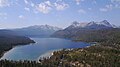 Redfish Lake, Sawtooth Range, Idaho.jpg 4,000 × 2,250; 3.62 MB
-
 Salmon ID - aerial.jpg 2,848 × 4,288; 5.27 MB
-
 Snake River summer aerial (34297741910).jpg 3,264 × 2,448; 1.7 MB
-
 Stanley ID - aerial.jpg 4,288 × 2,848; 3.5 MB
-
 T-17 Fire 2.jpg 5,616 × 2,904; 3.81 MB
-
 T-17 Fire 3.jpg 5,134 × 3,077; 2.39 MB
-
 T-17 Fire.jpg 4,711 × 2,745; 2.56 MB
-
 Thousand Springs Valley, Idaho - panoramio.jpg 2,552 × 1,912; 2.05 MB
-
 Transient Reactor Test Facility - Aerial View.jpg 1,350 × 900; 1.11 MB
-
 Troy Idaho aerial, May 2023.png 2,000 × 1,125; 4.28 MB
-

-
 Weiser High School oblique view.jpg 2,174 × 1,342; 1.86 MB
-
 Weiser ID - aerial.jpg 4,288 × 2,848; 5.49 MB
-
 Weiser, Idaho LCCN2007662251.tif 1,804 × 714; 3.69 MB
-
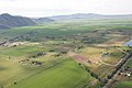 Wood River Valley aerial.jpg 4,288 × 2,848; 3.35 MB


.jpg)
.jpg)
.jpg)
.jpg)
.jpg)

.jpg)
.jpg)
.jpg)
.jpg)
.jpg)
.jpg)
.jpg)
.jpg)
.jpg)
.jpg)
.jpg)
.jpg)
.jpg)
.jpg)
.jpg)
.jpg)
.jpg)
.jpg)
.jpg)
.jpg)
.jpg)
.jpg)
.jpg)
.jpg)
.jpg)
.jpg)
.jpg)
.jpg)
.jpg)
.jpg)
.jpg)
.jpg)
.jpg)

.jpg)
.jpg)
_Visit_of_Secretary_Dirk_Kempthorne_to_southwestern_Idaho,_(where_he_took_an_aerial_tour_of_lands_affected_by_the_summer%27s)_Murphy_Complex_F_-_DPLA_-_21a8f42c0411fa9d0cfd11ac9476585b.JPG)
_Visit_of_Secretary_Dirk_Kempthorne_to_southwestern_Idaho,_(where_he_took_an_aerial_tour_of_lands_affected_by_the_summer%27s)_Murphy_Complex_F_-_DPLA_-_3cbead0fc8261fb3c2ae68fdff8e0c3e.JPG)
_Visit_of_Secretary_Dirk_Kempthorne_to_southwestern_Idaho,_(where_he_took_an_aerial_tour_of_lands_affected_by_the_summer%27s)_Murphy_Complex_F_-_DPLA_-_3f54638a133851d12cc3ec3160e85912.JPG)
_Visit_of_Secretary_Dirk_Kempthorne_to_southwestern_Idaho,_(where_he_took_an_aerial_tour_of_lands_affected_by_the_summer%27s)_Murphy_Complex_F_-_DPLA_-_efa522ded9566b558fe9c9c358f6ee09.JPG)
_Aerial_views_of_landscapes_in_Idaho,_taken_during_visit_of_Secretary_Dirk_Kempthorne_to_the_Boise_National_Forest_(area_to_observe_the_i_-_DPLA_-_50a46533815e403db13234c3ab7f750c.JPG)

.jpg)


.jpg)
.jpg)
.jpg)
.jpg)

.png)

.jpg)
.jpg)
.jpg)


.jpg)
.jpg)


.jpg)


.jpg)


