Category:A501 road (England)
Jump to navigation
Jump to search
road in central London, England   | |||||
| Upload media | |||||
| Instance of | |||||
|---|---|---|---|---|---|
| Location | |||||
| Transport network |
| ||||
| Connects with | |||||
| Has part(s) | |||||
| Partially coincident with | |||||
| |||||
Subcategories
This category has the following 6 subcategories, out of 6 total.
Media in category "A501 road (England)"
The following 48 files are in this category, out of 48 total.
-
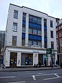
 Sainsbury's Local, City Road A501, London EC1.jpg 4,608 × 3,456; 3.84 MB
-
 Inmarsat Global HQ at 99 City Road (A501), London EC1.jpg 2,624 × 3,500; 4.57 MB
-
 A501 City Road - geograph.org.uk - 726192.jpg 640 × 480; 79 KB
-
 A501 City Road, looking east - geograph.org.uk - 726183.jpg 640 × 480; 66 KB
-
 A501 City Road, looking north - geograph.org.uk - 653572.jpg 640 × 480; 66 KB
-
 A501 City Road, looking south - geograph.org.uk - 653563.jpg 640 × 480; 82 KB
-
 A501 City Road, looking west - geograph.org.uk - 726185.jpg 640 × 480; 73 KB
-
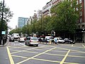
 A501 Euston Road Underpass (1) - geograph.org.uk - 671064.jpg 640 × 464; 73 KB
-
 A501 Euston Road Underpass (2) - geograph.org.uk - 671074.jpg 640 × 480; 84 KB
-
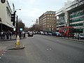
 A501, Marylebone Road - geograph.org.uk - 1396198.jpg 640 × 480; 107 KB
-
 A501, Marylebone Road - geograph.org.uk - 1396208.jpg 640 × 480; 111 KB
-
 A501, Marylebone Road - geograph.org.uk - 1396223.jpg 640 × 480; 85 KB
-
 A501, Marylebone Road - geograph.org.uk - 1396245.jpg 640 × 480; 97 KB
-
 A501, Marylebone Road - geograph.org.uk - 1396253.jpg 640 × 480; 78 KB
-
 Barclays Bank, City Rd - geograph.org.uk - 722870.jpg 480 × 640; 64 KB
-
 Box junction, Marylebone Road (A501) - geograph.org.uk - 1032957.jpg 640 × 480; 102 KB
-
 Camden Town Euston Road geograph-3004437-by-Ben-Brooksbank.jpg 2,394 × 1,438; 1.21 MB
-
 City Road London 2.jpg 748 × 575; 353 KB
-
 City Road, EC1 - geograph.org.uk - 1064963.jpg 640 × 480; 114 KB
-
 City Road, EC1 - geograph.org.uk - 416412.jpg 640 × 480; 148 KB
-
 Cityroad.jpg 2,112 × 2,816; 2.34 MB
-
 Eastern end of Marylebone Road.jpg 4,608 × 3,456; 5.41 MB
-
 End of Euston Road - geograph.org.uk - 434761.jpg 640 × 480; 93 KB
-
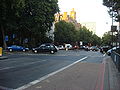
 Euston Road - geograph.org.uk - 443755.jpg 640 × 480; 104 KB
-
 Euston Road - geograph.org.uk - 723977.jpg 640 × 480; 111 KB
-
 Euston Road - geograph.org.uk - 946248.jpg 640 × 480; 94 KB
-
 Euston Road at Judd Street - geograph.org.uk - 1445027.jpg 640 × 480; 74 KB
-
 Euston Road at King's Cross - geograph.org.uk - 1445032.jpg 640 × 480; 57 KB
-
 Euston Road NW1 - geograph.org.uk - 1300083.jpg 479 × 640; 82 KB
-
 Euston Road underpass - geograph.org.uk - 951801.jpg 640 × 480; 113 KB
-
 London, Pentonville Road (geograph 4505306).jpg 640 × 480; 267 KB
-

-

-
 Marlyebone Road, London - panoramio.jpg 1,746 × 1,412; 1.89 MB
-
 Marylebone 033.jpg 3,648 × 2,736; 4.12 MB
-
 Marylebone Road - geograph.org.uk - 711811.jpg 640 × 480; 74 KB
-
 Marylebone Road 3 Dec 2016.jpg 4,608 × 3,456; 6.18 MB
-
 Marylebone Road at Baker Street Station - geograph.org.uk - 1750563.jpg 3,648 × 2,736; 2.59 MB
-
 Marylebone Road from Baker Street. - geograph.org.uk - 1552948.jpg 640 × 480; 70 KB
-
 Marylebone road large 2003.jpg 1,024 × 768; 159 KB
-
 Marylebone Road, NW1 - geograph.org.uk - 1025156.jpg 640 × 480; 85 KB
-
 Pentonville Road, N1 - geograph.org.uk - 415639.jpg 640 × 480; 134 KB
-

-
 Post Office on Euston Road - geograph.org.uk - 715867.jpg 640 × 480; 84 KB
-
 Sunset on the Euston Road - geograph.org.uk - 1041058.jpg 640 × 487; 51 KB
-

-
 UK road A501.PNG 568 × 184; 7 KB
-
 UK road A501.svg 446 × 191; 3 KB

,_London_EC1.jpg)


_-_geograph.org.uk_-_671064.jpg)
_-_geograph.org.uk_-_671074.jpg)


_-_geograph.org.uk_-_1032957.jpg)


.jpg)


