
Category:London Borough of Islington
Boroughs of London: City of London · City of Westminster · Barking and Dagenham · Barnet · Bexley · Brent · Bromley · Camden · Croydon · Ealing · Enfield · Greenwich · Hackney · Hammersmith and Fulham · Haringey · Harrow · Havering · Hillingdon · Hounslow · Islington · Kensington and Chelsea · Kingston · Lambeth · Lewisham · Merton · Newham · Redbridge · Richmond · Southwark · Sutton · Tower Hamlets · Waltham Forest · Wandsworth
borough in the London Region in England    | |||||
| Upload media | |||||
| Pronunciation audio | |||||
|---|---|---|---|---|---|
| Instance of | |||||
| Location | Greater London, London, England | ||||
| Capital | |||||
| Legislative body |
| ||||
| Executive body |
| ||||
| Head of government |
| ||||
| Inception |
| ||||
| Population |
| ||||
| Area |
| ||||
| Replaces | |||||
| Different from | |||||
| official website | |||||
 | |||||
Subcategories
This category has the following 24 subcategories, out of 24 total.
Media in category "London Borough of Islington"
The following 200 files are in this category, out of 2,940 total.
(previous page) (next page)-
-
 "Blue plaque" on Great Sutton Street, EC1 - geograph.org.uk - 6397249.jpg 1,200 × 1,600; 156 KB
-
 "Buxton", narrowboat on Regent's Canal by Islington tunnel - geograph.org.uk - 5763952.jpg 3,648 × 2,736; 3.48 MB
-
 "Clarissa II", narrowboat by towpath near Islington tunnel - geograph.org.uk - 5763957.jpg 3,648 × 2,736; 3.54 MB
-
 "Prosper", narrowboat on Regent's Canal, Islington - geograph.org.uk - 5762862.jpg 3,648 × 2,736; 3.05 MB
-
 "Quest" narrowboat by Wharf Road bridge - geograph.org.uk - 5763826.jpg 3,648 × 2,736; 3.57 MB
-
 "Widgeon" narrowboat by City Road Basin - geograph.org.uk - 5763841.jpg 3,648 × 2,736; 2.89 MB
-
 'Ghost sign', Angel, Islington - geograph.org.uk - 3595667.jpg 1,515 × 1,904; 1.77 MB
-
 'Oliekop' on the Regent's Canal - geograph.org.uk - 1923388.jpg 1,280 × 960; 183 KB
-
 'Tier' e-bike hire, Cowcross Street - geograph.org.uk - 7206559.jpg 1,600 × 1,200; 430 KB
-
 (Part of) Highbury Corner, N5 - geograph.org.uk - 3163893.jpg 640 × 480; 77 KB
-
 1 Islington High Street - geograph.org.uk - 6744771.jpg 810 × 1,024; 392 KB
-
 1-12 Wilmington Square - geograph.org.uk - 6120627.jpg 4,032 × 3,024; 3.53 MB
-
 1-4 Cruikshank Street - geograph.org.uk - 4515720.jpg 562 × 640; 230 KB
-
 12-33 Chadwell Street - geograph.org.uk - 4517275.jpg 543 × 640; 202 KB
-
 15-24 River Street - geograph.org.uk - 4518433.jpg 640 × 492; 207 KB
-
 156 Caledonian Road - geograph.org.uk - 4904690.jpg 640 × 427; 92 KB
-
 16 - 38 Barnsbury Road - geograph.org.uk - 6216387.jpg 1,024 × 678; 745 KB
-
 17 Tabley Road, Islington - geograph.org.uk - 3371783.jpg 3,216 × 4,288; 4.2 MB
-
 18-28 Arlington Way - geograph.org.uk - 4518401.jpg 494 × 640; 206 KB
-
 1906 horns.jpg 522 × 373; 37 KB
-
 1A Alwyne Place - geograph.org.uk - 3026029.jpg 640 × 480; 115 KB
-
 2-5 Mylne Street - geograph.org.uk - 4517260.jpg 640 × 519; 198 KB
-
 2-5 Owen's Row - geograph.org.uk - 4518386.jpg 640 × 508; 215 KB
-
 30 Crown Place and Broadgate Tower - geograph.org.uk - 4338331.jpg 1,280 × 960; 304 KB
-
 35-45 Skinner Street, EC1 - geograph.org.uk - 6154997.jpg 1,024 × 768; 220 KB
-
 37a Clerkenwell Green - geograph.org.uk - 2508571.jpg 636 × 456; 167 KB
-
 38 Graham Street N1 - geograph.org.uk - 4748388.jpg 640 × 480; 112 KB
-
 4 new houses, Sotheby Road - geograph.org.uk - 3050746.jpg 640 × 480; 76 KB
-
 42-57 Turpin Way N19 - geograph.org.uk - 2211011.jpg 640 × 480; 75 KB
-
 43 - 46, Chiswell St (geograph 6531403).jpg 684 × 1,024; 174 KB
-
 51, Calthorpe Street, WC1 - geograph.org.uk - 4749584.jpg 640 × 428; 99 KB
-
 54 - 60 Liverpool Road - geograph.org.uk - 6216832.jpg 1,024 × 678; 708 KB
-
 59-75 Pentonville Road - geograph.org.uk - 6744765.jpg 1,024 × 798; 532 KB
-
 77 Caledonian Road, Islington - geograph.org.uk - 7373103.jpg 967 × 1,280; 411 KB
-
 8-10 Charterhouse Buildings, Clerkenwell - geograph.org.uk - 5236978.jpg 1,599 × 1,789; 632 KB
-
-
 99 St John Street, Clerkenwell - geograph.org.uk - 4766424.jpg 1,131 × 2,081; 2.06 MB
-
 A Bit of Colour on Central Street - geograph.org.uk - 4439991.jpg 4,000 × 3,000; 2.08 MB
-
 A hidden pub - geograph.org.uk - 7015806.jpg 3,200 × 2,400; 3.33 MB
-
 A new view across Pentonville Road - geograph.org.uk - 5849853.jpg 819 × 1,024; 867 KB
-
 A pair of spheres, City Road - geograph.org.uk - 5133479.jpg 2,304 × 1,728; 841 KB
-

-
 A street full of scaffolding - geograph.org.uk - 4889558.jpg 5,560 × 3,706; 3.2 MB
-
 A traditional view - geograph.org.uk - 6464311.jpg 1,906 × 1,260; 1.41 MB
-
 A Triangular Building - geograph.org.uk - 5383460.jpg 1,024 × 992; 303 KB
-
 A1 - geograph.org.uk - 6623797.jpg 1,024 × 684; 162 KB
-
 A1 at Highgate - geograph.org.uk - 3302689.jpg 640 × 427; 84 KB
-
 A103 - geograph.org.uk - 6647961.jpg 1,024 × 684; 185 KB
-
 A105 - geograph.org.uk - 5376697.jpg 640 × 426; 66 KB
-
 A105, Newington Green - geograph.org.uk - 5376753.jpg 640 × 426; 83 KB
-
 A5200 - geograph.org.uk - 3783777.jpg 640 × 480; 81 KB
-
 Abandoned railway cutting - geograph.org.uk - 5856877.jpg 1,024 × 768; 475 KB
-
 Abandoned railway cutting - geograph.org.uk - 5857070.jpg 1,024 × 768; 515 KB
-
 Aberdeen Park - geograph.org.uk - 4905006.jpg 640 × 427; 123 KB
-
 Aberdeen Park, Highbury N5 - geograph.org.uk - 6964598.jpg 1,600 × 1,200; 652 KB
-

-
 Adventure playground entrance on Grenville Road - geograph.org.uk - 4383528.jpg 2,304 × 1,728; 836 KB
-
 Agdon street junction with St John Street - geograph.org.uk - 6363980.jpg 2,910 × 2,235; 1.84 MB
-
 Akari Japanese Restaurant - geograph.org.uk - 5052430.jpg 1,600 × 1,279; 536 KB
-
 Al-Nehar Mosque ^ Education Centre, Caledonian Road - geograph.org.uk - 5982774.jpg 1,067 × 1,600; 392 KB
-
 Albert Wharf, Regent's Canal - geograph.org.uk - 5087442.jpg 4,000 × 3,000; 3.03 MB
-
 Albert Wharf, Regent's Canal - geograph.org.uk - 5087443.jpg 4,000 × 3,000; 2.86 MB
-
 Albion Lodge, Islington - geograph.org.uk - 3374096.jpg 4,288 × 3,216; 5.4 MB
-
 Alexandra Trust dining rooms, EC1 - geograph.org.uk - 2051793.jpg 3,504 × 2,336; 1.96 MB
-
 Alive and dead pubs - geograph.org.uk - 4747267.jpg 640 × 480; 102 KB
-
 All London Glass^ - geograph.org.uk - 3234898.jpg 768 × 1,024; 157 KB
-
 Almeida Theatre - geograph.org.uk - 3255244.jpg 3,648 × 2,736; 2.04 MB
-
 Along Regent's Canal - geograph.org.uk - 4904688.jpg 640 × 427; 116 KB
-
 Alwyne Road, N1 - geograph.org.uk - 4514066.jpg 640 × 480; 102 KB
-
 Alwyne Road, N1 - geograph.org.uk - 4514961.jpg 640 × 480; 137 KB
-
 Ambler Primary School - geograph.org.uk - 7184007.jpg 1,024 × 684; 202 KB
-
 Ambler Rd - geograph.org.uk - 6648053.jpg 1,024 × 684; 212 KB
-
 Ambler Rd, Plimsoll Rd junction - geograph.org.uk - 6648055.jpg 1,024 × 684; 169 KB
-
 Amwell Street - River Street, EC1 - geograph.org.uk - 4299253.jpg 480 × 640; 83 KB
-
 An entrance to Elthorne Park - geograph.org.uk - 4328566.jpg 4,000 × 3,000; 4.03 MB
-
 Angel (Islington) major intersection, 1990 - geograph.org.uk - 4649844.jpg 2,277 × 1,470; 3.43 MB
-
 Angel Baptist Church, Chadwell Street - geograph.org.uk - 3985563.jpg 972 × 1,200; 265 KB
-
 Angel bus station - geograph.org.uk - 4259383.jpg 1,920 × 1,080; 1.65 MB
-
 Angel Gate - geograph.org.uk - 2921070.jpg 640 × 430; 87 KB
-
 Angel Square, Islington - geograph.org.uk - 5382154.jpg 1,320 × 1,600; 451 KB
-
 Angel Square, Islington, London N1 - geograph.org.uk - 3762119.jpg 3,796 × 3,019; 2.25 MB
-
 ANGEL, Angel - geograph.org.uk - 5470567.jpg 640 × 480; 64 KB
-
 Angel, Pentonville Road N1 - geograph.org.uk - 2759122.jpg 640 × 480; 64 KB
-
 Angelz Dry Cleaners, Arlington Way, EC1 - geograph.org.uk - 6111299.jpg 1,024 × 768; 129 KB
-
 Annette Crescent, Islington - geograph.org.uk - 3322311.jpg 4,144 × 3,216; 4.74 MB
-
 Another brick in the wall - geograph.org.uk - 6109200.jpg 1,024 × 768; 294 KB
-
 Ansell's Cottage, Islington - geograph.org.uk - 5381824.jpg 1,222 × 1,600; 837 KB
-
 Apart Hotel, Goswell Rd - geograph.org.uk - 2923643.jpg 640 × 430; 63 KB
-
 Apartment blocks, Queensland Road, Holloway - geograph.org.uk - 5164511.jpg 1,600 × 1,385; 560 KB
-
 Apostleship of the Sea - geograph.org.uk - 2988711.jpg 2,736 × 3,648; 3.38 MB
-
 Approaching Petherton Roundabout - geograph.org.uk - 4905010.jpg 640 × 427; 120 KB
-
 Approaching the Archway Gyratory System - geograph.org.uk - 4879750.jpg 6,000 × 4,000; 7.49 MB
-

-
 Arch entrance to Waterside, Wharf Road, Hackney - geograph.org.uk - 5762852.jpg 3,586 × 2,689; 1.78 MB
-
 Arches and Windows, Clerkenwell - geograph.org.uk - 5056034.jpg 3,436 × 3,000; 2.6 MB
-
 Architectural diversity, Holloway Road (A1) - geograph.org.uk - 4257070.jpg 1,340 × 1,600; 449 KB
-
 Archway campus - geograph.org.uk - 1834361.jpg 640 × 480; 231 KB
-
 Archway Close - geograph.org.uk - 3312701.jpg 1,024 × 768; 197 KB
-
 Archway Leisure Centre - geograph.org.uk - 3929590.jpg 1,024 × 647; 636 KB
-
 Archway Methodist Church - geograph.org.uk - 6929942.jpg 1,024 × 768; 188 KB
-
 Archway Tower 1994 - geograph.org.uk - 4033181.jpg 1,120 × 1,776; 329 KB
-
 Archway, North London - geograph.org.uk - 3898590.jpg 768 × 1,024; 596 KB
-
 Arms of the New River Company - geograph.org.uk - 3369651.jpg 640 × 480; 125 KB
-
 Arsenal - geograph.org.uk - 2253226.jpg 1,292 × 1,600; 509 KB
-
 Arsenal Food ^ Wine, Blackstock Road N4 - geograph.org.uk - 3775569.jpg 636 × 476; 184 KB
-
 Arsenal lettering, Drayton Park - geograph.org.uk - 4768378.jpg 2,716 × 1,582; 4.42 MB
-
 Arsenal Superstore - geograph.org.uk - 3873985.jpg 640 × 458; 61 KB
-
 Art galleries in Wharf Road, Hackney side - geograph.org.uk - 5762703.jpg 2,736 × 3,648; 4.2 MB
-
 Arthouse, King's Cross - geograph.org.uk - 3370649.jpg 4,288 × 3,216; 4.72 MB
-
 Artillery Place West - geograph.org.uk - 6036235.jpg 4,288 × 3,216; 3.54 MB
-

-
 Ashbrook Road at the junction of Fairbridge Road - geograph.org.uk - 6728415.jpg 1,892 × 1,236; 1.2 MB
-
 Ashbrook Road, Archway - geograph.org.uk - 6722348.jpg 1,920 × 1,280; 1.11 MB
-
 Ashbrook Road, Archway - geograph.org.uk - 6722350.jpg 1,916 × 1,274; 1.44 MB
-
 Ashbrook Road, Archway - geograph.org.uk - 6728409.jpg 1,920 × 1,280; 1.64 MB
-
 Ashbys St - geograph.org.uk - 6629564.jpg 1,024 × 684; 204 KB
-
 Ashley Rd - geograph.org.uk - 7329193.jpg 1,024 × 685; 203 KB
-
 Ashley Road at the corner of Crouch Hill - geograph.org.uk - 6465163.jpg 1,280 × 1,920; 1.93 MB
-
 Ashurst Lodge, Islington - geograph.org.uk - 3374349.jpg 4,288 × 3,216; 4.37 MB
-
 Asteys Row Rock Garden (2) - geograph.org.uk - 4513815.jpg 640 × 480; 128 KB
-
 Asteys Row Rock Garden - geograph.org.uk - 4513685.jpg 640 × 480; 105 KB
-
 Asteys Row Rock Garden - geograph.org.uk - 4513689.jpg 640 × 480; 151 KB
-
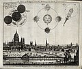 Astronomy; a view of London in 1748, with diagrams of an ecl Wellcome V0024734.jpg 2,972 × 2,512; 3.43 MB
-
 At the corner of Caledonian Road and Pentonville Road - geograph.org.uk - 6203127.jpg 1,024 × 1,024; 1.12 MB
-
 Atlas Building, City Road - geograph.org.uk - 6570556.jpg 426 × 640; 76 KB
-
 Attneave St - geograph.org.uk - 5403028.jpg 640 × 426; 53 KB
-
 Aubert Park - geograph.org.uk - 7183892.jpg 1,024 × 684; 221 KB
-
 Aubert Park, Highbury - geograph.org.uk - 7060208.jpg 3,886 × 2,840; 4.47 MB
-
 Autumn colour on Highbury Fields - geograph.org.uk - 5971192.jpg 1,024 × 768; 408 KB
-
 Autumn in Bunhill Fields - The North West Corner - geograph.org.uk - 5571602.jpg 3,600 × 2,365; 1.88 MB
-
 Autumn leaves on Camden Road, Holloway - geograph.org.uk - 6669260.jpg 1,920 × 1,280; 1.69 MB
-
 Autumn sunlight on Highbury Fields - geograph.org.uk - 5971185.jpg 1,024 × 768; 409 KB
-
 Autumn sunshine on Highbury Fields - geograph.org.uk - 5971189.jpg 1,024 × 768; 396 KB
-
 Avenell Rd - geograph.org.uk - 6648044.jpg 1,024 × 684; 200 KB
-
 Avenell Rd, Gillespie Rd - geograph.org.uk - 6648040.jpg 1,024 × 684; 177 KB
-
 B502 - geograph.org.uk - 5403039.jpg 640 × 426; 73 KB
-
 Baker's Rd - geograph.org.uk - 6525990.jpg 1,024 × 684; 123 KB
-

-
 Balls Pond Road at the junction of Kingsland Road - geograph.org.uk - 5146521.jpg 2,048 × 1,536; 955 KB
-
 Balls Pond Road, Canonbury - geograph.org.uk - 6301932.jpg 1,280 × 1,696; 868 KB
-
 Baltic St West - geograph.org.uk - 2923634.jpg 640 × 430; 59 KB
-
 Baltic Street West - geograph.org.uk - 6623799.jpg 1,024 × 684; 222 KB
-
 Bank Buildings, Goswell Road-St John Street, Islington - geograph.org.uk - 5382188.jpg 1,600 × 1,475; 538 KB
-
 Bank of Friendship, Highbury - geograph.org.uk - 4566965.jpg 2,272 × 1,704; 865 KB
-
 Barber shop, Highbury Barn - geograph.org.uk - 5398839.jpg 1,478 × 1,600; 491 KB
-
 Barcham House, Riversdale Road, N5 - geograph.org.uk - 4577609.jpg 640 × 480; 104 KB
-
 Barclays Bank, Highbury Corner, London - geograph.org.uk - 3435865.jpg 1,024 × 683; 646 KB
-
 Baring St - geograph.org.uk - 6632709.jpg 1,024 × 684; 188 KB
-
 Baring St - geograph.org.uk - 6632712.jpg 1,024 × 684; 202 KB
-
 Baring St - geograph.org.uk - 6632735.jpg 1,024 × 684; 212 KB
-
 Baring Street - geograph.org.uk - 1054529.jpg 640 × 480; 79 KB
-
 Baring Street - geograph.org.uk - 1054534.jpg 640 × 480; 87 KB
-
 Barnard Park - geograph.org.uk - 7176384.jpg 1,024 × 684; 341 KB
-
 Barnes Court, Islington - geograph.org.uk - 5483201.jpg 1,024 × 768; 213 KB
-

-
 Barnsbury Road - geograph.org.uk - 6216183.jpg 1,024 × 678; 682 KB
-

-
 Barnsbury Street, N1, an end elevation - geograph.org.uk - 6975090.jpg 1,136 × 1,600; 441 KB
-
 Barnsbury Terrace, Barnsbury - geograph.org.uk - 2092195.jpg 3,264 × 2,448; 1.18 MB
-
 Barnsby Rd - geograph.org.uk - 7176379.jpg 1,024 × 684; 240 KB
-
 Barnsby Rd - geograph.org.uk - 7183640.jpg 1,024 × 684; 235 KB
-
 Barnsby St - geograph.org.uk - 7183657.jpg 1,024 × 684; 210 KB
-
 Barnsby St, Liverpool Rd junction - geograph.org.uk - 7183660.jpg 1,024 × 684; 141 KB
-
 Barratt House, Sable Street - geograph.org.uk - 6171313.jpg 4,032 × 3,024; 3.89 MB
-
 Bartholomew Square, EC1 (north side) (2) - geograph.org.uk - 3886972.jpg 640 × 480; 113 KB
-
 Bartholomew Square, EC1 (north side) - geograph.org.uk - 3886964.jpg 640 × 480; 99 KB
-

-
 Basin on the Grand Union Canal - geograph.org.uk - 3847759.jpg 640 × 478; 90 KB
-
 Basin on the Regents Canal, Kings Cross - geograph.org.uk - 4542155.jpg 1,024 × 768; 157 KB
-
 Bat boxes, Duncan Terrace Gardens - geograph.org.uk - 2917418.jpg 640 × 430; 110 KB
-
 Bath Street Cycle Hire - geograph.org.uk - 4909116.jpg 640 × 427; 141 KB
-
 Bathurst Mansions, Holloway - geograph.org.uk - 5164471.jpg 1,600 × 1,545; 653 KB
-
 Battlebridge Basin - geograph.org.uk - 6643142.jpg 1,024 × 684; 129 KB
-
 Battlebridge Basin on the Regent's Canal - geograph.org.uk - 6382457.jpg 5,456 × 3,632; 2.15 MB
-
 Battlefield Basin, Regent's Canal - geograph.org.uk - 6407394.jpg 1,280 × 850; 433 KB
-
 Bavaria Rd - geograph.org.uk - 7324194.jpg 1,024 × 684; 194 KB
-
 Bavaria Rd - geograph.org.uk - 7324195.jpg 1,024 × 684; 184 KB
-
 Be At One Bar, Islington - geograph.org.uk - 5489594.jpg 640 × 480; 85 KB
-
 Beaumont Rise, Upper Holloway - geograph.org.uk - 6476387.jpg 1,920 × 1,280; 1.96 MB
-
 Beckett House Nursery School - geograph.org.uk - 7183645.jpg 1,024 × 684; 156 KB
-
 Beckford House - geograph.org.uk - 4889612.jpg 6,000 × 4,000; 5.31 MB
-
 Belitha Villas, Barnsbury. London N1 - geograph.org.uk - 6995652.jpg 1,200 × 1,600; 493 KB
-
 Benchmark, St Mary Hornsey - geograph.org.uk - 7329923.jpg 1,024 × 684; 224 KB
-
 Benjamin St - geograph.org.uk - 6526028.jpg 1,024 × 684; 168 KB
-
 Benwell Road - width restriction - geograph.org.uk - 3717834.jpg 640 × 480; 94 KB
-
 Beresford Rd - geograph.org.uk - 3844095.jpg 640 × 430; 84 KB
-
 Beresford Rd - geograph.org.uk - 5381949.jpg 640 × 426; 77 KB
-
 Beresford Road bus stop - geograph.org.uk - 2233377.jpg 640 × 480; 112 KB
-
 Beresford Road, N5 (2) - geograph.org.uk - 4516692.jpg 640 × 480; 110 KB
-
 Beresford Road, N5 - geograph.org.uk - 4516691.jpg 640 × 480; 104 KB
-
 Beresford Terrace looking towards Petherton Road - geograph.org.uk - 4025632.jpg 2,304 × 1,728; 827 KB
-
 Besant Court - geograph.org.uk - 5385270.jpg 426 × 640; 71 KB
-
 Betsey Trotwood - geograph.org.uk - 6525996.jpg 1,024 × 684; 132 KB
-
 Betty Brunker Hall - geograph.org.uk - 3855885.jpg 640 × 430; 71 KB
-

-
 Bevin Court from Holford Street - geograph.org.uk - 3948626.jpg 640 × 480; 112 KB
-
 Bevin Court, Holford Street - geograph.org.uk - 4517105.jpg 434 × 640; 180 KB
-
 Bezier Building, City Road - geograph.org.uk - 6036147.jpg 4,288 × 3,216; 3.66 MB
-
 Big Yellow car wash, Finsbury Park - geograph.org.uk - 7388815.jpg 1,906 × 1,260; 1.03 MB


_Highbury_Corner,_N5_-_geograph.org.uk_-_3163893.jpg)


.jpg)


_major_intersection,_1990_-_geograph.org.uk_-_4649844.jpg)


_-_geograph.org.uk_-_4257070.jpg)


_-_geograph.org.uk_-_4513815.jpg)


_(2)_-_geograph.org.uk_-_3886972.jpg)
_-_geograph.org.uk_-_3886964.jpg)


_-_geograph.org.uk_-_4516692.jpg)


